![Death Valley Mesquite Dunes. Driving to a Different California. US Southwest Trip Day 10 [POL/ENG]](https://img.truvvle.com/?src=aHR0cHM6Ly9pbWcudHJhdmVsZmVlZC5pby9zbnVma2luJTJGMjAyNS0wOC0wNS0xNy0wOC0yMDItbWVzcXVpdGVkdW5lcy1wbmc&width=2000)
"Death Valley Mesquite Dunes" is written in Polish and English. The English text is in italics, below each paragraph in Polish.
W pierwszej przymiarce do planu podróży po USA, Dolina Śmierci (Kalifornia) miała być tylko krótkim przystankiem. Ale im więcej o niej czytałem, tym bardziej byłem przekonany, że potrzebujemy dwóch dni. Park Narodowy Doliny Śmierci jest rozległy i bardzo różnorodny. Pierwszego dnia poznaliśmy jego esencję. Drugiego dnia odwiedziliśmy kolejne ciekawe miejsca - Death Valley Mesquite Dunes i Mosaic Canyon, po czym ruszyliśmy w długą drogę na zachód i zobaczyliśmy inną Kalifornię.
Originally I had planned just a short stop in the Death Valley, California. But the more I read, the more I was convinced we would need two days for this vast and diverse National Park. The first day there was really the park's essence. On the second day, we visited another two interesting places - Death Valley Mesquite Dunes i Mosaic Canyon. Then we drove west and entered a different California.
Death Valley Mesquite Dunes
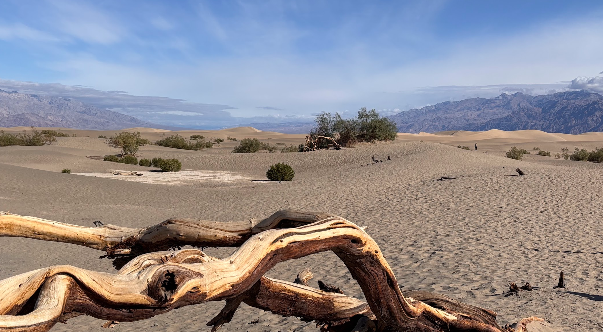
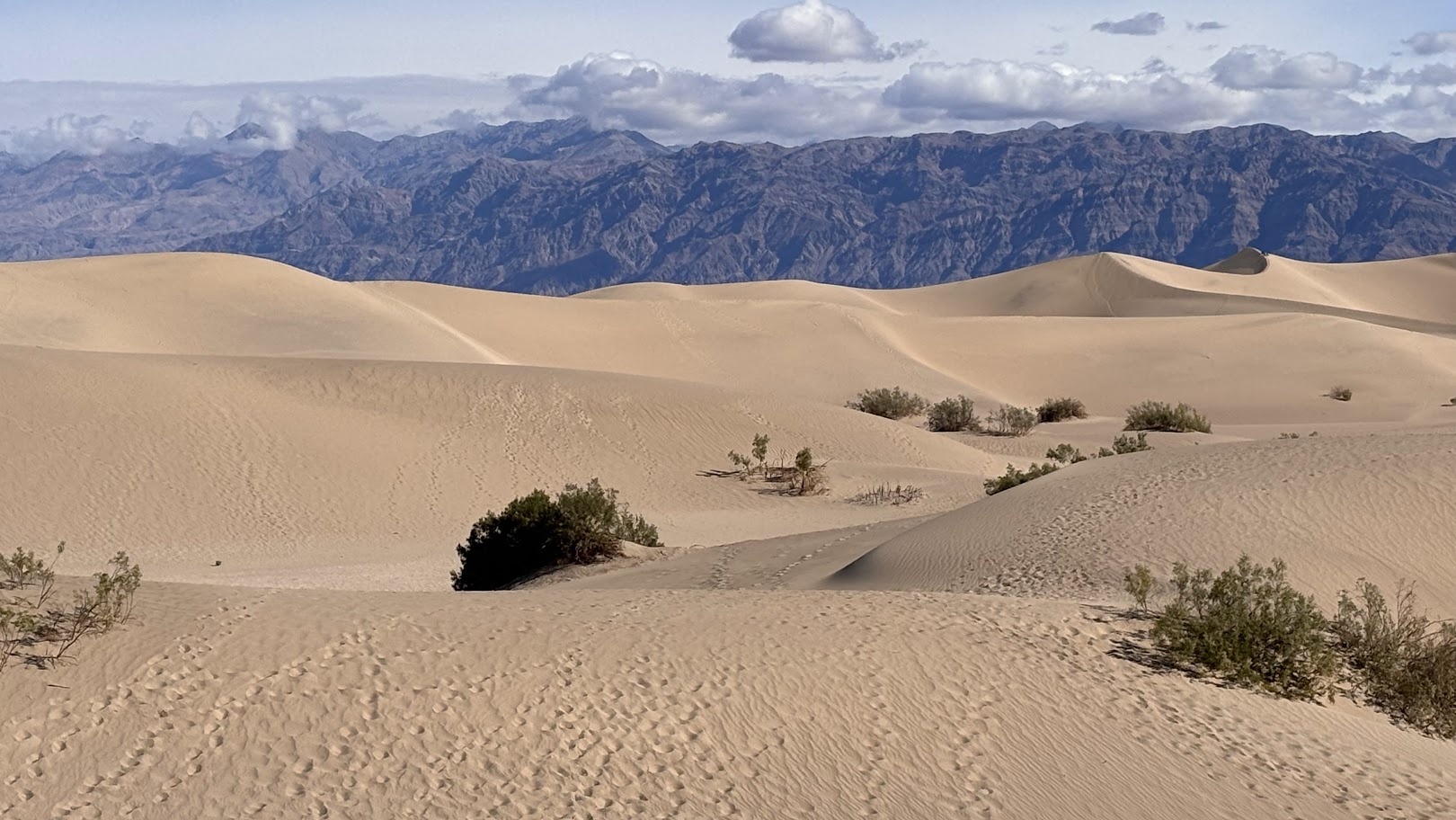
'Mesquite' to zbiorcza nazwa pustynnych krzaków z rodziny fasolowatych, typowych dla pustyń amerykańskiego południowego zachodu. 'Mesquite Dunes' to piaszczysty, pustynny fragment północnej części Doliny Śmierci, z rzadka porośnięty wspomnianą roślinnością. To kolejne miejsce pokazujące różnorodność tego Parku Narodowego. Nie ma tam szlaku - parkujemy przy drodze 190 i po prostu wędrujemy po piasku.
'Mesquite' is a common name for leguminous shrubs typical for desert areas of the US Southwest. 'Mesquite Dunes' denotes a sand desert in the northern part of Death Valley. It's yet another place that shows the diversity of Death Valley landscapes. There's no marked trail - we simply parked by HWY 190 and strolled the dunes.
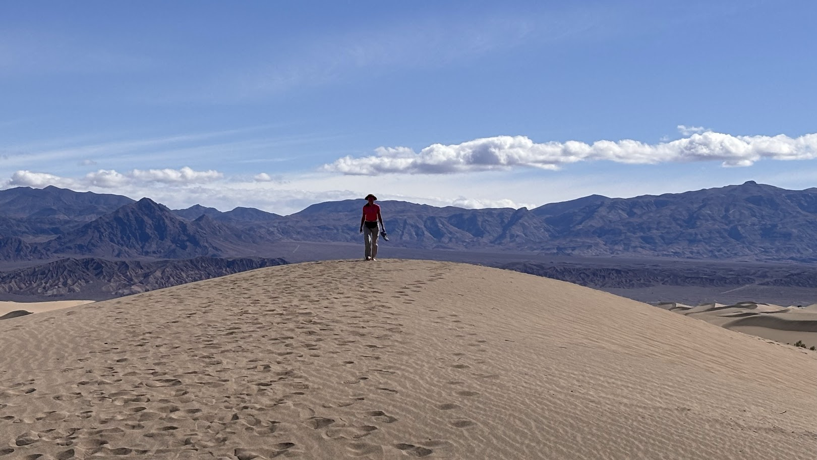
Naszym celem jest dojazd z Beatty (Nevada) to Bakersfield (Kalifornia). Mesquite Dunes mamy po drodze. Mogę jednak polecić to miejsce samo w sobie. Warto pospacerować po drobnym, żółtym piasku i poczuć klimat pustyni.
The day's goal is to transfer from Beatty, Nevada to Bakersfield, Kalifornia. Mesquite Dunes are on the way. I recommend this place as a worthwhile destination. Walk the sand dunes and get a feeling of a desert climate.
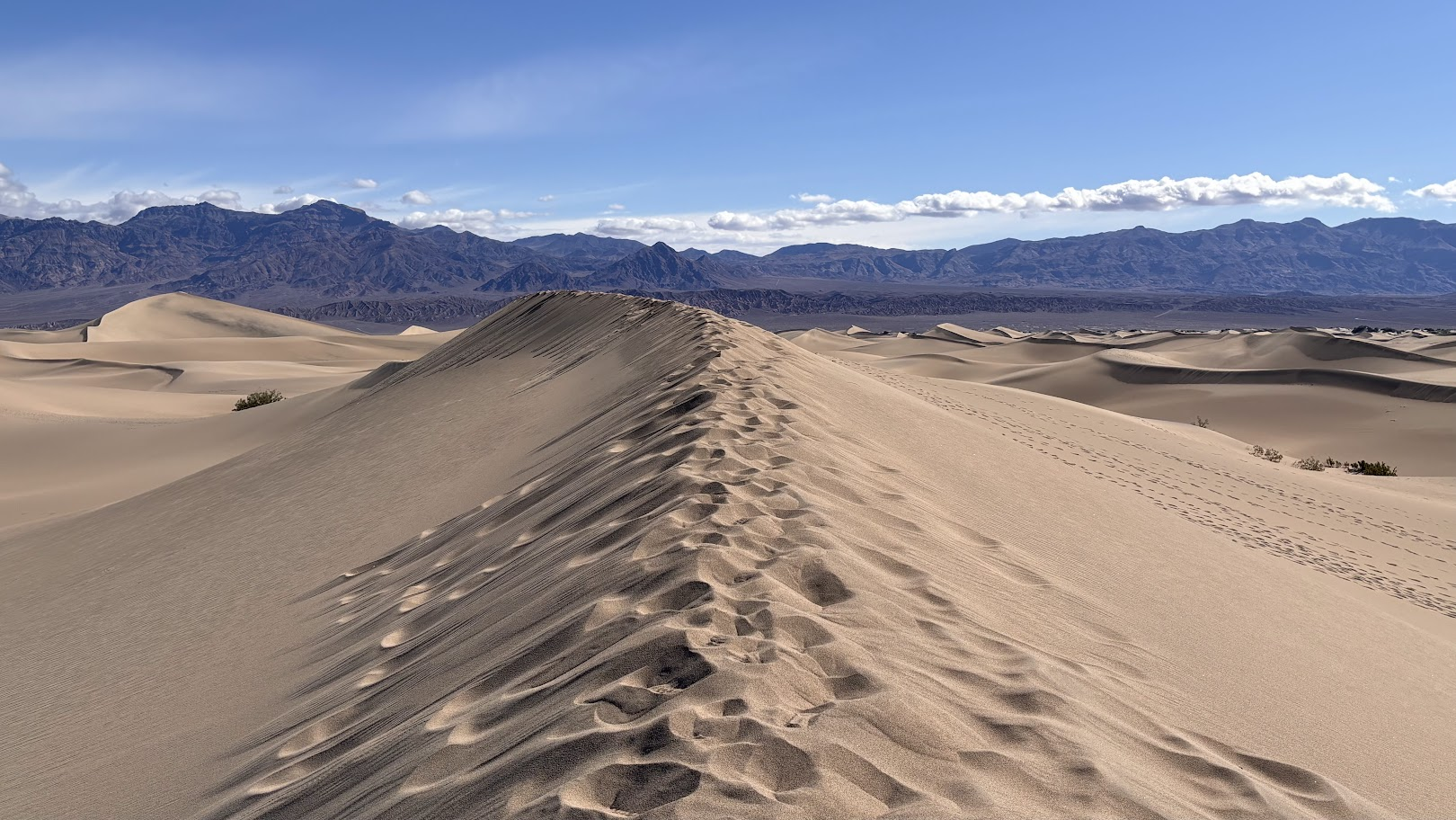
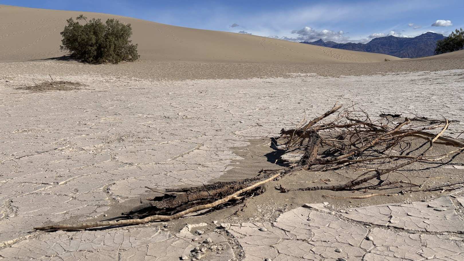
Chodzenie po piasku jest przyjemne (ale tylko wcześnie rano!) samo w sobie. Ale ja widzę więcej niż piasek. W obniżeniu pomiędzy wydmami widać... formowanie piaskowca. Przepis jest taki - bierzemy piasek, polewamy wodą i zapiekamy w palącym słońcu. Proces powtarzamy. W końcu zamiast sypkiego piasku będziemy mieli litą skałę - piaskowiec.
Sand walking is a pleasure for feet (only early in the morning!). But I saw more than sand. In a low place between the dunes, I noticed... sandstone being formed. The recipe is the following - take some sand, add water and bake it in the scorching sun. Repeat. We will eventually see how sand changes into a rock - a sandstone.
Mosaic Canyon
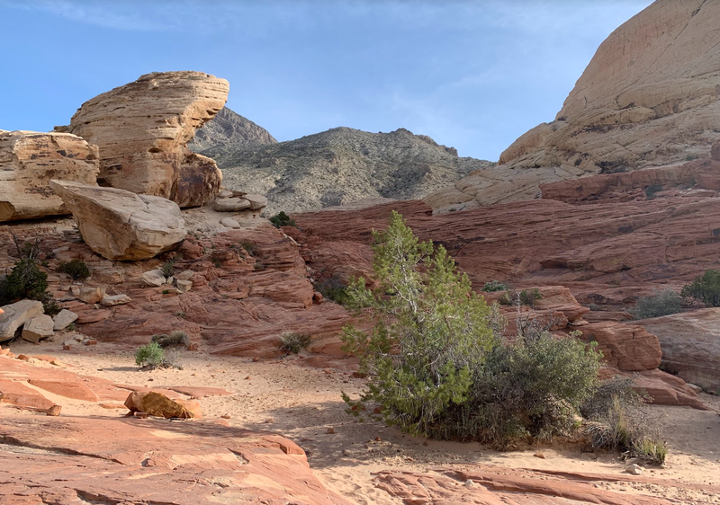
Kilkanaście minut jazdy od Mesquite Dunes zatrzymujemy się na ostatni przystanek w Parku Narodowym Doliny Śmierci - Mosaic Canyon. Gdybyśmy zobaczyli go jako nasz pierwszy kanion w USA, bylibyśmy zachwyceni. Ale chyba zostaliśmy trochę rozpieszczeni przed widoki, bo tu nasza reakcja to "kolejny kanion, nic specjalnego".
About 15 minutes drive from Mesquite Dunes, we stopped for our last hike in Death Valley National Park - Mosaic Canyon. If it had been our first canyon in the USA, we would have been amazed. But I guess the nature had pampered our senses and there our reaction was just "ok, another canyon".
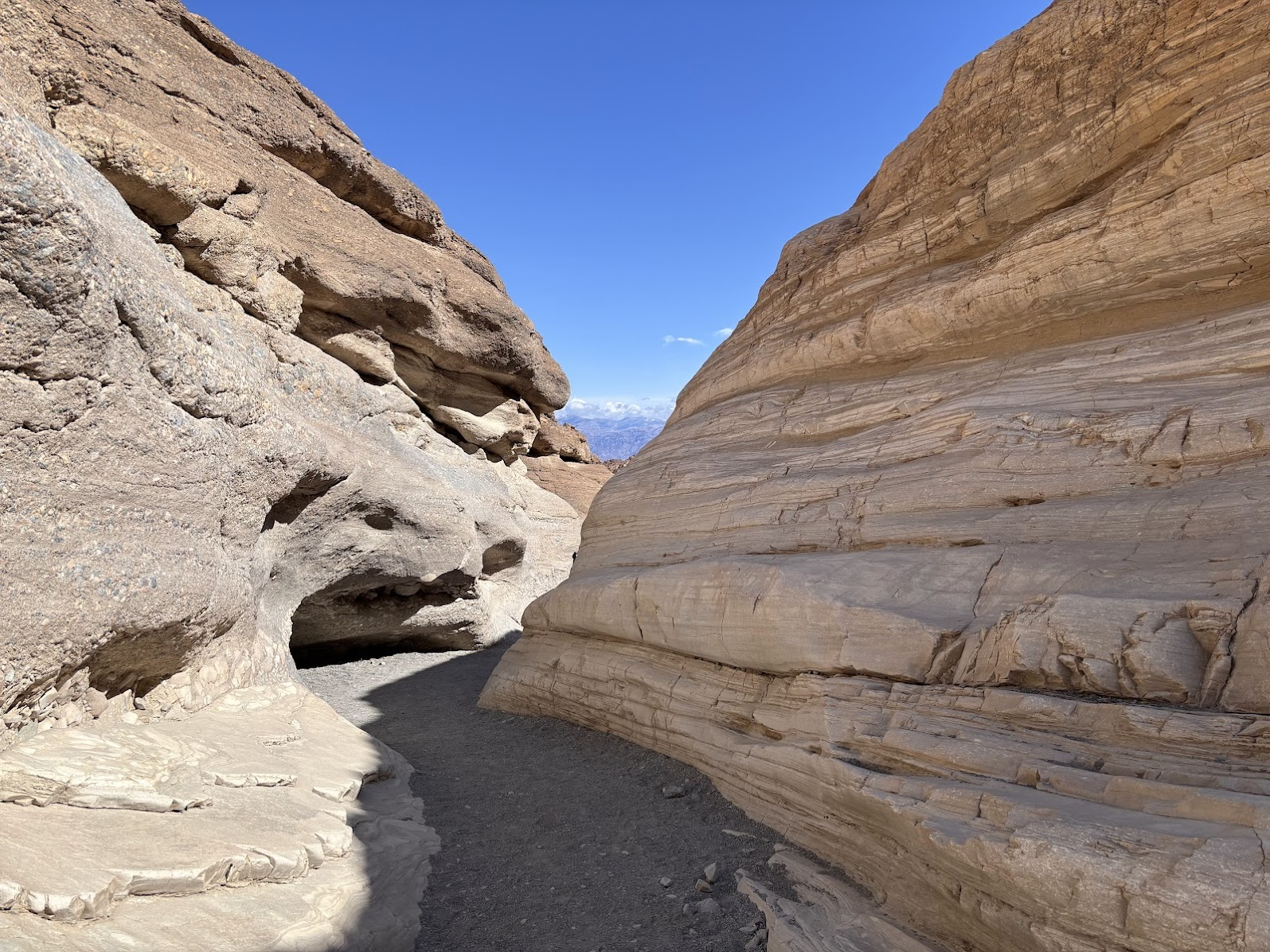
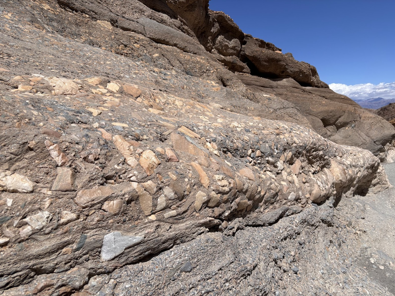
Przy bliższym przyjrzeniu się, kanion wygląda na bardziej chaotyczny niż odwiedzone wcześniej. Warstwy skalne nie wszędzie przebiegają równolegle, widzimy sporo różnych skał oraz w kilku miejscach rumowiska lub duże bloki skalne zagradzają przejście. Widzimy też skąd pochodzi nazwa - niektóre skały nie są jednolitymi piaskowcami, tylko zlepieńcami różnych formacji. Taki 'bałagan' najpewniej świadczy o gwałtownym formowaniu, np. w czasie dużej powodzi.
At a closer look, we notice that the canyon is more chaotic than others we had visited. Rock layers are not ideally parallel, we see several different rock formations and there are large boulders blocking passage. We also see how the canyon got its name - some rocks are not solid sandstone, there are conglomerates. Such chaos is typically a sign of rapid formation, for example during a big flood, rather then peaceful sedimentation.
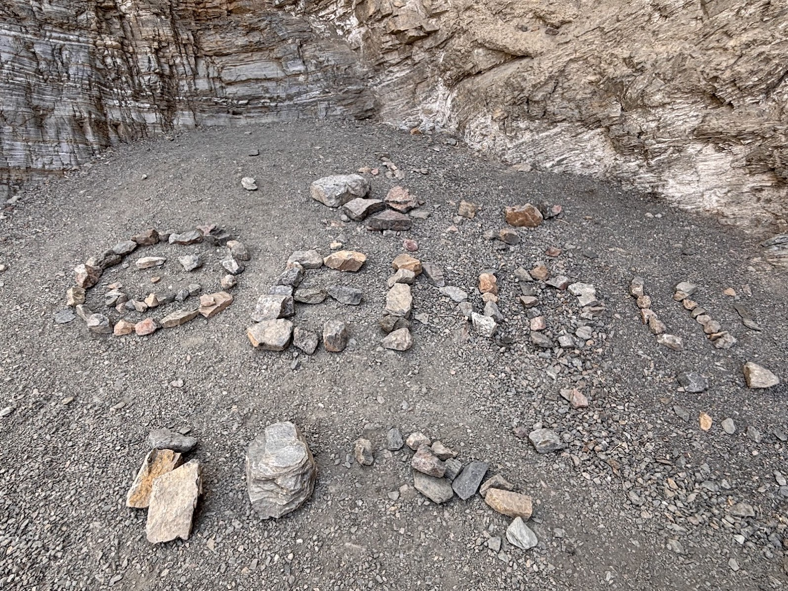
Przez dwa rumowiska dość sprawnie przechodzimy. Obejścia są nawet oznaczone kamykami ułożonymi w strzałki. Aż w końcu dochodzimy do miejsca, którego nie da się łatwo obejść. Ktoś przed nami też doszedł do tego wniosku i ułożył z kamieni napis 'END'. Kończymy więc dwudniową przygodę z fascynującą Doliną Śmierci i ruszamy na zachód. Ostatni tydzień naszego wyjazdu spędzimy w zachodniej Kalifornii. Zupełnie innej Kalifornii niż okolice Doliny Śmierci.
We negotiated two boulders quite well, aided by arrows formed by stones. But when we saw a sheer wall blocking passage, we knew it was the end. Someone had realized that before us and they had created an 'END' sign on the canyon floor. So this ended our two days of hiking in fascinating Death Valley. The last week of our tour would be in western California. A California so much different from the vicinity of Death Valley.
Where Is the River in Bakersfield?
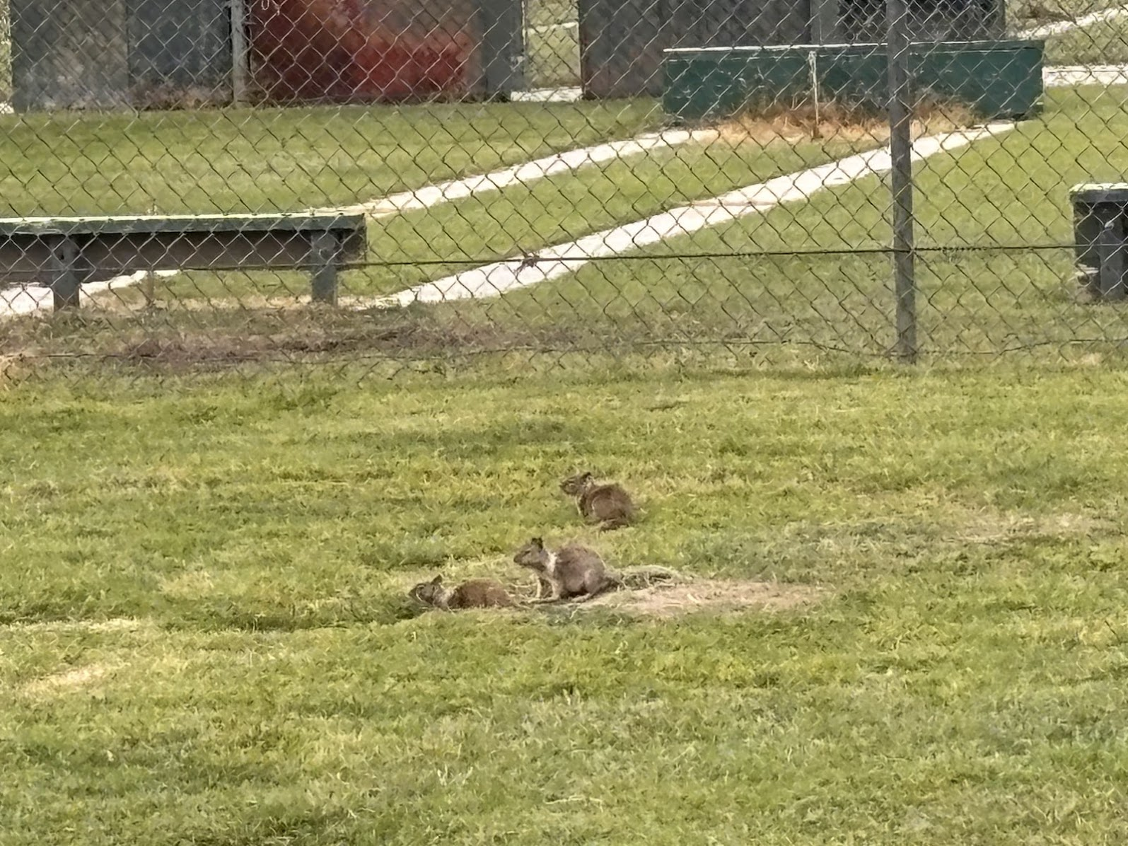
W innej Kalifornii zobaczyliśmy... trawę. Po raz pierwszy od dwóch tygodni (nie licząc sztucznie nasadzonej i nawadnianej). Dojechaliśmy do miasta Bakersfield, które będzie naszą bazą na najbliższe dni. Wieczorem poszliśmy na spacer do miejscowego parku (przy okazji, chodzenie na piechotę po dużym amerykańskim mieście nie jest proste). Park został przejęty przez pieski preriowe, które wykopały sobie pod trawnikiem skomplikowany system korytarzy. Te sprytne zwierzęta (nie mają nic wspólnego z psami - to rodzaj wiewiórek) żyją na powierzchni, wszędzie ich pełno. W razie zagrożenia, czujki ostrzegają resztę i całe towarzystwo dosłownie znika pod ziemią.
In the different California we saw... grass for the first time in two weeks (not counting artificially grown and watered lawns). We reached the city of Bakersfield, which would be our base for the following two days. In the evening, we went for a walk to a park (which, btw, is not an easy way of moving around in an American city). The park was owned by prairie dogs (not dogs at all, they are kinds of squirrels). They had dug a complex system of underground corridors. They live above, looking for food and playing around. But when there's perceived danger, a guard warns everyone and they immediately disappear under the ground.
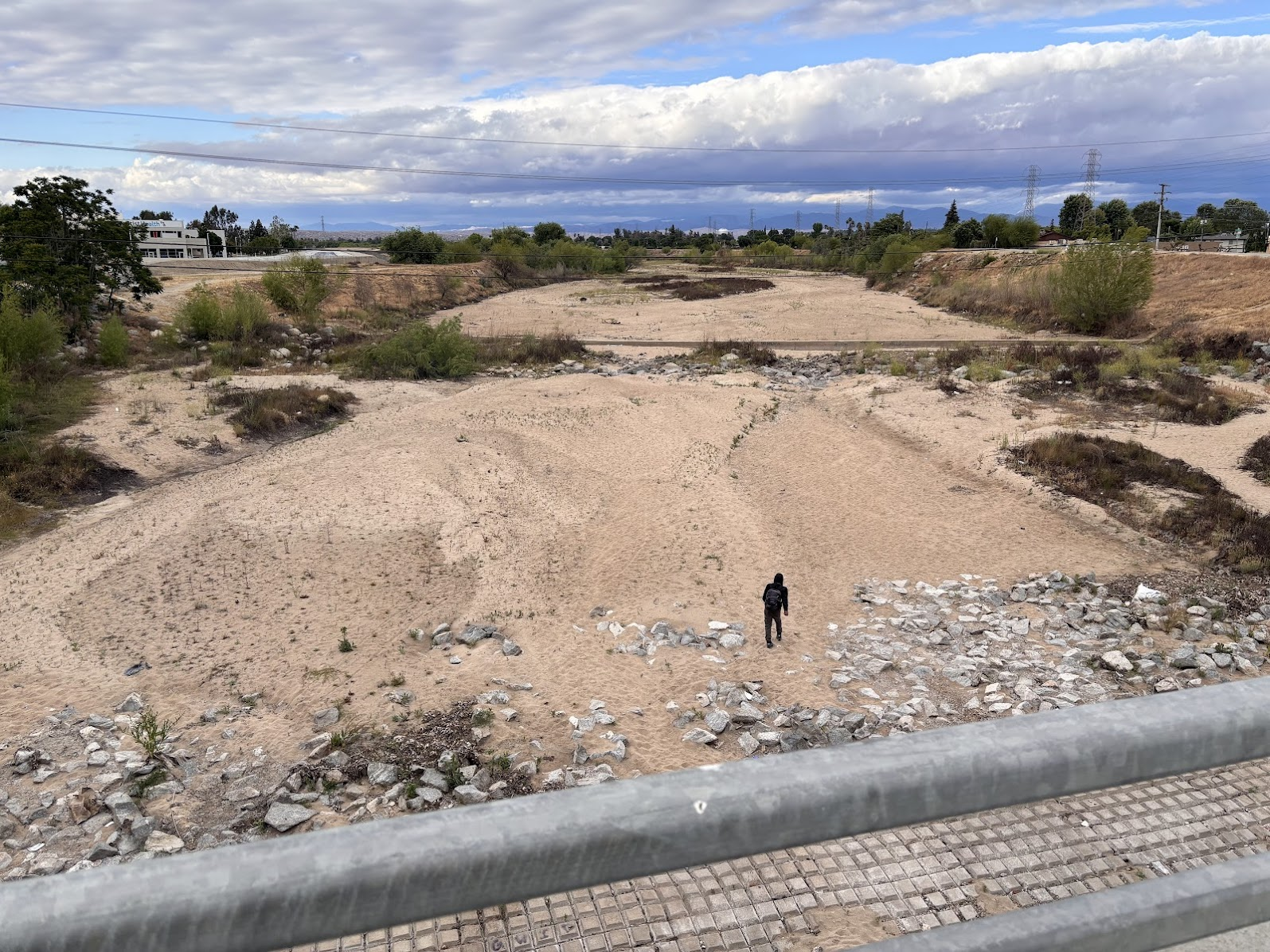
Przez Bakersfield przepływa rzeka Fern. Całkiem spora, sądząc po długości mostów. Ale mosty są nad pustym korytem. Rzeki nie ma. Gdzie się podziała? O tym w kolejnym odcinku.
River Fern flows thru Bakersfield. Based on the length of bridges, it should have been quite sizable one. But the bridges are over dry beds. There's no river. Where is it then? Read my next post.
America the Beautiful Trip - Day 10
Death Valley Mesquite Dunes
| Data / Date | 27.04.2025 |
|---|---|
| Poprzedni dzień / Previous day | Death Valley Day 1 |
| Trasa samochodem / Route by car | Beatty, NV => Mesquite Dunes, CA => Bakersfield, CA (390km) |
| Szlak(i) pieszo / Trail(s) on foot | Mesquite Dunes (without trail); Mosaic Canyon (3km out an back) |
| Wstęp / Entry fee | America the Beautiful Annual Pass |
| Strona www Parku / Park website | https://www.nps.gov/deva/index.htm |
| Nocleg / Accommodation | Holiday Inn & Suites Bakersfield, CA |
| Następny dzień / Next day | Fern River and Lake Isabella |
| Plan podróży / Trip itinerary | 'America the Beautiful Trip' |
![Hiking in Death Valley. It's So Much More Than a Salty Depression! US Southwest Trip Day 9 [POL/ENG]](https://img.truvvle.com/?src=aHR0cHM6Ly9pbWcudHJhdmVsZmVlZC5pby9zbnVma2luJTJGMjAyNS0wNy0zMS0xNy0wNy0zMjEtZGVhdGh2YWxsZXktcG5n&width=800)
![Land of the Giants. Sequoia National Park, California. US Southwest Trip Day 12 [POL/ENG].](https://img.truvvle.com/?src=aHR0cHM6Ly9pbWcudHJhdmVsZmVlZC5pby9zbnVma2luJTJGMjAyNS0wOS0wMS0xNC0wOS0xMTctc2VxdW9pYS1wbmc&width=800)
![River Kern and Lake Isabella. Unbearable Lightness of Hiking. US Southwest Trip Day 11 [POL/ENG].](https://img.truvvle.com/?src=aHR0cHM6Ly9pbWcudHJhdmVsZmVlZC5pby9zbnVma2luJTJGMjAyNS0wOC0xOC0xNi0wOC01MzktbGFrZWlzYWJlbGxhLXBuZw&width=800)