![Hiking in Death Valley. It's So Much More Than a Salty Depression! US Southwest Trip Day 9 [POL/ENG]](https://img.truvvle.com/?src=aHR0cHM6Ly9pbWcudHJhdmVsZmVlZC5pby9zbnVma2luJTJGMjAyNS0wNy0zMS0xNy0wNy0zMTktZGVhdGh2YWxsZXktcG5n&width=2000)
"Hiking in Death Valley" is written in Polish and English. The English text is in italics, below each paragraph in Polish.
W pierwszej przymiarce do planu podróży po USA, Dolina Śmierci (Kalifornia) miała być tylko krótkim przystankiem. Ale im więcej o niej czytałem, tym bardziej byłem przekonany, że potrzebujemy dwa dni. Park Narodowy Doliny Śmierci jest rozległy (to największy park w USA poza Alaską) i bardzo różnorodny. Uwaga - opisane trasy przeszliśmy w kwietniu. W lipcu nie odważyłbym się na piesze wędrówki.
Originally I had planned just a short stop in the Death Valley, California. But the more I read, the more I was convinced we would need two days for this vast and diverse National Park (it's the largest park in contiguous USA). Note - we hiked in April. I would not dare to leave a car for long in July.
Golden Canyon
Zaczynamy od wizyty w Centrum Informacyjnym. Dzień zaplanowałem jako serię krótkich wędrówek (najdłuższa to zaledwie 5km). Obszar i niegościnny klimat nie sprzyjają długim trasom. Naszym celem jest poznanie różnorodności parku. To dużo więcej niż słone jezioro w depresji.
We started hiking in Death Valley at the Visitor's Center. I had planned the day as a series of short hikes (the longest just 5km). The reasons are the size of the park and its inhibiting climate. We wanted to taste the park's diversity. Death Valley National Park is so much more than a flat, salty depression.
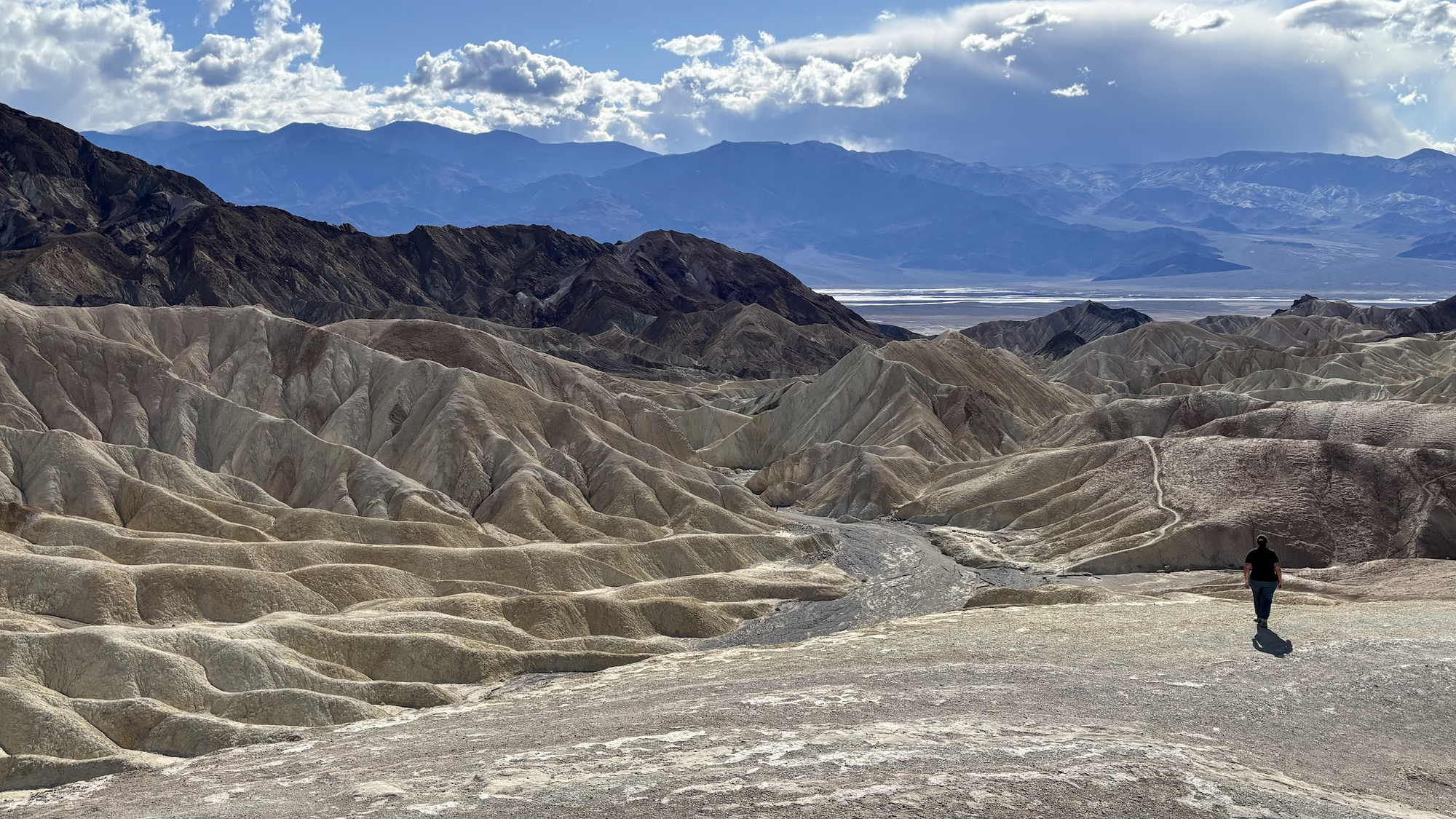
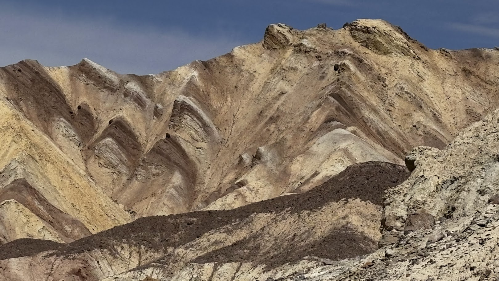
Pierwszy etap to spacer w głąb wąwozu Golden Canyon. To kanion o bardzo nieregularnych ścianach zbudowanych z żółtawego piaskowca. Kanion to labirynt ścieżek, my wybraliśmy dojście do punktu Red Cathedral i powrót tą samą drogą. Ciekawą opcją byłoby przejście do Zabriskie Point, po drugiej stronie niewysokiego łańcucha gór. Ale do tego potrzeba rozstawienia samochodów, a my mamy tylko jeden.
The first stage was an out-an-back hike into the Golden Canyon up to Red Cathedral point. The canyon sports irregular walls made of yellow-ish sandstone. It offers an interesting option to get to the other side of a low mountain range, to Zabriskie Point, but this poses transportation problem (perfect option for a group with two cars or if you have a bus to pick you up).
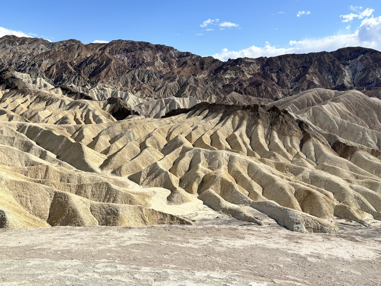
Tematem przewodnim Parku Narodowego Doliny Śmierci jest różnorodność. Tu nic nie jest nudne, za każdym rogiem czai się niespodzianka. Golden Canyon zdumiewa różnorodnością kolorów i form. Podobno na terenie parku skatalogowano 61 różnych formacji skalnych. Golden Canyon zachwycił nas, a okazał się zaledwie przystawką do kolejnego etapu - Artist's Palette.
The main theme of Death Valley National Park is diversity. One cannot be bored here, each turn offers an unexpected view. Golden Canyon offers variety of rock colors and shapes. According to park administration, there are 61 different rock formations. The Golden Canyon took our breaths away and yet it was only an appetizer for the next stage - Artist's Palette.
Artist's Palette
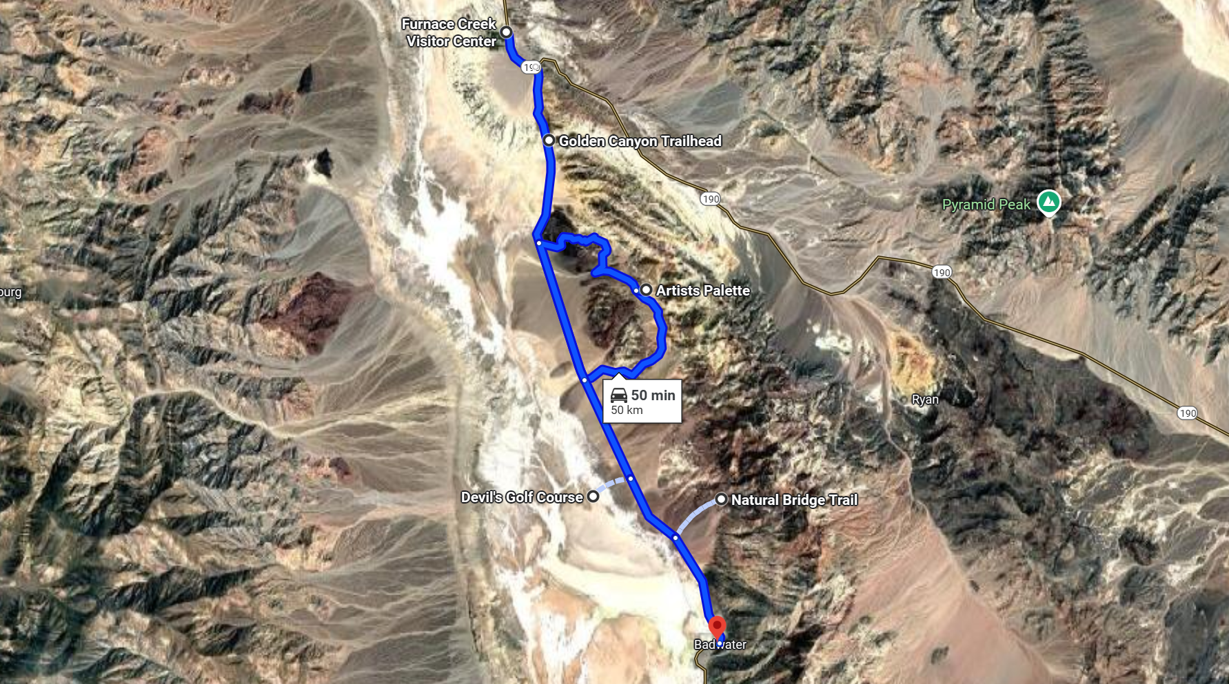
Pomiędzy poszczególnymi punktami naszego planu poruszamy się samochodem. Przez park prowadzi droga asfaltowa. Jest kilka odnóg (niektóre szutrowe) i są dostępne parkingi z wiatami i suchymi toaletami. Droga prowadząca do Artist's Palette to jedna z takich odnóg. Uwaga - jest jednokierunkowa.
The only option to check the different parts of the park is to travel by car. There's an paved road with side branches. There are parking lots with dry toilets. One of these branches is a loop road (one way) that takes us to Artist's Palette.
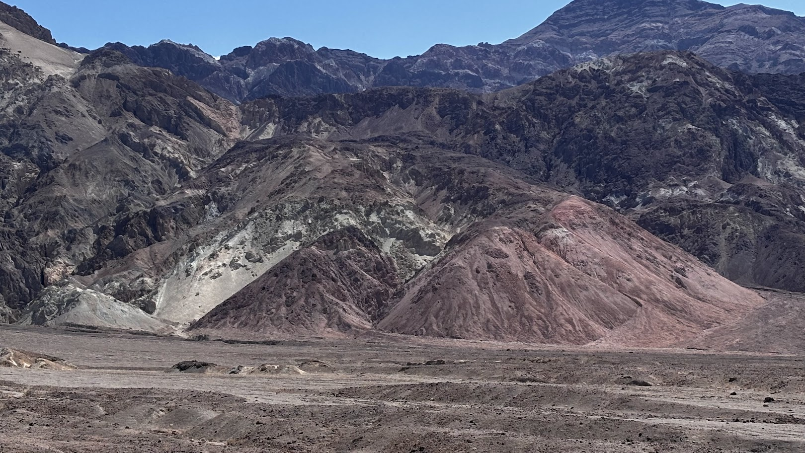
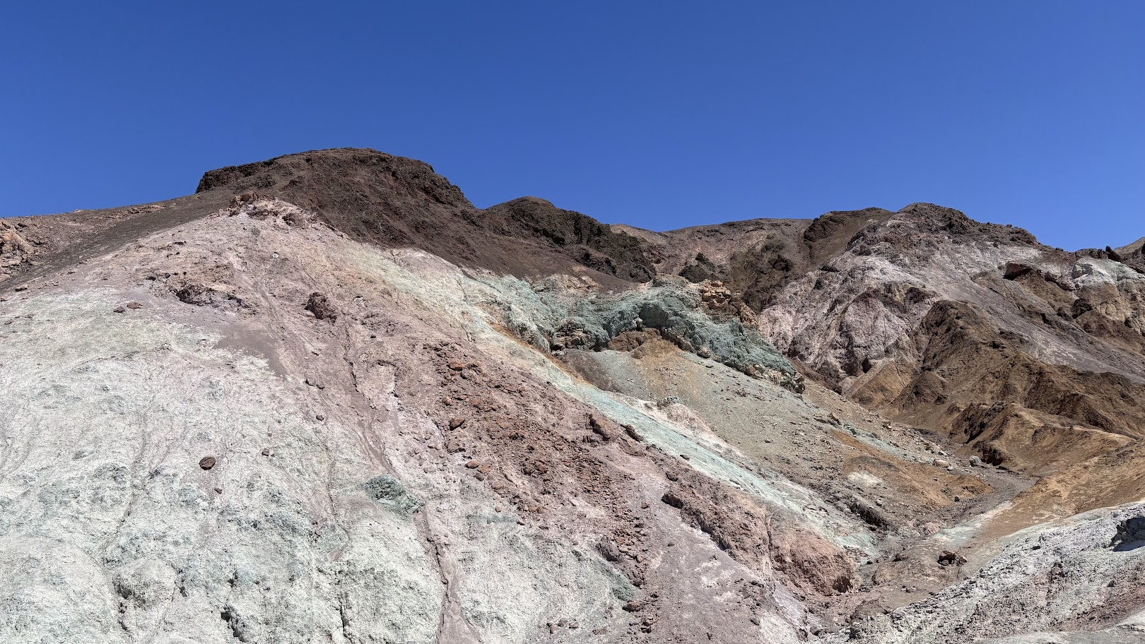
Przed chwilą oglądaliśmy żółte i czerwone piaskowce oraz żółto-brązowe pofałdowane warstwy wyglądające jak tiramisu. Mało? No to zobaczcie skały zielone, purpurowe, fioletowe, białe... Te kolory to efekt przeszłej aktywności wulkanicznej, która wyniosła na powierzchnię minerały zawierające m.in. żelazo i mangan. Proces utleniania daje niesamowite efekty kolorystyczne.
We have now seen yellow and red sandstone and tiramisu-like layers of yellow and dark alluvial sediments. Not enough? Hiking in Death Valley brings us to a place where the rocks are green, purple, violet, white... These colors are produced by oxidation of minerals brought to surface by past volcanic activity.
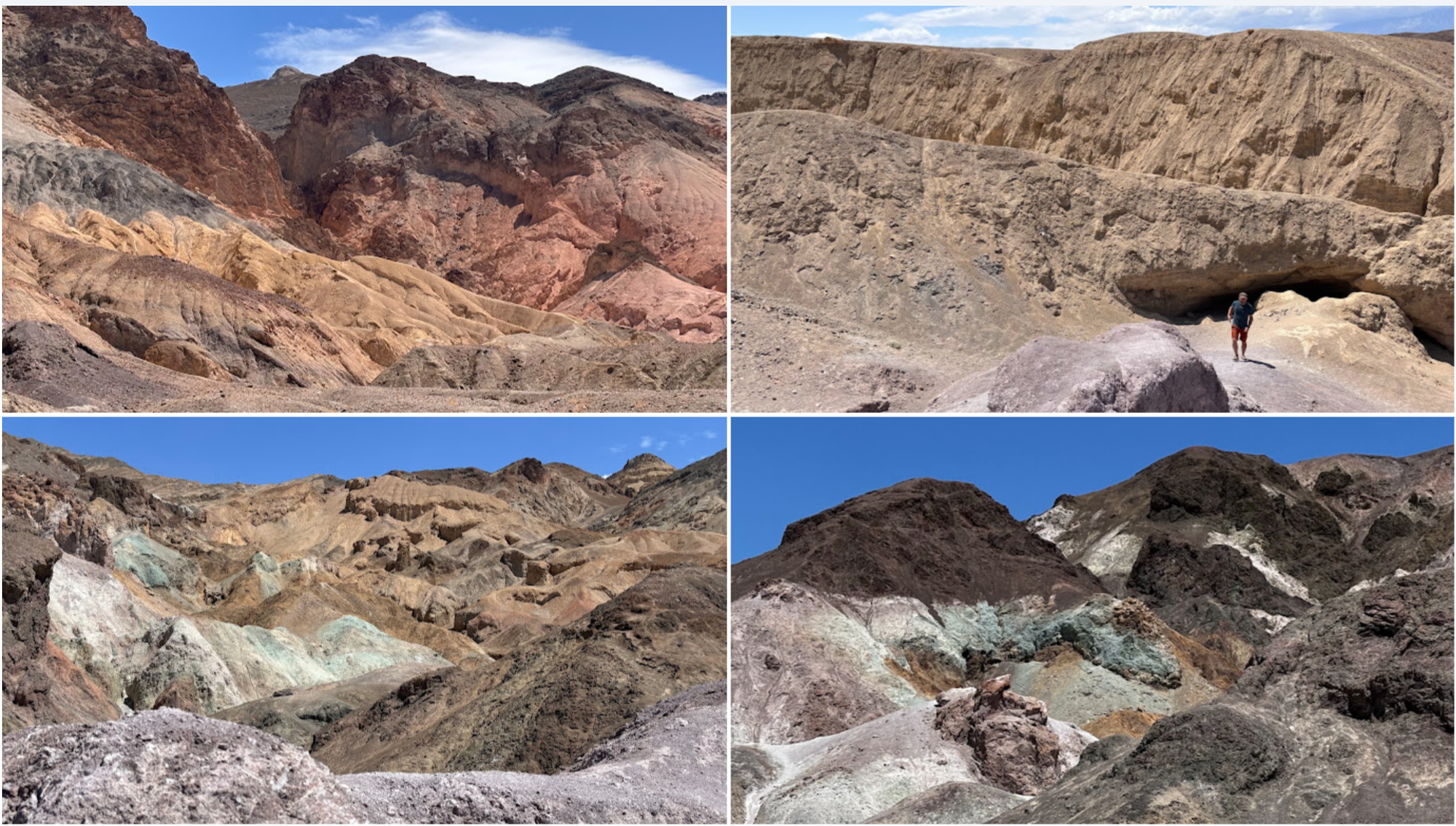
Rzadko ilustruję moje posty kolażami zdjęć, ale w tym miejscu po prostu nie można inaczej. Poniżej cztery zdjęcia, zrobione w tym samym miejscu, w ciągu 1 minuty (!) spaceru w pobliżu parkingu 'Artist's Palette'.
I rarely create photo collages, but here there's no other way to show the diversity. The four photos below were taken within a 1 minute (!) walk, near the parking lot for 'Artist's Palette'.
Devil's Golf Course
Jeśli masz takie wyobrażenie o Dolinie Śmierci jak ja przed wyjazdem, to możesz się zastanawiać dlaczego pokazuję kolorowe skały a nie słone jezioro. Po dwóch spacerach w górach po wschodniej stronie Doliny Śmierci (Black Mountains), przyszła pora na Devil's Golf Course - płaski obszar pokryty solą.
If your imagination matches mine prior to the trip, Death Valley must have seemed as an endless flatland covered with salt. So why all those colorful rocks? Up to now our hiking in Death Valley (the above described trails were in Black Mountains) was far from the expected. Until we got to Devil's Gold Course - here's the salty flatland.
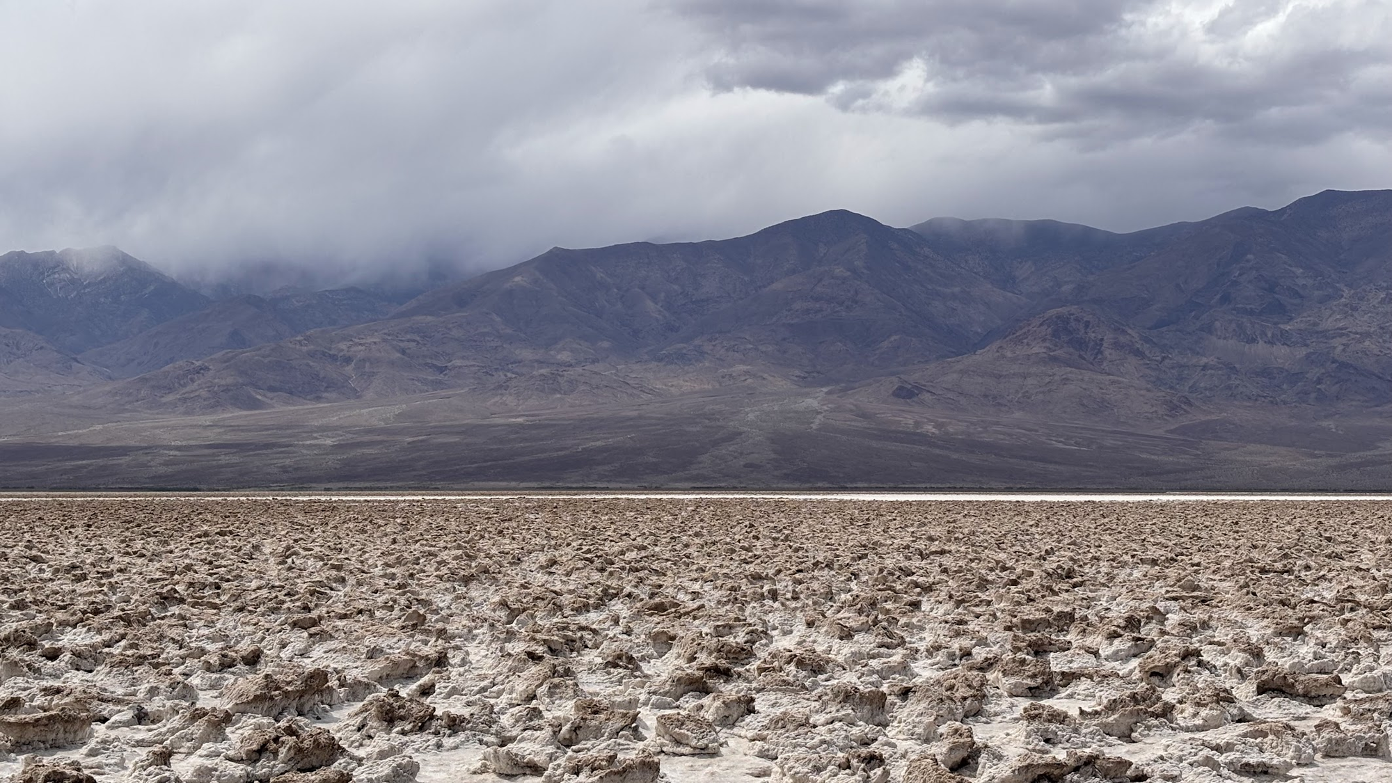
Devil's Golf Course nie jest idealnie płaski. Są obszary, gdzie sól osadziła się na stwardniałym błocie, formując charakterystyczne 'kalafiory'. Chodzenie po nich jest trudne, dobrze mieć dobre buty, bo ostre krawędzie mogą kaleczyć stopy w sandałach.
Devil's Golf Course is far being perfectly flat. There are areas with hard mud covered with salt. These are tricky to walk on - good hiking boots are recommended, as sharp edges may can cut skin if one walks in sandals.
Natural Bridge and Dry Waterfall
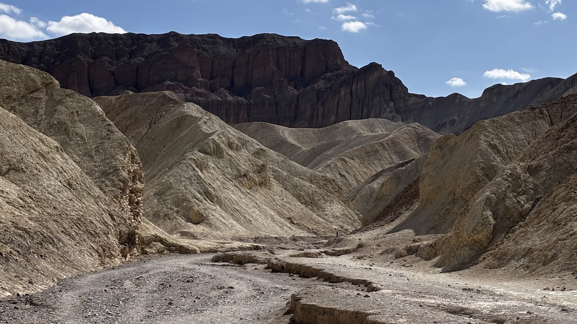
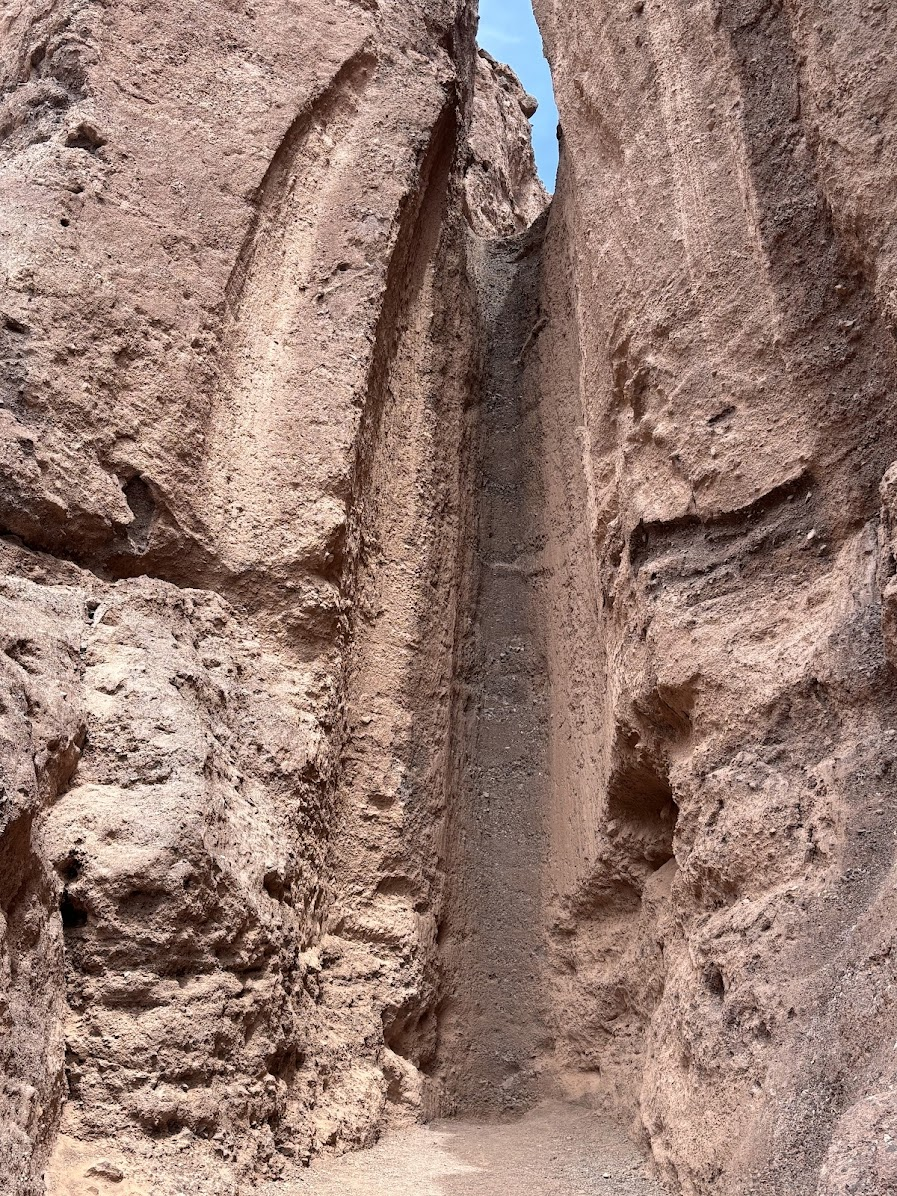
Zostawiamy (na chwilę) wyschnięte słone jezioro i znów wchodzimy w głąb kanionu. Chcemy zobaczyć naturalny most z czerwonego piaskowca (Natural Bridge) i suchy wodospad (Dry Waterfall).
We left the dried salt lake for a moment to hike inside yet another canyon. We wanted to see Natural Bridge and Dry Waterfall.
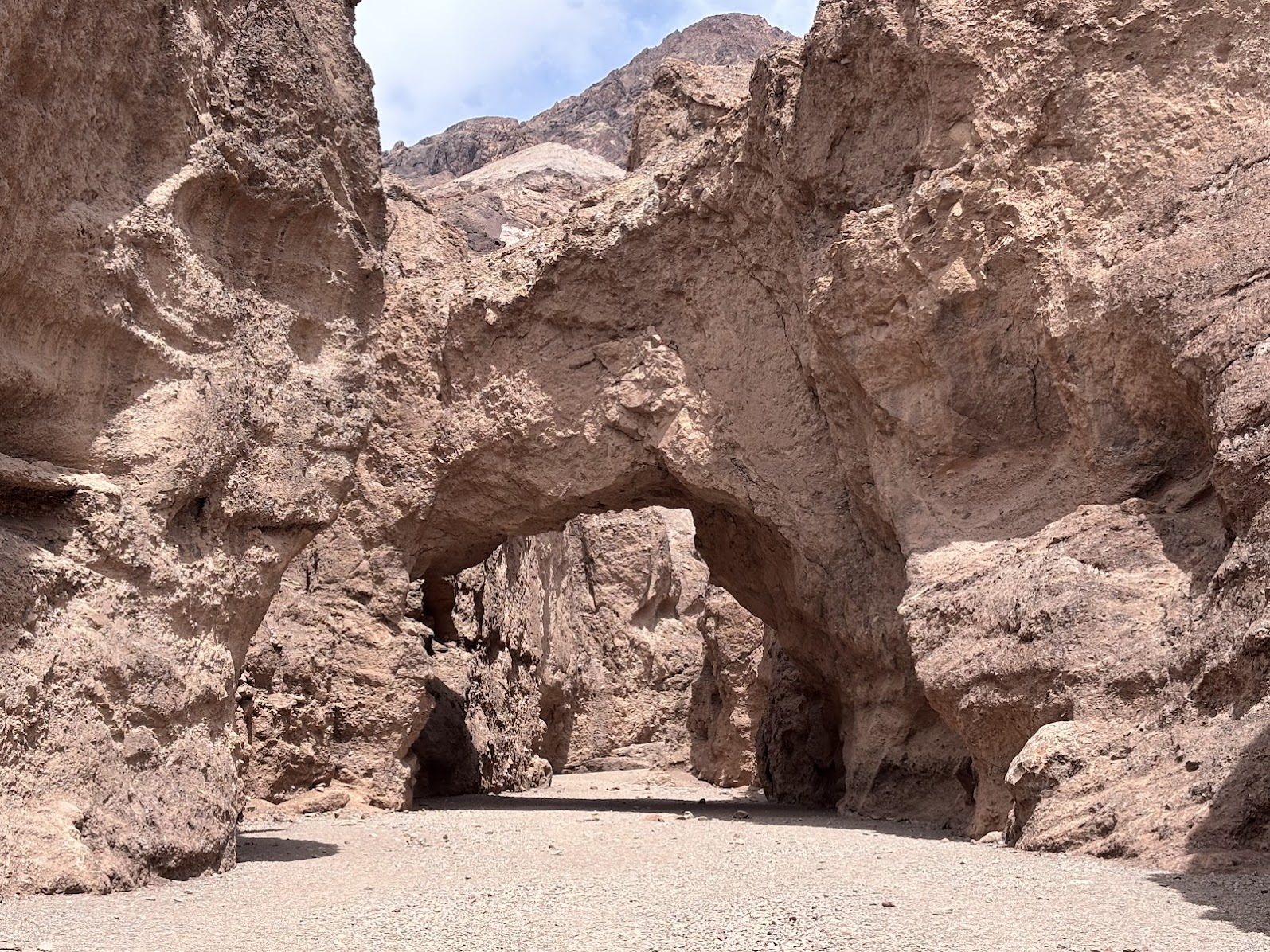
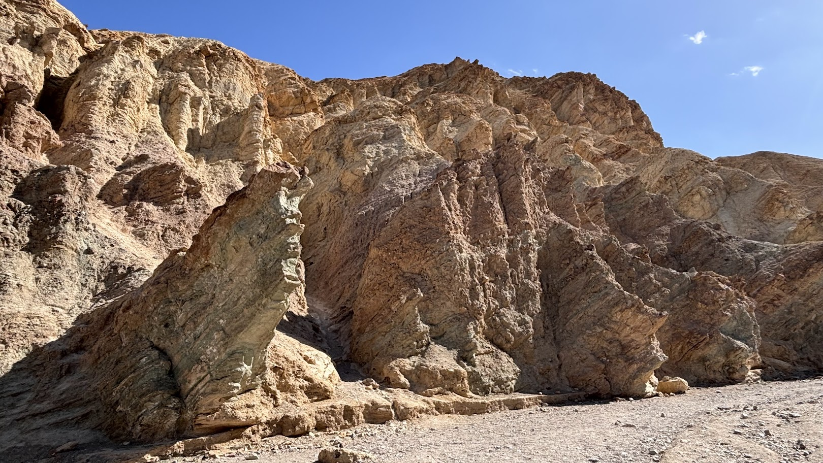
Kaniony 'żyją'. Po opadach - rzadkich, ale gwałtownych, woda spływa z dużą prędkością i niesie żwir i kamienie. To powoduje rzeźbienie skał kanionu. Most z piaskowca dzisiaj jest, ale z czasem erozja może spowodować jego zawalenie.
Canyons 'are alive'. After rains - which are rare but violent, water comes down with high speed. It carries gravel and stones, which sculpt the canyon walls. The Natural Bridge may exist today, but erosion may cause its collapse.
Badwater Basin
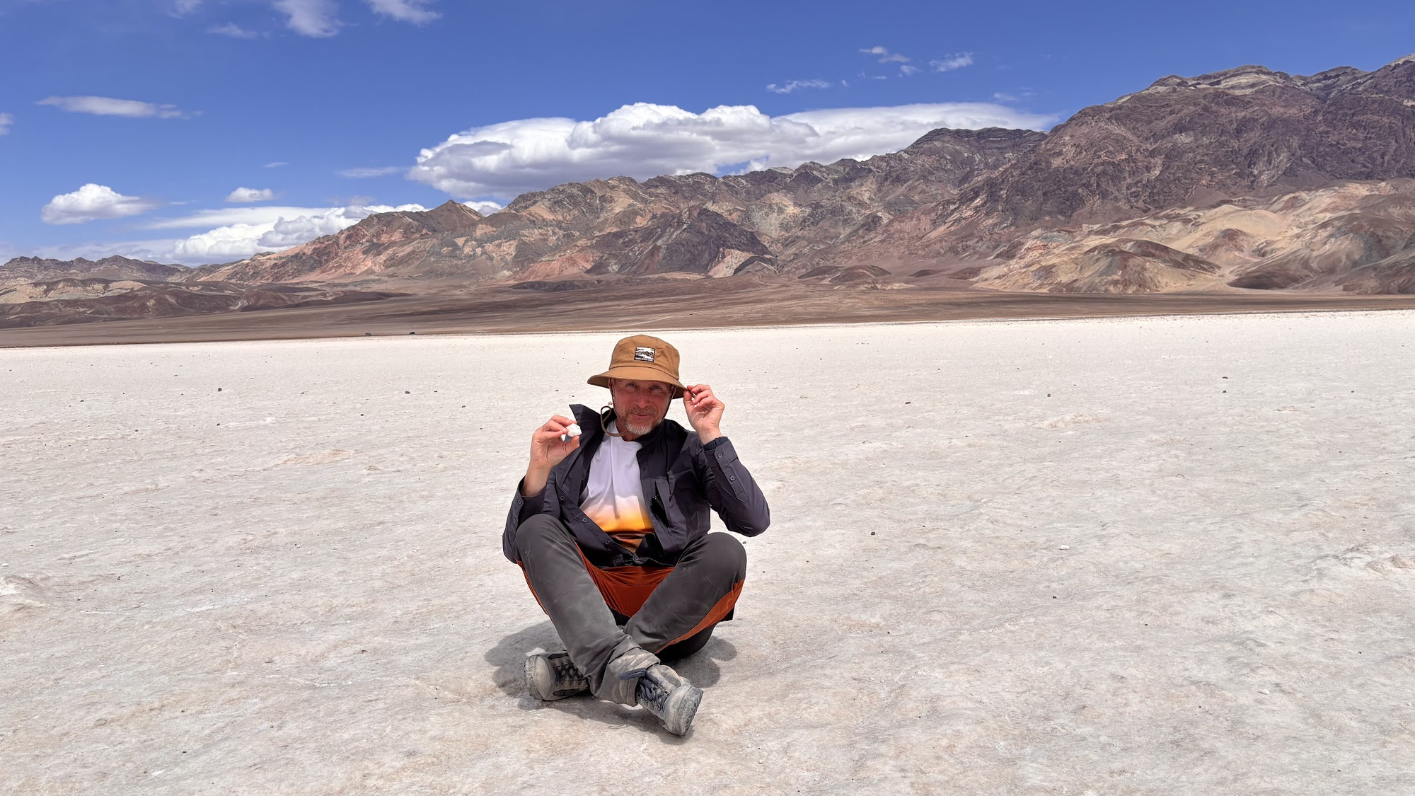
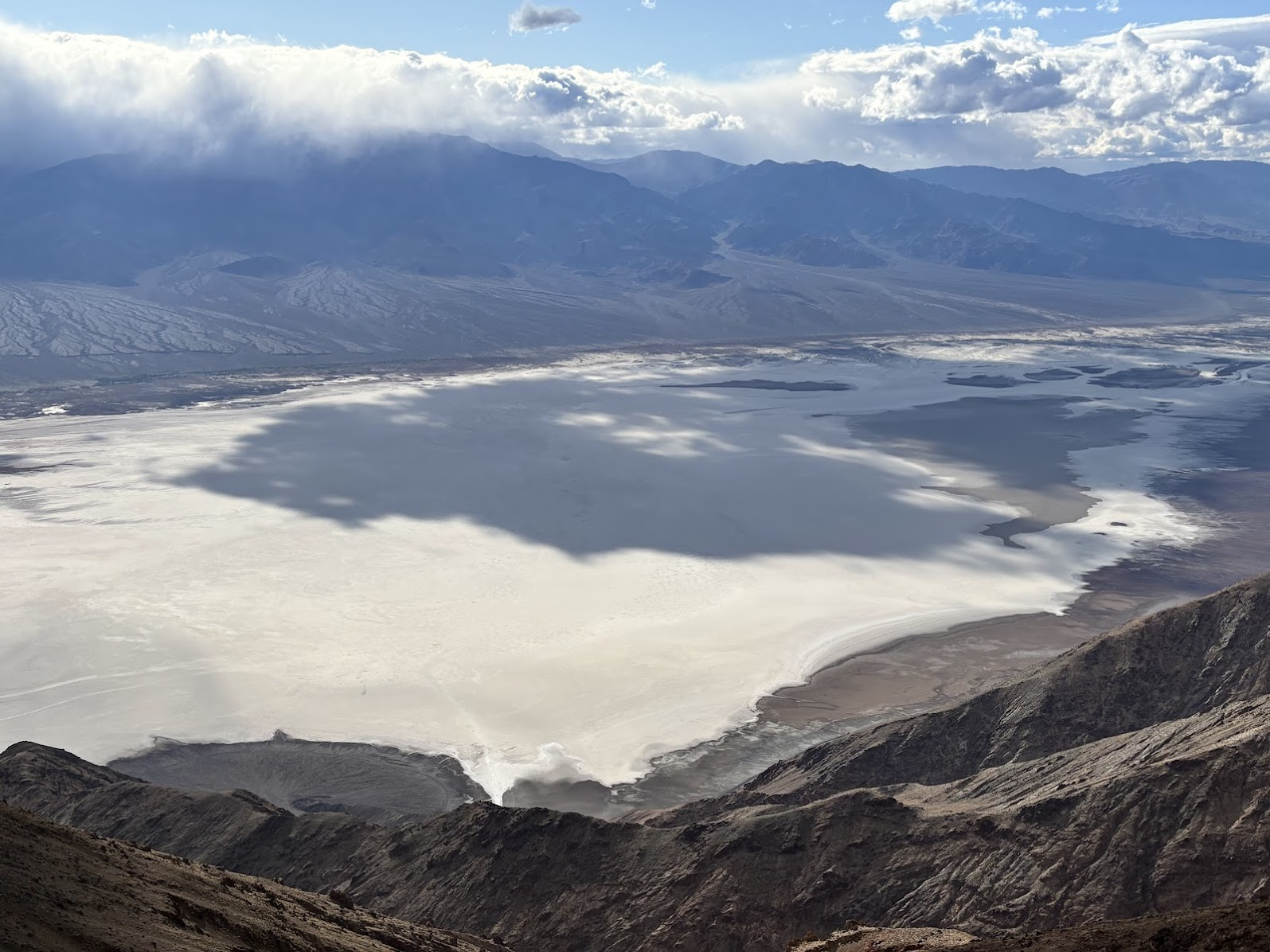
Punktem kulminacyjnym dnia był długi spacer po wyschniętym jeziorze (Badwater Basin). Z parkingu prowadzi molo jak nad morzem. Tyle, że zamiast wody jest sól. Prawdziwa - kosztowałem!
Badwater Basin was certainly the highlight of our hiking in the Death Valley. This was what we had expected. A wooden walkway leads from the parking - it feels like at sea, except there's no water, only salt. Real salt - I have tasted it!
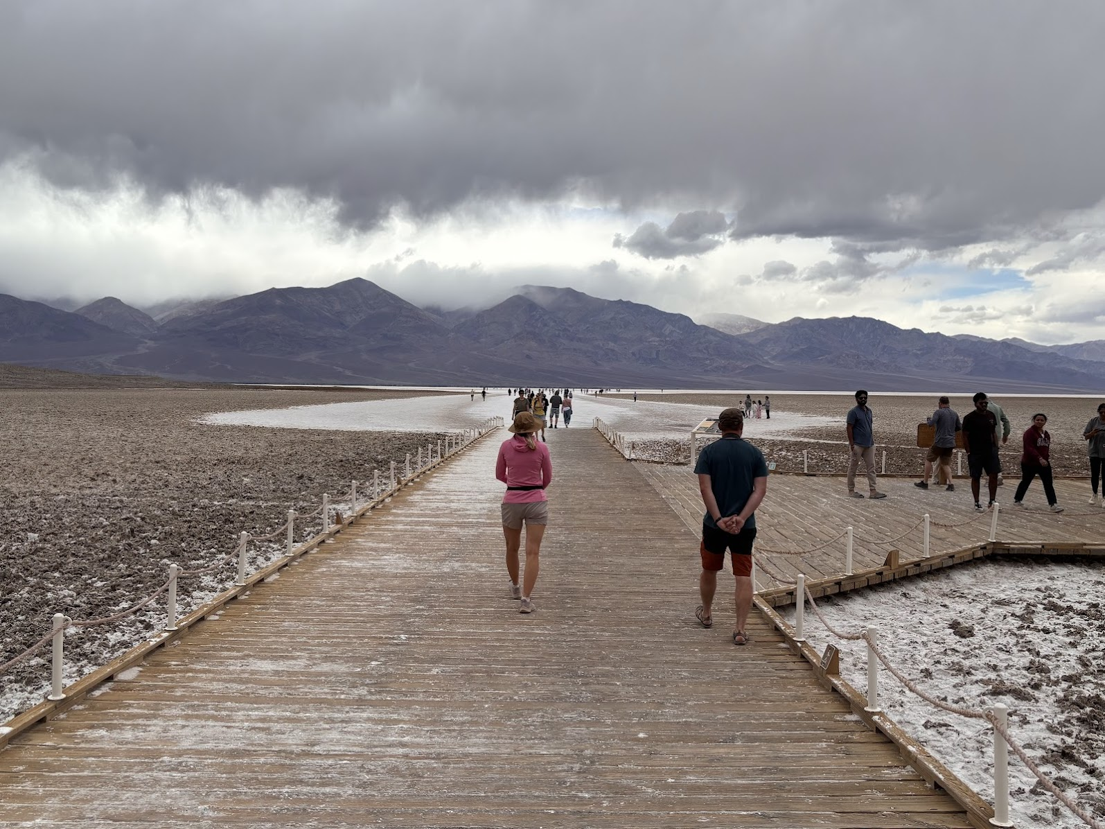
Przy molo oczywiście tłum turystów. Ale poszliśmy dalej w głąb i z każdym krokiem ludzi coraz mniej. Sól jest twarda, wędruje się dobrze. Ale przy aucie odkryję solidną warstwę kurzu solnego na butach i spodniach.
There are crowds at the head of the walkway. However, as we went into the basin, the crowds dispersed. The salt surface is hard, good for walking. When we returned to our car, I discovered a layer of salt dust on my boots and pants.
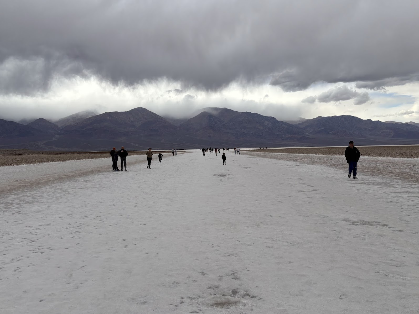
Warto zwrócić uwagę na chmury na zdjęciu powyżej. W górach Panamint Mts pada solidny deszcz. Do nas nie dotrze - choć jesteśmy oddaleni od nich o zaledwie 25km. To częste tutaj zjawisko - 'cień opadowy'. Wilgotne powietrze znad Pacyfiku daje deszcz zachodniej Kalifornii. Następnie chmury rozbijają się o wysokie góry Sierra Nevada (ponad 4000m n.p.m.) i trochę niższe Panamint Mountains (ponad 3000m n.p.m.) i tam zostawiają resztę wody. Nad Dolinę Śmierci nie dociera prawie nic. Średnio w roku spada tu zaledwie 5cm deszczu. Dolina Śmierci dzierży też światowy rekord temperatury - 57° (roczna średnia to 33°).
It's worth turning attention the clouds seen on the photo above. It's raining in the Panamint Mts, but it will never reach is, although we are just 25km away. This phenomenon is called 'rain shadow'. Humid air from the Pacific gives generous rains to western California. Then the clouds 'bump' into high Sierra Nevada (peaks over 4000m a.s.l.) and Panamint (above 3000m a.s.l.) ranges. All the water is discharged there and few rains ever reach the Death Valley. The average yearly precipitation is just over 5cm. It's also the hottest place on Earth - the highest recorded temperature was 57° C (yearly average is 33°).
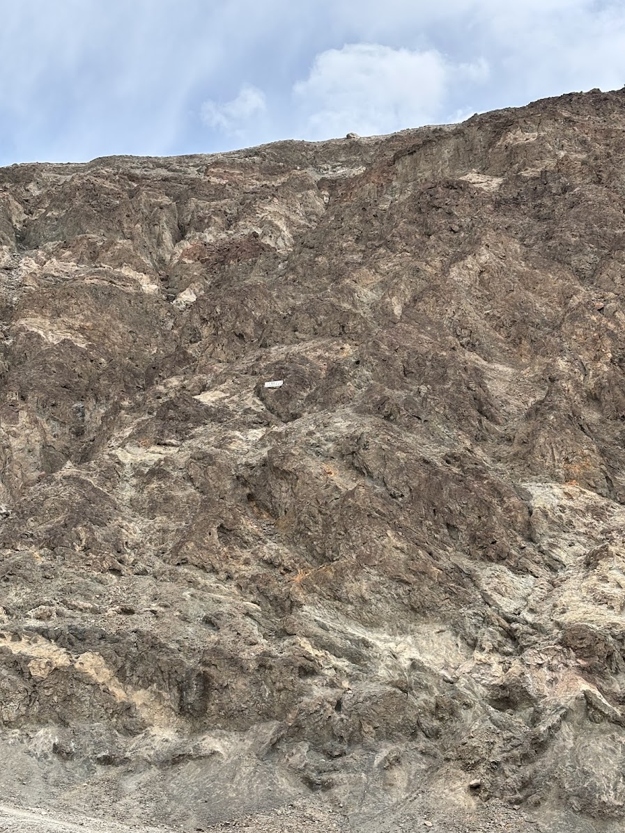
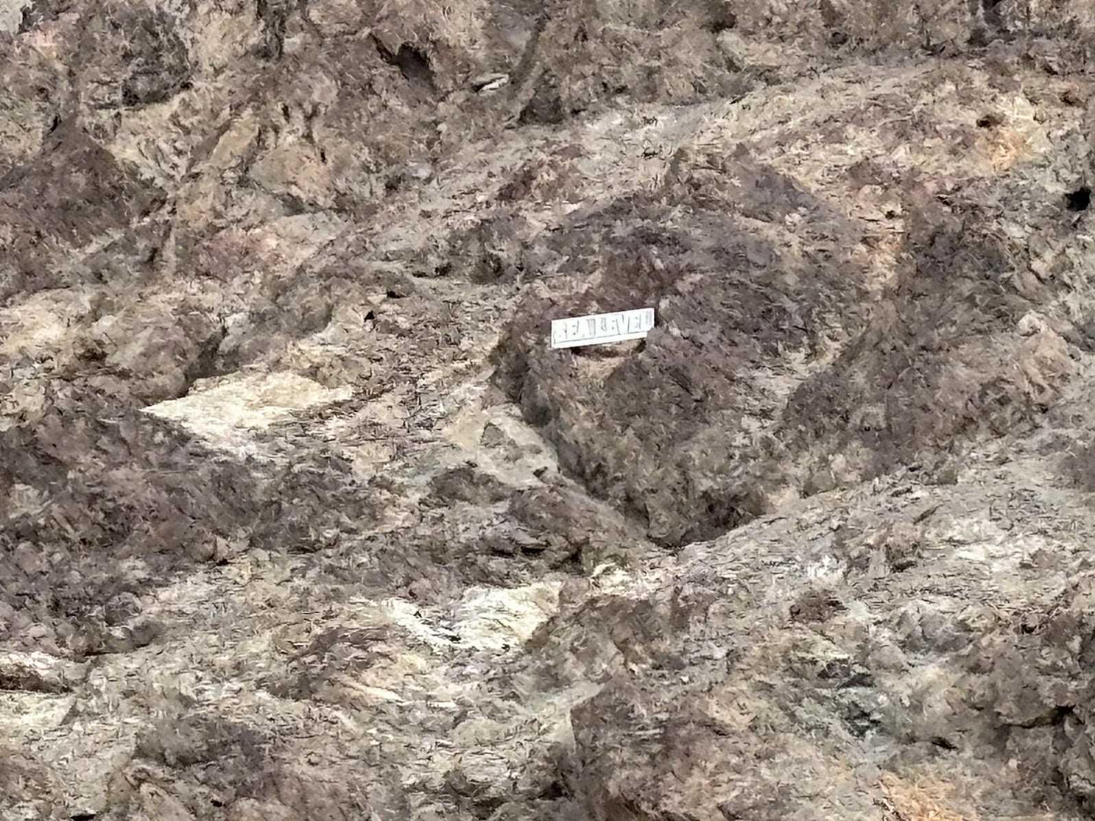
Dolina Śmierci to depresja i najniższe miejsce na półkuli zachodniej. W Badwater Basin jesteśmy 86m poniżej poziomu morza. Na górze nad parkingiem umieszczony jest znak Sea Level, wskazujący poziom morza.
Death Valley is a depression and it is the lowest point in the western hemisphere. The Badwater Basin is 86m below sea level. There is a sign on the mountain opposite the parking, and it marks the sea level.
Driving in Death Valley
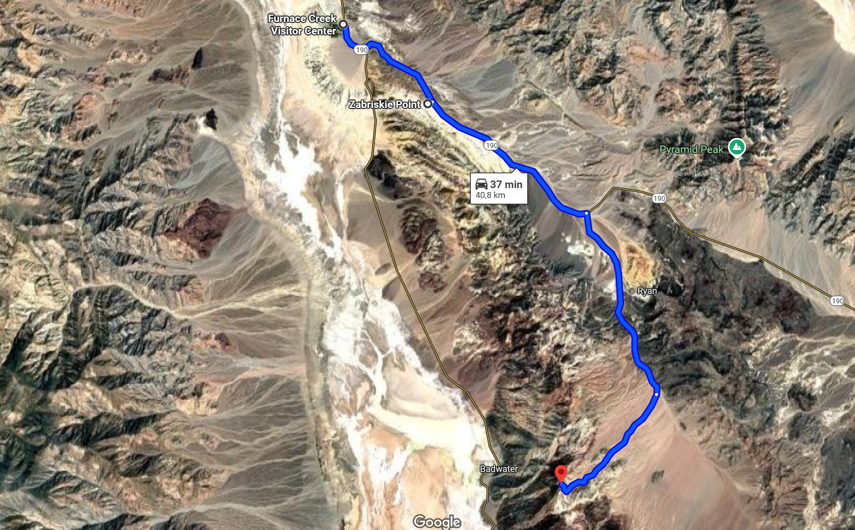
Nasza wycieczka po Dolinie Śmierci to wiele przejazdów z miejsca w miejsce. Od centrum informacyjnego po Badwater Basin przejechaliśmy 50km.
Our hiking in Death Valley required substantial driving between the points of interest. From Visitor's Center to Badwater Basin we drove 50km.
Zabriskie Point
Wiecie już, że Dolina Śmierci dalece wykracza poza wyobrażenia o płaskim dnie słonego jeziora. Dwie ostatnie wycieczki dnia jeszcze bardziej nas w tym utwierdziły. Najpierw jedziemy do Zabriskie Point.
You know already that hiking in Death Valley is so much more beyond flat salty plain. Our last two walks of the day have only reinforced that notion. We will first drive to Zabriskie Point.
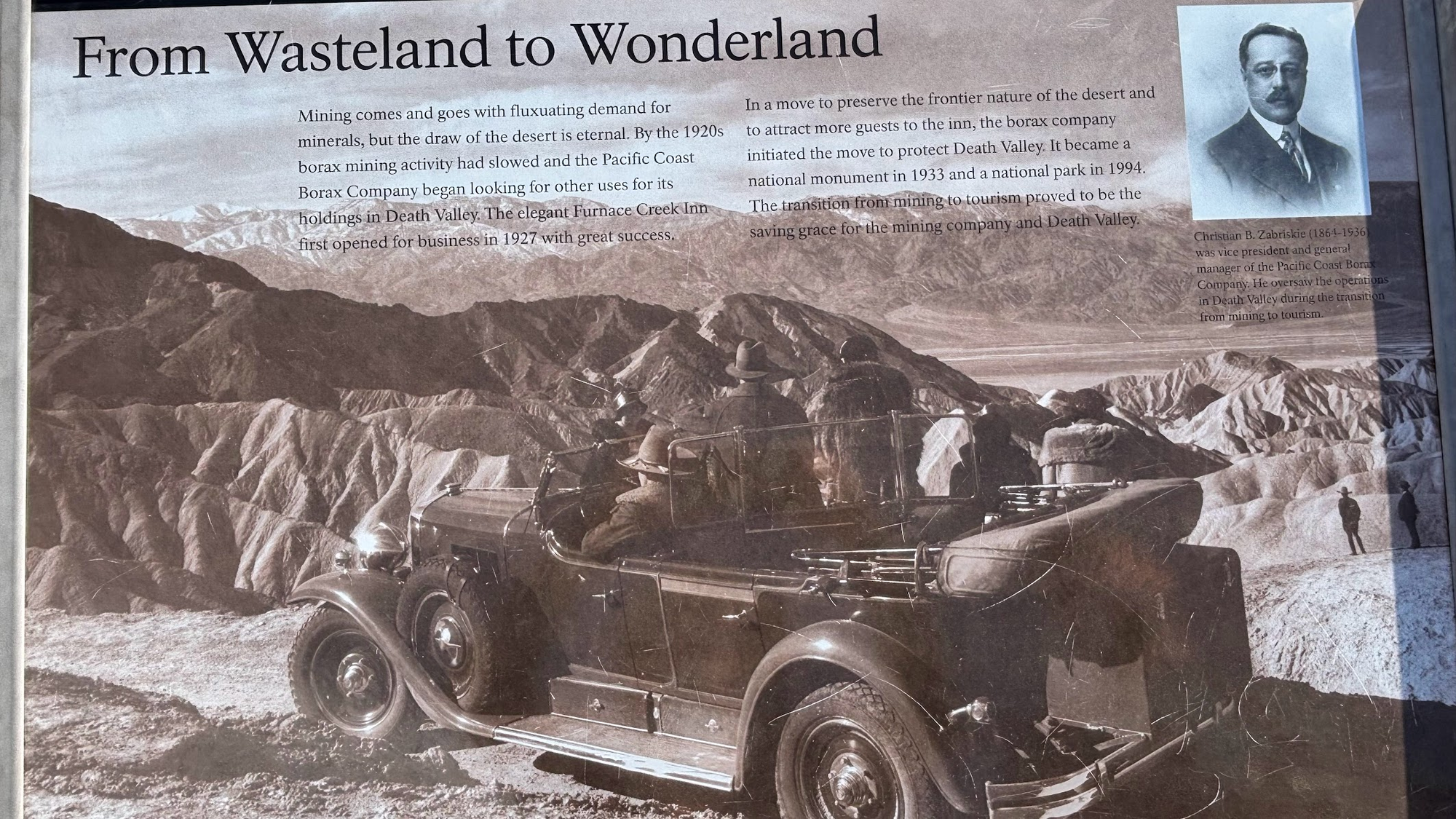
Nazwa 'Zabriskie Point' pochodzi od nazwiska dyrektora generalnego firmy Pacific Coast Borax Company, która na przełomie XIX i XX wieku wydobywała boraty - minerały używane w produkcji środków czystości i pestycydów.
The name 'Zabriskie Point' comes from the surname of general manager of Pacific Coast Borax Company, which mined borates in Death Valley in late 1890s and early 1900s.
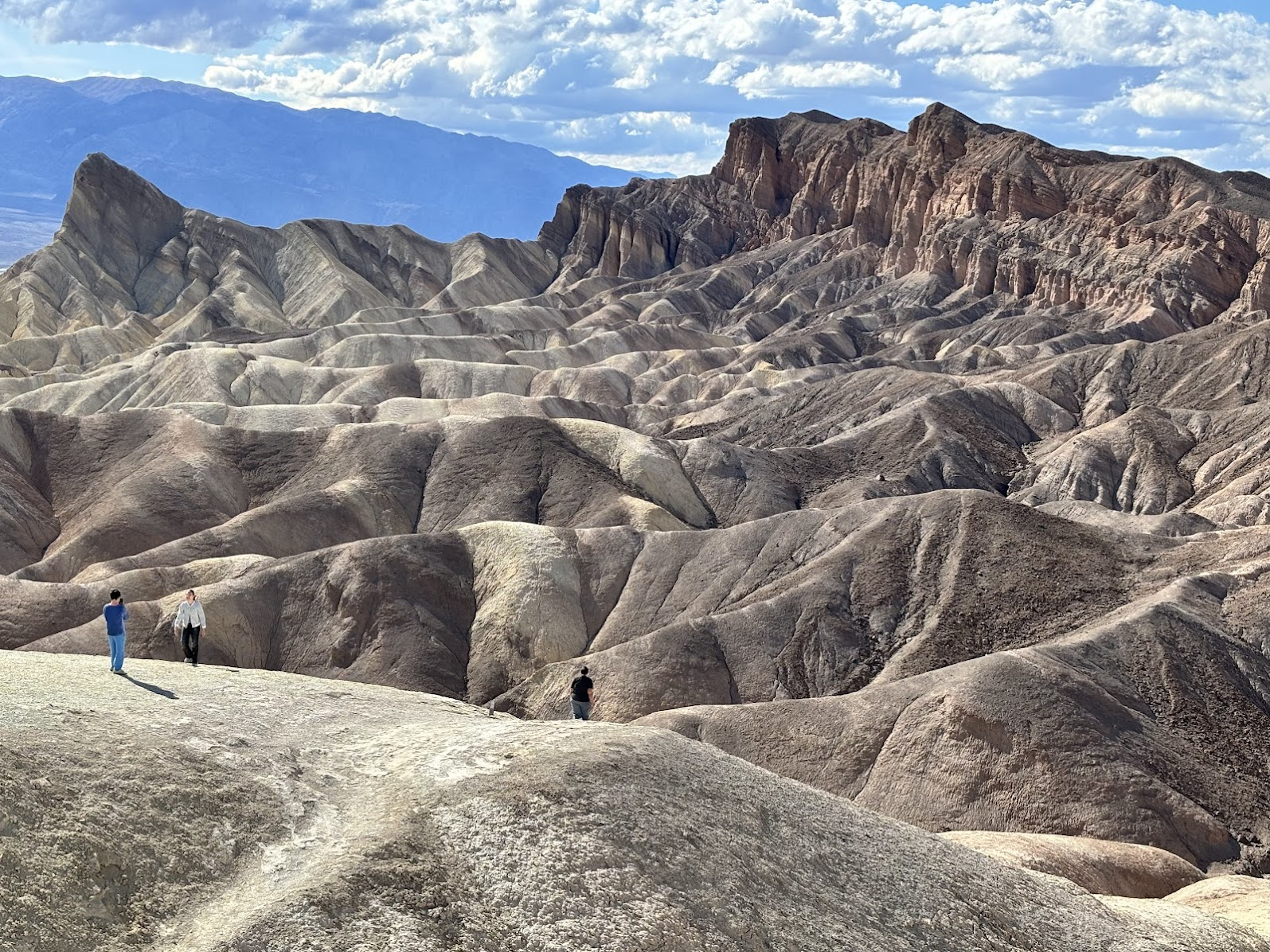
Nieziemskie formacje widoczne w Zabriskie Point to spetryfikowane solne błota, żwir oraz popiół i osady pochodzenia wulkanicznego. Fani U2 powinni rozpoznać krajobraz ze zdjęć - widnieje on na okładce albumu "The Joshua Tree". Z kolei miłośnicy kinematografii mogą kojarzyć Zabriskie Point z filmem Michelangelo Antonioni' ego pod tym tytułem (ścieżkę dźwiękową do filmu tworzyli m.in. Pink Floyd i Rolling Stones). Filozof Michel Foucault nazwał podróż do Zabriskie Point "największym doświadczeniem swojego życia".
The unearthly formations visible at Zabriskie Point are petrified saline muds, gravels and volcanic ashes. U2 fans should recognize the view - it was featured in the cover photo of their album "The Joshua Tree". The name 'Zabriskie Point' should also ring a bell with cinematography lovers. Michelangelo Antonioni shot a movie with that title and it was partially filmed on this location (the sound track was created by Pink Floyd and the Rolling Stones). The famous philosopher Michel Foucault called his trip there "the greatest experience of his life".
Dante's View
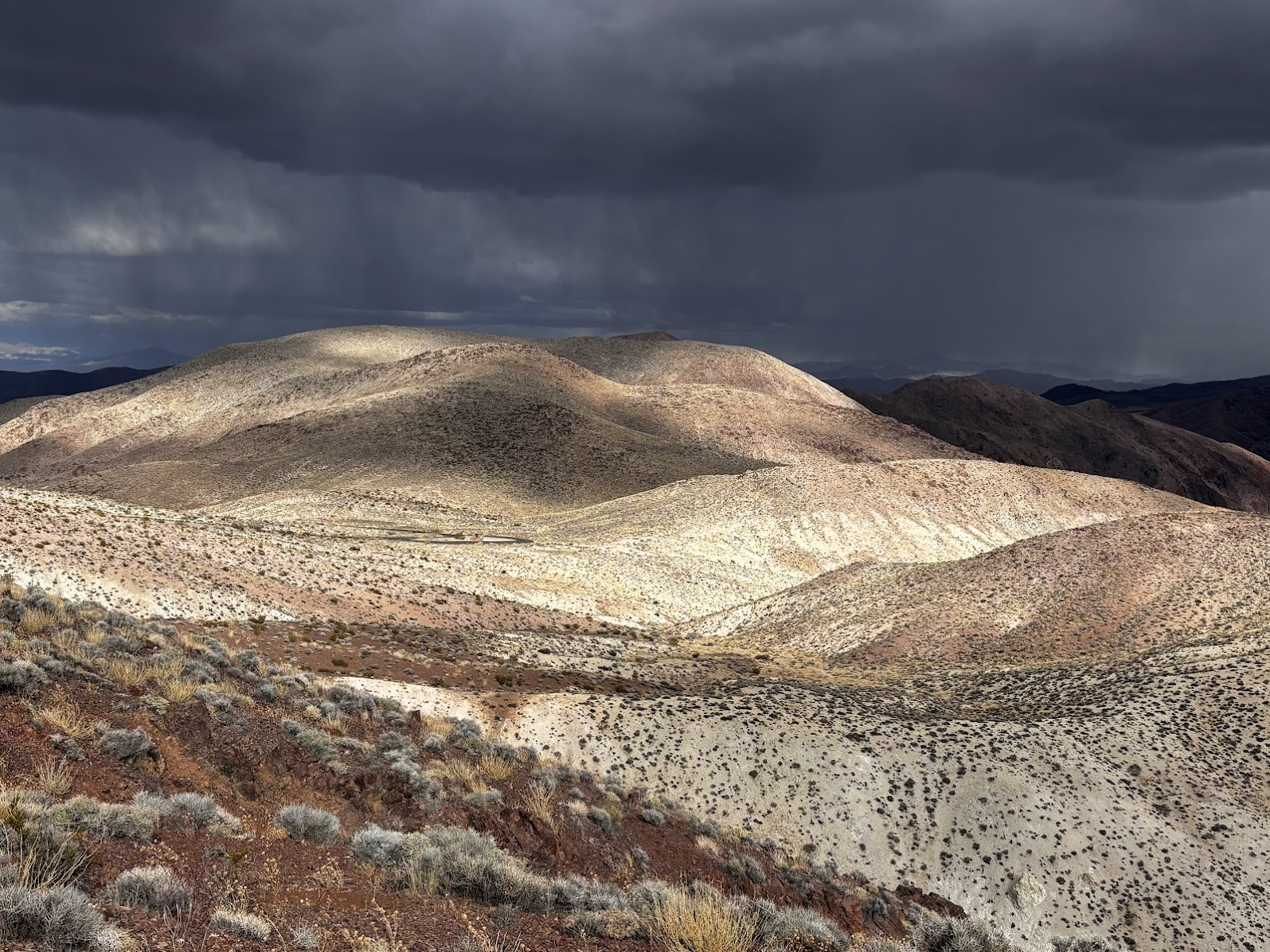
Pełen wrażeń dzień zamknęliśmy wizytą na szczycie Dante's View. To góra o wysokości 1639m n.p.m. (czyli trochę niższa od polskiej Babiej Góry), wznosząca się w łańcuchu Black Mountains. Na górę prowadzi droga asfaltowa.
We ended the day by driving to Dante's View. Even though the peak is at 1639m a.s.l. (and more than 1700m above the Badwater Basin), there is an easy paved road leading to a parking.
Z góry wyraźnie widać topografię Doliny Śmierci. Od zachodu ogranicza ją wysokie pasmo gór Panamint (najwyższe szczyty mają ponad 3000m n.p.m.), a od wschodu łańcuch Black Mountains (maksymalna wysokość nie przekracza 1800m n.p.m.). Widzimy też, że z gór Panamint spływają stożki napływowe (aluwialne), niosące błoto i materiał skalny. Natomiast zbocza gór Black Mountains opadają do doliny stromymi ścianami.
We can now clearly see the topographic outline of Death Valley. It is flanked from the west by Panamint Mts (reaching well over 3000m a.s.l.) and its eastern limes are Black Mts (highest peaks are below 1800m a.s.l.). We can also observe alluvial fans coming down from the Panamint Mts. Black Mountains slopes are very steep and drop sharply into the valley.

Dante's View był znakomitym wyborem na zakończenie wycieczki. W ciągu dnia odkrywaliśmy po kolei tajemnice Doliny Śmierci, a na koniec spojrzeliśmy na nią z góry. Przy dobrej pogodzie, Dante's View warto odwiedzić o zachodzie słońca. My niestety wieczorem mieliśmy deszcz. Co w niczym nie obniża naszego zachwytu różnorodnością krajobrazów Doliny Śmierci.
Dante's View made an excellent finale of our trip. During the day we discovered Death Valley's secrets and we crowed the day by a view from above. When the weather is good, Dante's View is worth visiting at sunset. We were met by rains there. But it doesn't affect our amazement by Death Valley's diversity of landscapes.
America the Beautiful Trip - Day 9
Hiking in Death Valley
| Data / Date | 26.04.2025 |
|---|---|
| Poprzedni dzień / Previous day | Route 66 and Hoover Dam |
| Trasa samochodem / Route by car | Beatty, NV <=> Death Valley (Furnace Creek), CA (120km) + routes within Death Valley National Park (105km) |
| Szlak(i) pieszo / Trail(s) on foot | Golden Canyon (5km out and back) + numerous shorter walks |
| Wstęp / Entry fee | America the Beautiful Annual Pass |
| Strona www Parku / Park website | https://www.nps.gov/deva/index.htm |
| Nocleg / Accommodation | Atomic Inn Beatty near Death Valley, NV |
| Następny dzień / Next day | Death Valley Day 2 |
| Plan podróży / Trip itinerary | 'America the Beautiful Trip' |
![Death Valley Mesquite Dunes. Driving to a Different California. US Southwest Trip Day 10 [POL/ENG]](https://img.truvvle.com/?src=aHR0cHM6Ly9pbWcudHJhdmVsZmVlZC5pby9zbnVma2luJTJGMjAyNS0wOC0wNS0xNy0wOC0zNjQtbWVzcXVpdGVkdW5lcy1wbmc&width=800)
![America the Beautiful Trip - Itinerary. Podróż po południowo-zachodnich stanach USA - Plan [POL/ENG]](https://img.truvvle.com/?src=aHR0cHM6Ly9pbWcudHJhdmVsZmVlZC5pby9zbnVma2luJTJGMjAyNS0wNS0wOS0xNS0wNS05OTItYW1lcmljYXRoZWJlYXV0aWZ1bC1qcGc&width=800)
![Valley of Fire State Park, NV. Muflony, antyczny FB i kolorowe skały. US SW Trip Day 0.5 [POL / ENG]](https://img.truvvle.com/?src=aHR0cHM6Ly9pbWcudHJhdmVsZmVlZC5pby9zbnVma2luJTJGMjAyNS0wNS0xNC0xOS0wNS02MTQtdmFsbGV5b2ZmaXJlLWpwZw&width=800)