![Grand Canyon South Rim Trail / Szlak brzegiem Wielkiego Kanionu. US Southwest trip Day 6 [POL / ENG]](https://img.truvvle.com/?src=aHR0cHM6Ly9pbWcudHJhdmVsZmVlZC5pby9zbnVma2luJTJGMjAyNS0wNy0wMS0xOS0wNy00NDItZ3JhbmRjYW55b24tcG5n&width=2000)
"Grand Canyon South Rim Trail" post is written in Polish and English. The English text is in italics, below each paragraph in Polish.
Wielki Kanion Kolorado został wpisany na naszą listę jako pierwsze miejsce do odwiedzenia. Trudno wyobrazić sobie podróż przez południowy zachód USA bez Wielkiego Kanionu (Arizona). Przeznaczyliśmy nań 2 dni. Pierwszego dnia przeszliśmy 20km wzdłuż południowego brzegu kanionu. Drugiego zeszliśmy w dół.
The Grand Canyon, Arizona is a must see during a first-time Southwestern US trip. We spent 2 days there. The first day was a walk along the south rim, from Kaibab Trailhead to Hermit's Rest. On the second day we descended into the abyss.
Plan
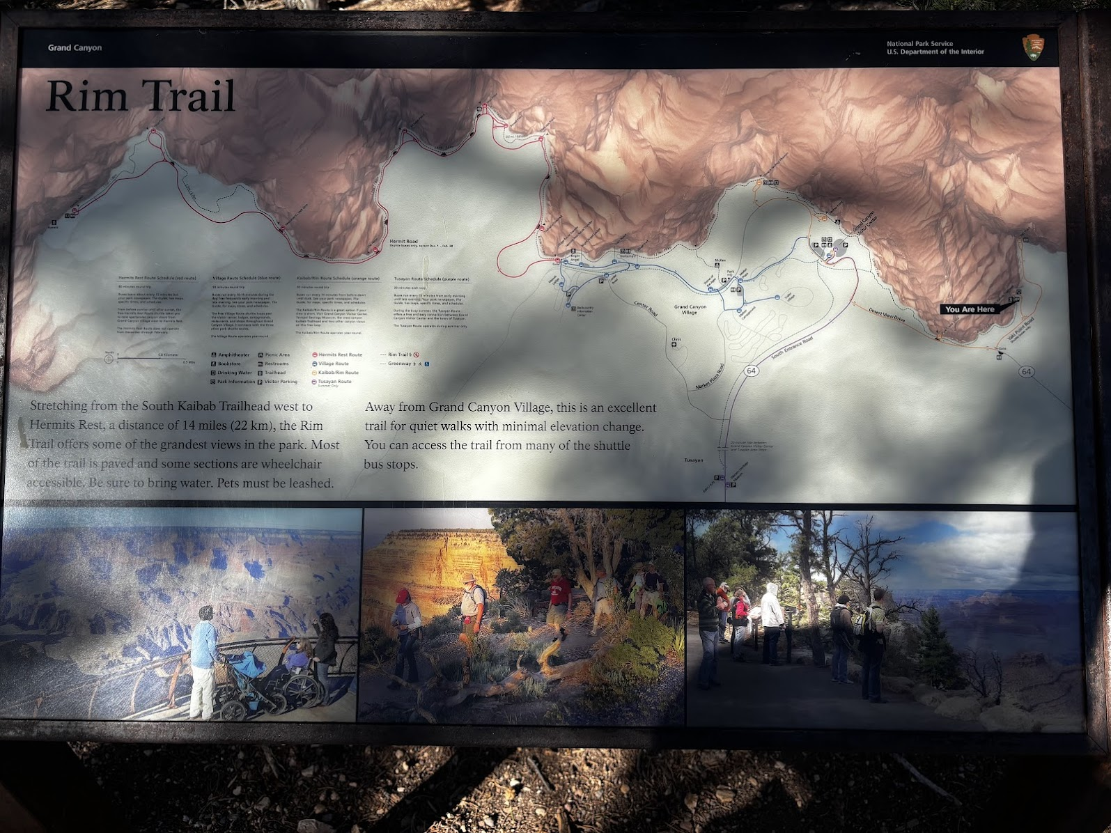
Logistykę znacznie upraszcza dostępność darmowych autobusów. Parkujemy przy Centrum Informacyjnym i busem linii pomarańczowej jedziemy do punktu Kaibab Trailhead. Przed nami 21km wzdłuż brzegu kanionu. W punkcie Hermit's Rest wsiadamy do autobusu linii czerwonej. Ten zawozi nas do punktu przesiadkowego, skąd bus niebieski zabiera nas na parking.
The logistics of Grand Canyon South Rim Trail is easy due to free shuttle buses. We parked at the Visitors Center and took the orange line to Kaibab Trailhead. Then we walked along the rim all the way to Hermit's Rest (red bus line terminus). The red lines took us to Transfer Point, and then the blue line got us back to the parking.
Easy Stroll
Kaibab Trailhead - w kolejnym dniu z tego punktu będziemy zaczynać zejście na dno Wielkiego Kanionu. Ale pierwszy dzień jest zapoznawczy - przejdziemy 21km wzdłuż brzegu kanionu. Jesteśmy na wysokości ok. 2200m n.p.m. (czyli wyżej niż Tatry Zachodnie!) a skończymy na ok. 1985m (czyli mniej więcej Kasprowy Wierch).
The Kaibab Trailhead will be the starting point for both our days in Grand Canyon National Park. The first day is an easy "get to know the canyon" - 21km walk along the rim. We are at 2200m a.s.l. and the trail ends at 1985m a.s.l.
Przejście 20km wzdłuż południowej krawędzi Wielkiego Kanionu to spacer. Prawie płasko i w większości idziemy asfaltową ścieżką. Gdy osiągamy Centrum Informacyjne, schodzimy ze szlaku do auta by zmienić buty. Zostawiamy ciężkie buty trekkingowe i ubieramy lżejsze.
The 20km Grand Canyon South Rim Trail is really a walk. 20km, almost flat and the vast majority of the trail is paved. It's so easy, that when we reached the Visitor's Center, we went back to our car to drop our trekking boots and put on lighter sneakers.
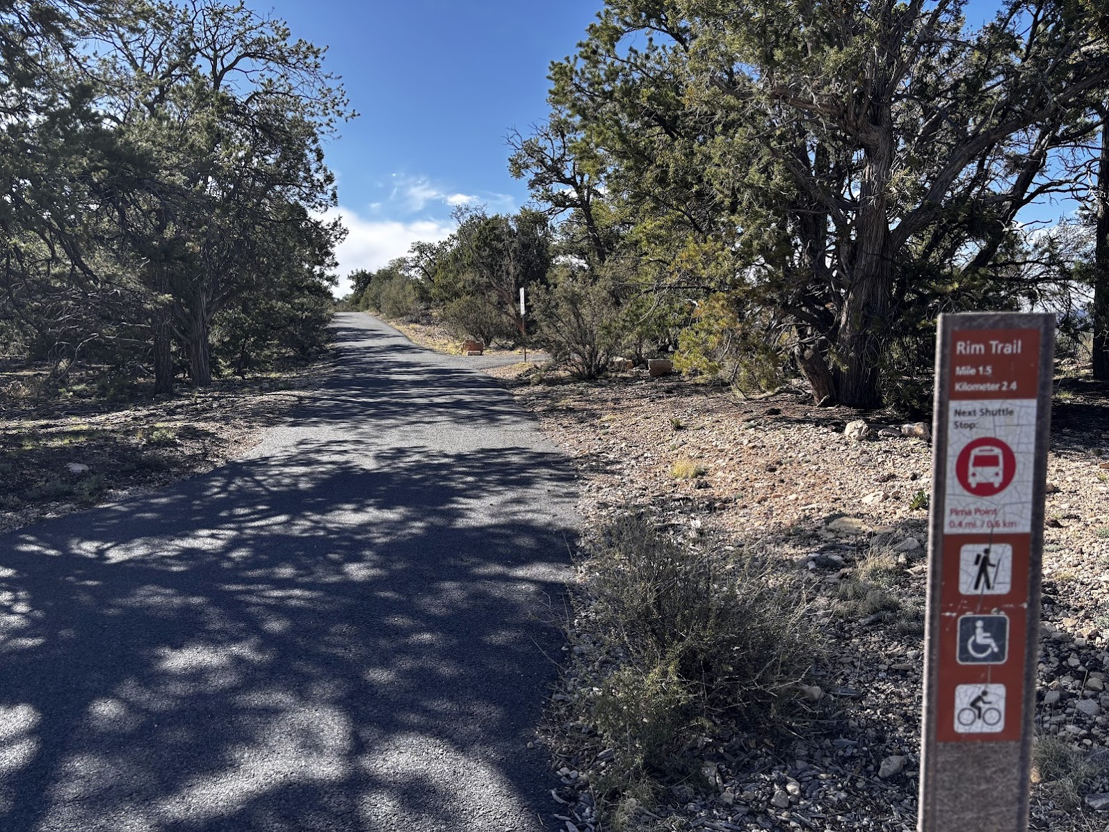
My przeszliśmy całe 21km, ale szlak można dowolnie skracać. Wzdłuż brzegu kanionu kursują darmowe autobusy. Jeśli 20km to za dużo, nie ma problemu - można wrócić wcześniej. Taka organizacja oraz asfaltowa ścieżka sprawiają, że brzeg kanionu jest dostępny dla każdego. Wystarczy podjechać busem, przejść do punktu widokowego i mamy zdjęcie kanionu.
We did the complete 21km, but this trail can be easily shortened. The free shuttle buses go along the whole trail. If 20km sounds like too much, one can do a shorter walk and return by bus. Due to the trail being mostly paved, it is also easily accessible. To visit the canyon, one could take a ride on the bus, walk to the nearest view point and take a breathtaking photo.
Geology Lesson
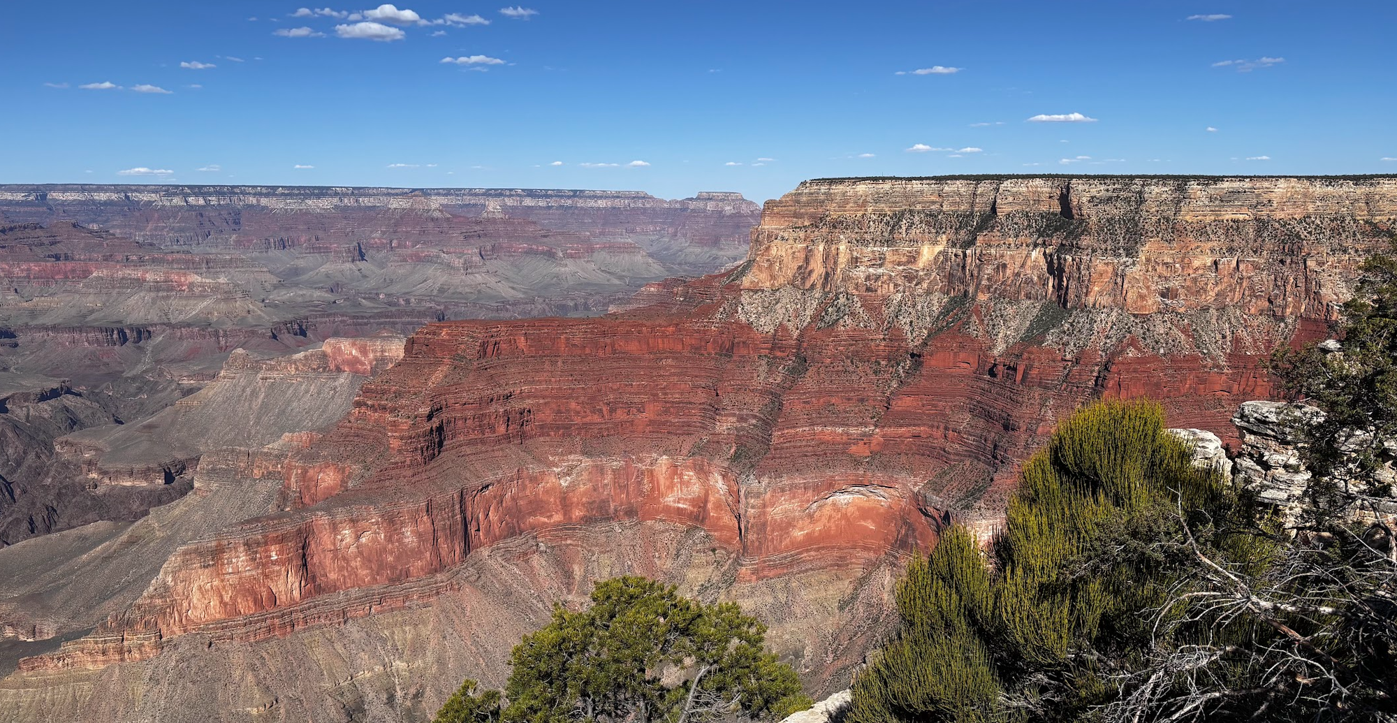
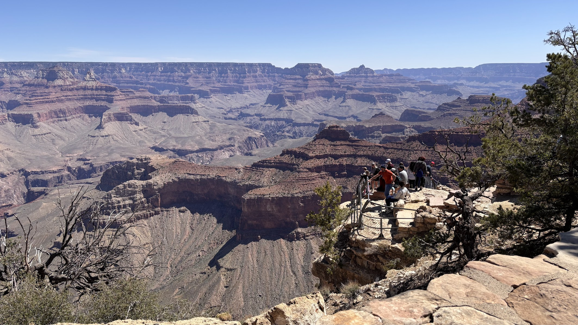
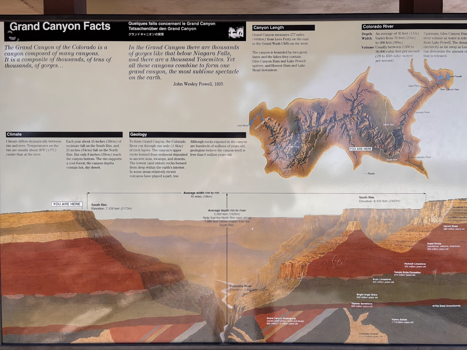
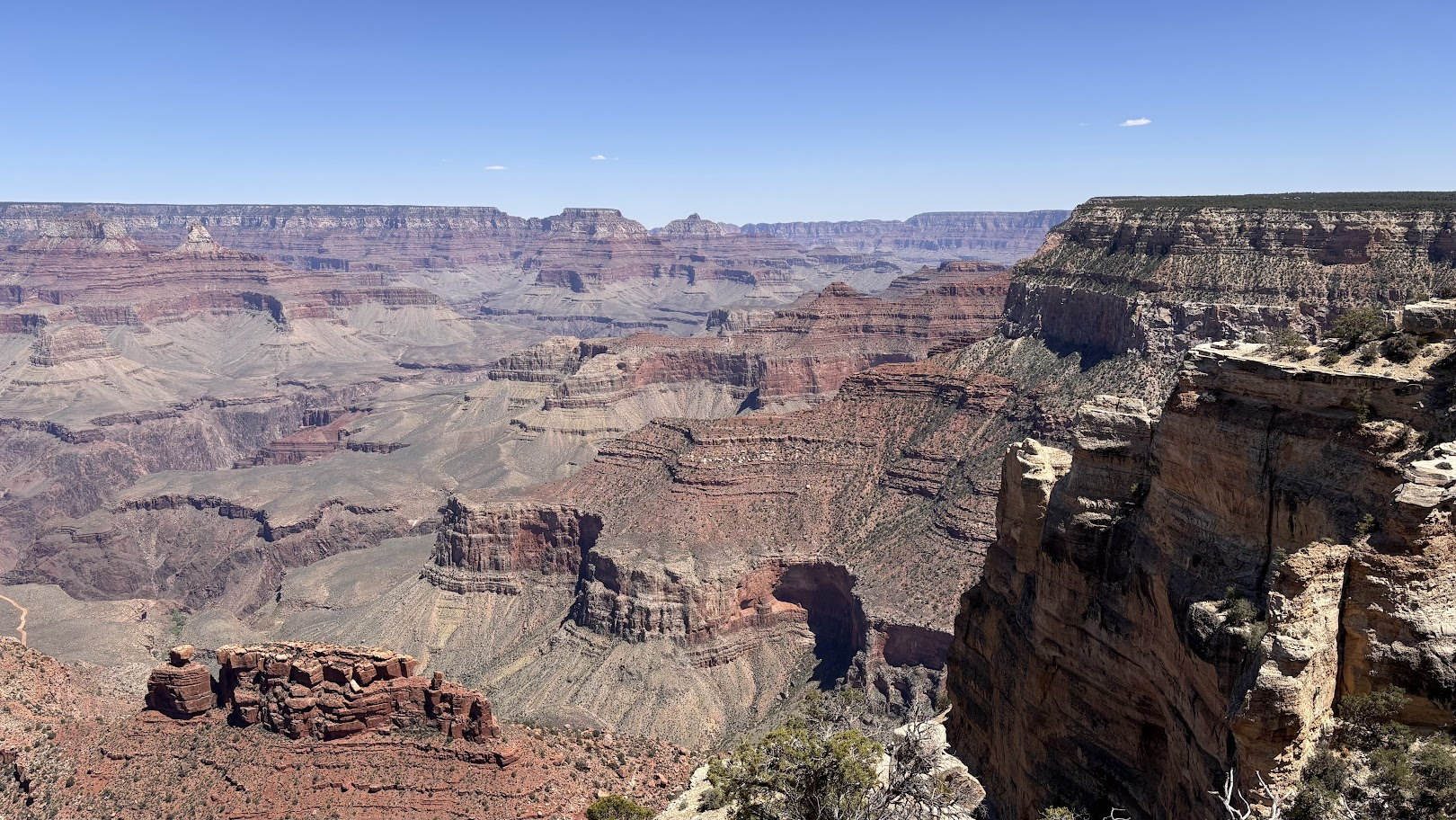
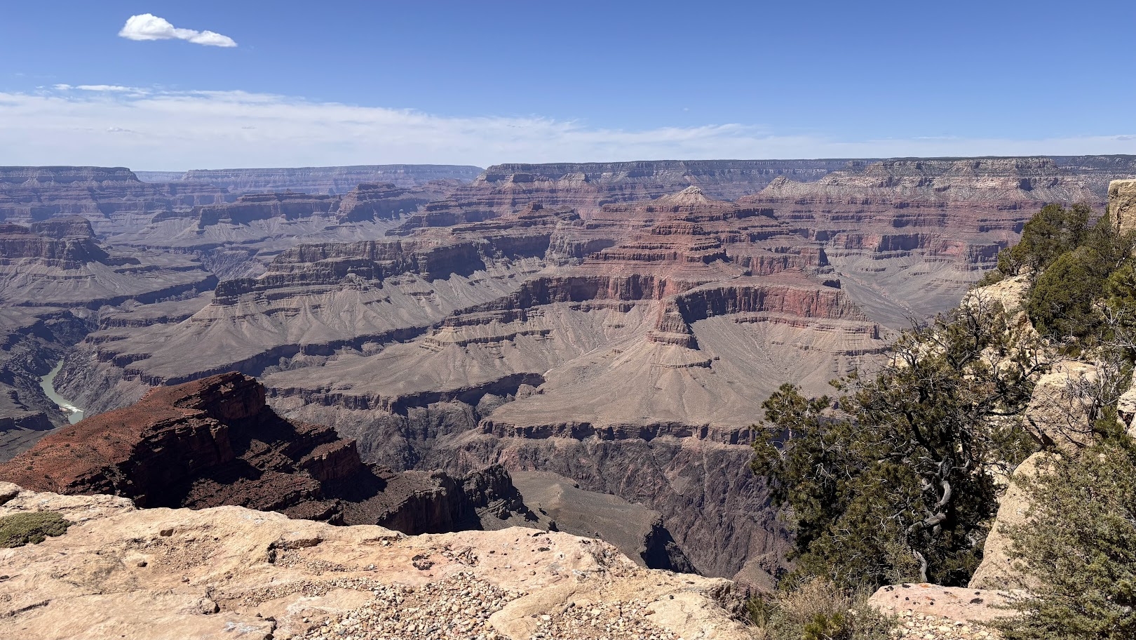
Wielki Kanion ma ponad 1,5km głębokości. Brak poważniejszych fałdowań pozwala na wgląd w przeszłość geologiczną. Warstwy skalne są elegancko poukładane jedna na drugiej. Woda (rzeka Kolorado, jej niewielkie dopływy oraz opady) wyrzeźbiła głębokie szczeliny, które przecinają skały, odsłaniając kolejne, równoległe warstwy. Ściany kanionu nie opadają pionowo w dół. Owszem, są strome ściany, ale widać także liczne wypłaszczenia.
The Grand Canyon is over 1.5km deep. There haven't been any serious mountain shaping movements. Therefore the rock layers are neatly placed one on top of another. Water (Colorado river and its tributaries, but also precipitation) has sculpted deep gaps in the rock, uncovering subsequent, parallel layers. The walls of the canyon are not a single drop. They are steep indeed, but in many places we see flat terraces.
Warto uzmysłowić sobie, że Grand Canyon "żyje". Woda dalej cierpliwie rzeźbi skały. Drobne odłamki skał osypują się w kierunku dna. Czasem dochodzi do większych oberwań, gdy struktury skał nie wytrzymują siły grawitacji.
It's worth realizing that the Grand Canyon "lives". Water continues to erode rocks. Little stones roll towards the bottom. Sometimes greater boulders give up and allow the gravity force to take its course.
Exploration
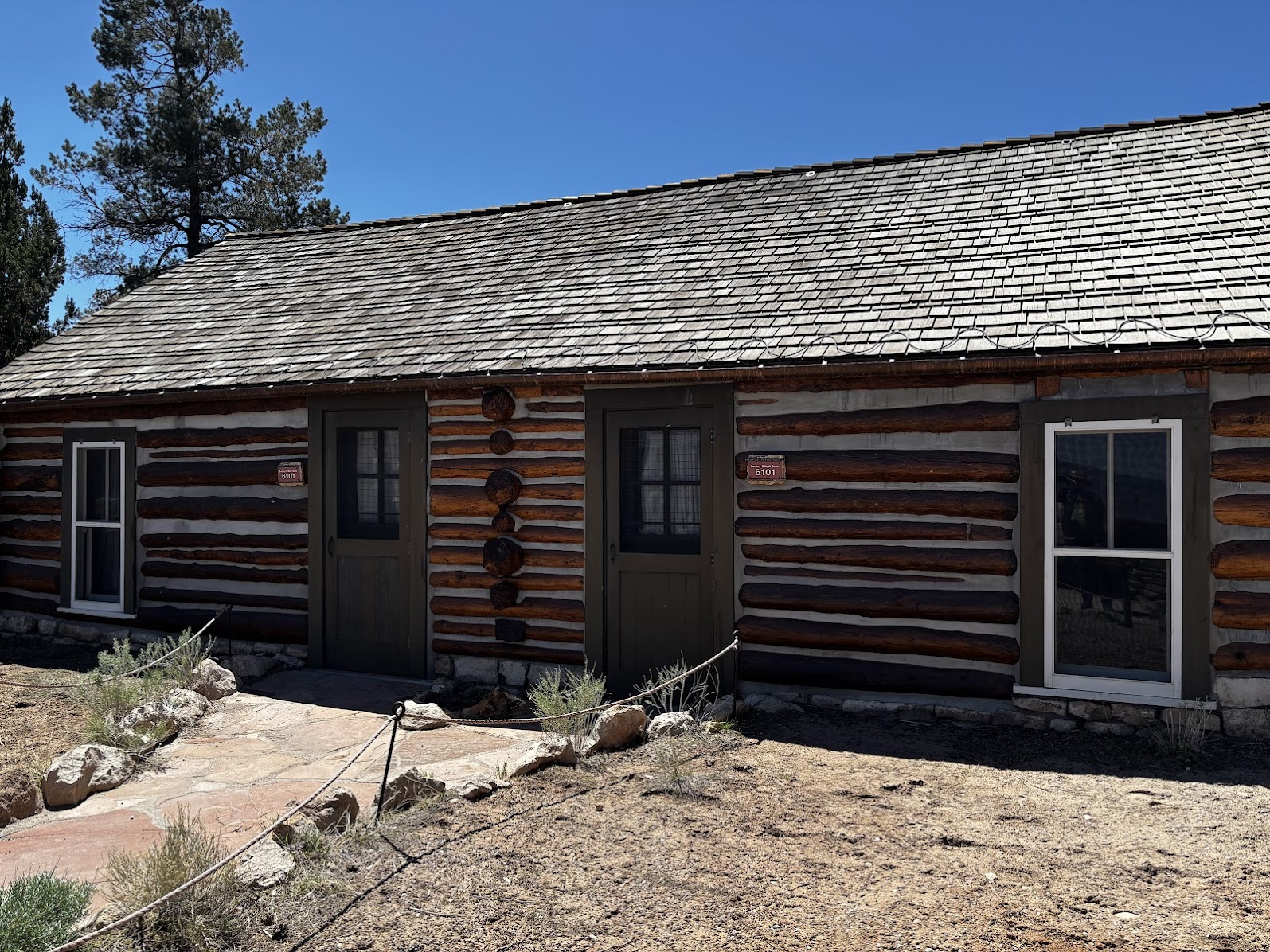
Park Narodowy Wielkiego Kanionu został utworzony w 1919r za rządów prezydenta Woodrow'a Wilson'a, jako 14-ty park w USA (w tym samym roku powołano Park Zion, a pierwsza trójka to Yellowstone 1870, Sequoia 1890 i Yosemite 1890). Zainteresowanie turystyczne zaczęło się oczywiście wcześniej. Jeśli odejdziemy na chwilę od brzegu kanionu, w Canyon Village możemy zobaczyć budynki z XIX wieku.
The Grand Canyon National Park was created in 1919, under Woodrow Wilson's administration. It was the 14th national park in the USA (Zion was established in the same year and the first three are Yellowstone 1870, Sequoia 1890 and Yosemite 1890) . Tourist exploration is of course much older. In Canyon Village one can see buildings from XIX century.
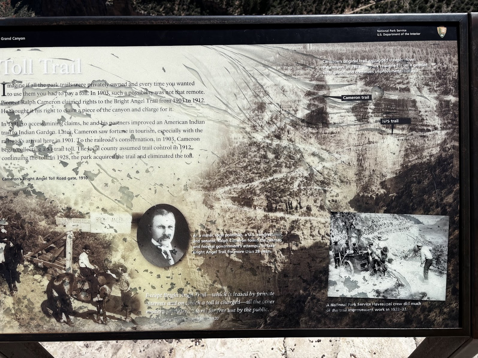
Kanion był tak popularny, że na początku XXw przedsiębiorczy Amerykanin, Ralph Cameron ogłosił się właścicielem szlaku Bright Angel (przejdziemy nim drugiego dnia) i pobierał opłaty za przejście! Obecnie park odwiedza prawie 5mln ludzi rocznie. Jeśli nie mamy karty America the Beautiful, wejście na 7 dni kosztuje 20$ (pieszo/rowerem) lub 34$ (samochód, max 15 pasażerów).
The Canyon was so popular that in the beginning of the 20th century, Ralph Cameron claimed ownership rights and collected tolls for hiking the Bright Angel Trail (we will walk part of the trail on our second day). Nowadays, the park is visited by almost 5mln people yearly. If you don't have the America the Beautiful annual pass, an entry valid for 7 days costs $20 per cyclist or pedestrian and $35 for a private car (with up to 15 passengers).
Where's the River?
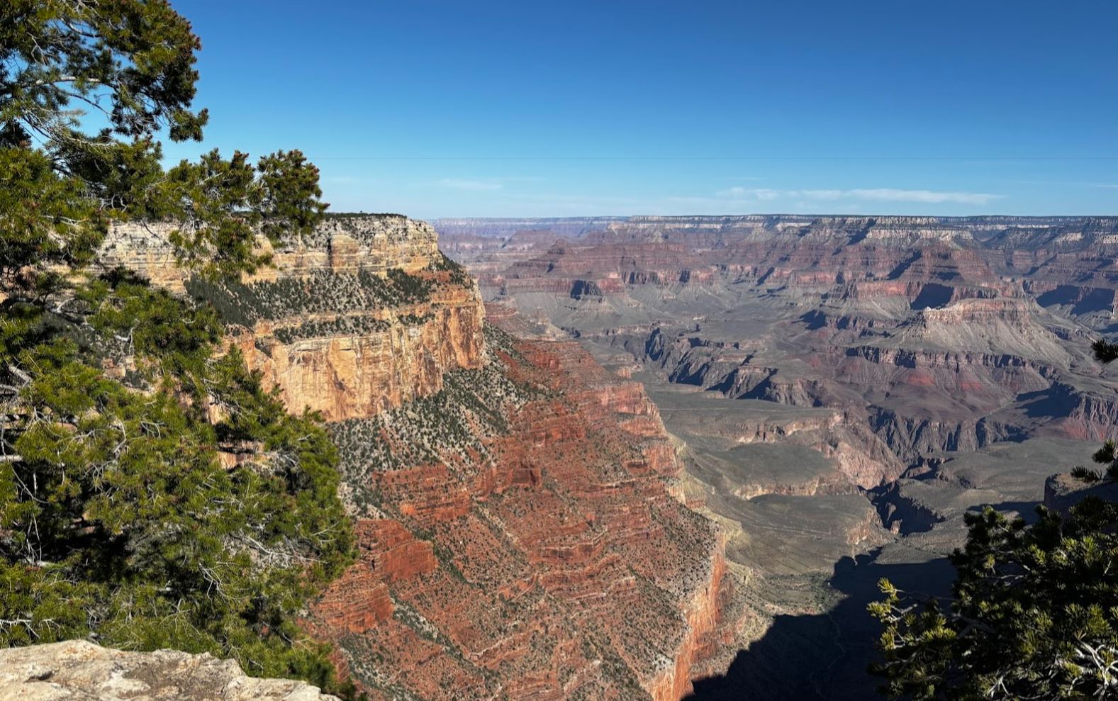
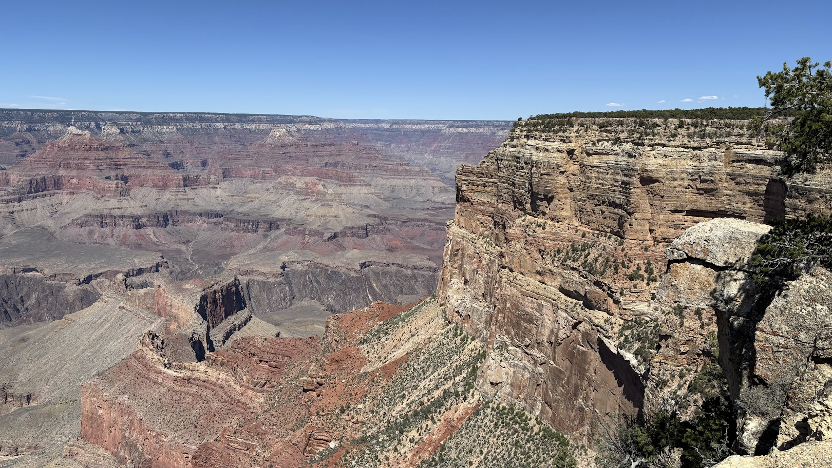
Pierwsza połowa szlaku, do Canyon Village, jest bardziej popularna. Bliskość parkingów, Centrum Informacyjnego oraz gastronomii sprawia, że turystów nie brakuje. Po minięciu Canyon Village, mniej więcej od Powell Point, długimi fragmentami idziemy zupełnie sami. Ludzie pojawiają się tylko w pobliżu przystanków autobusowych.
The first half the trail is very popular with tourists. It's close to parking lots, the Visitor's Center and so there are a lot of people. However, once we passed Canyon Village, from Powell Point onward, there were large stretches of the trail where we walked alone.
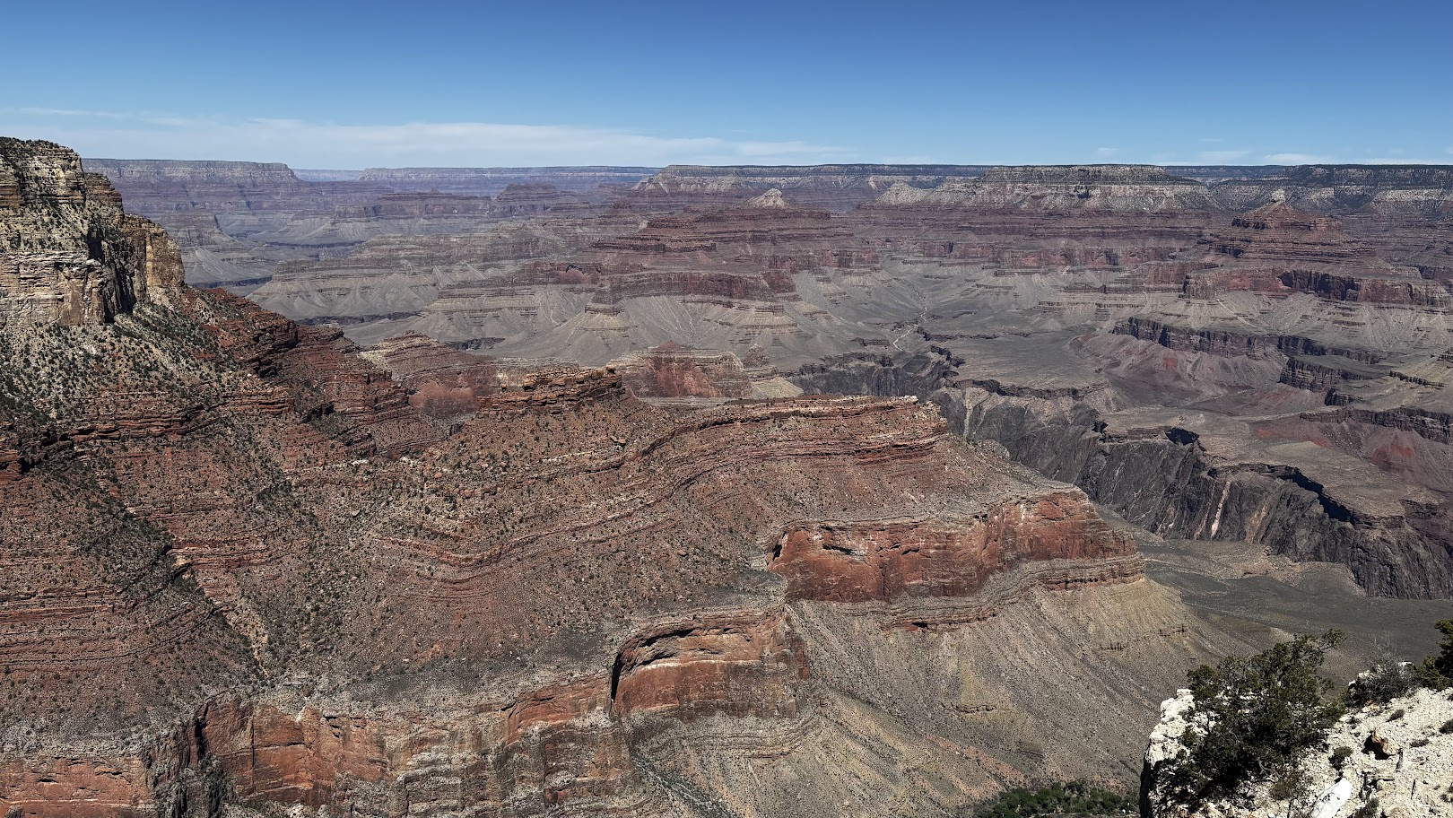
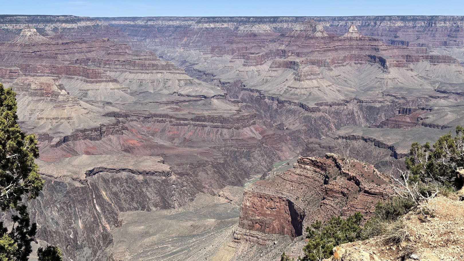
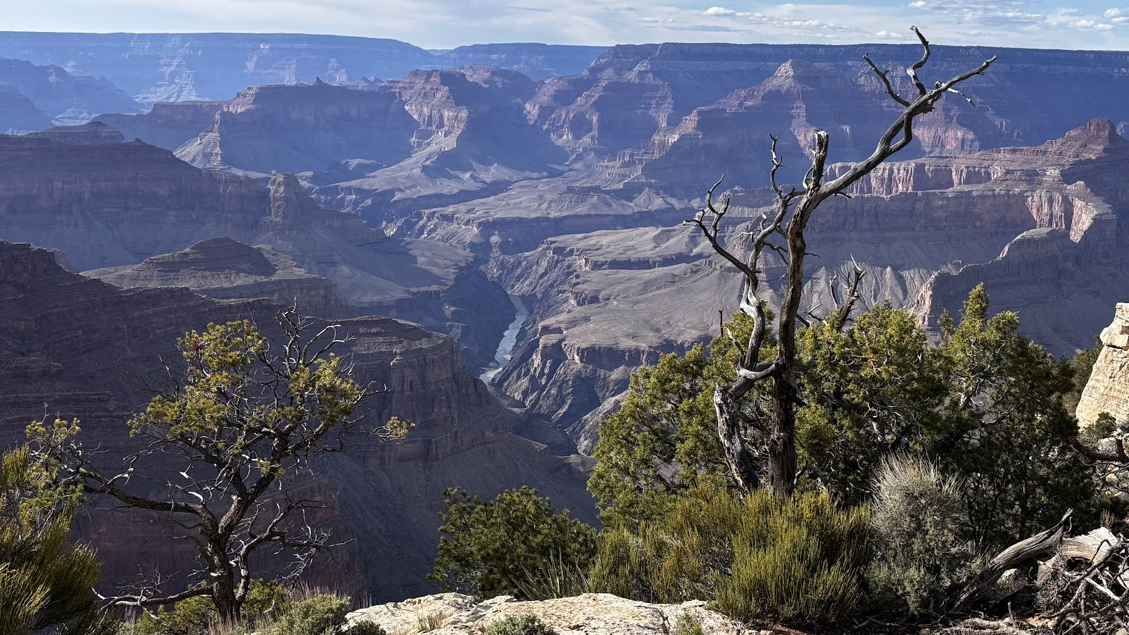
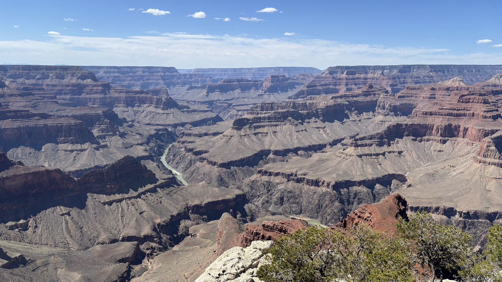
Moja definicja wąwozu to brzeg, strome ściany i woda w dole. Tak wygląda na przykład pieniński przełom Dunajca. Ale w Wielkim Kanionie rzeka Kolorado jest tak głęboko, że... jej nie widać. Jest tylko kilka punktów, skąd można dostrzec rzekę.
My definition of a canyon includes the rim, steep walls and water down there. One could experience it for example in the Dunajec gorge in Pieniny Mts in Poland. But in Grand Canyon the Colorado river is located so deeply, that... it's mostly not visible. There are only a few points from where the river can be spotted.
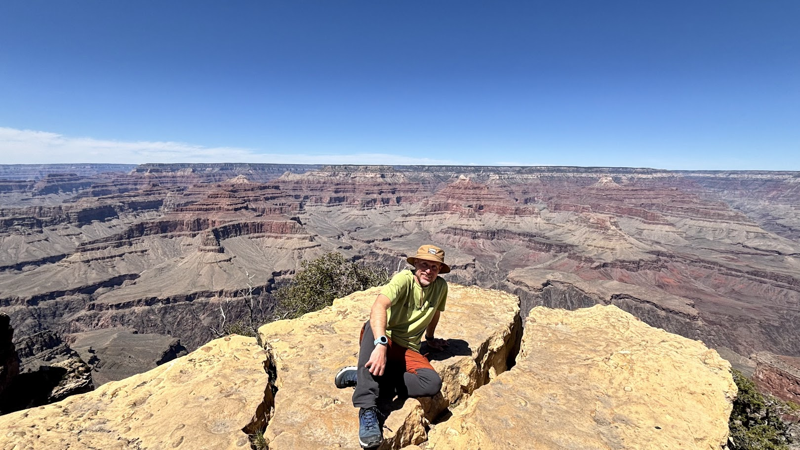
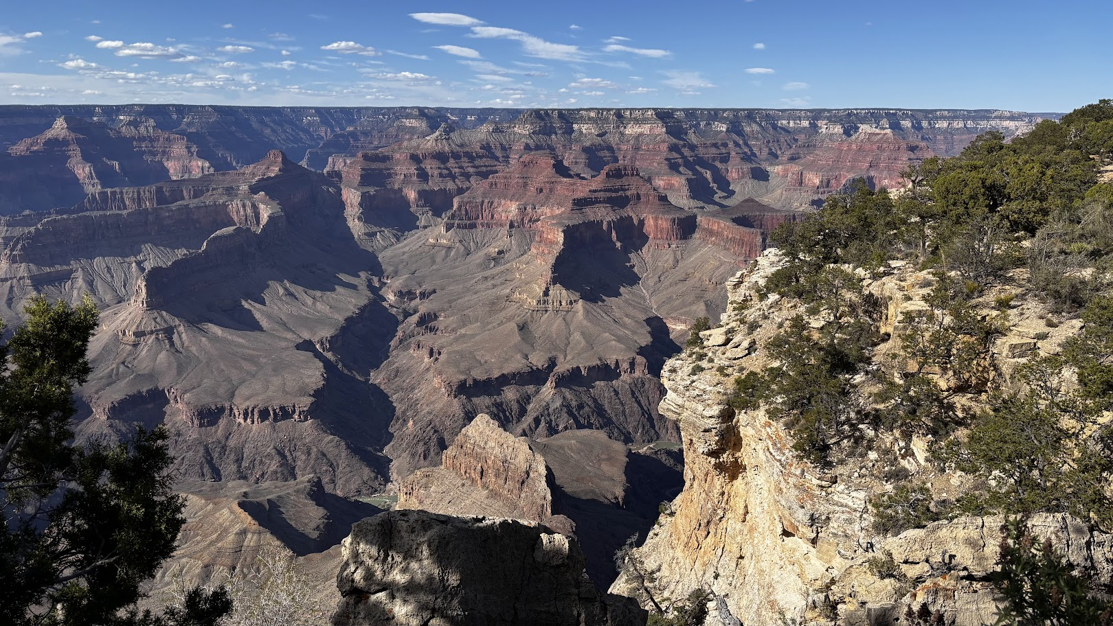
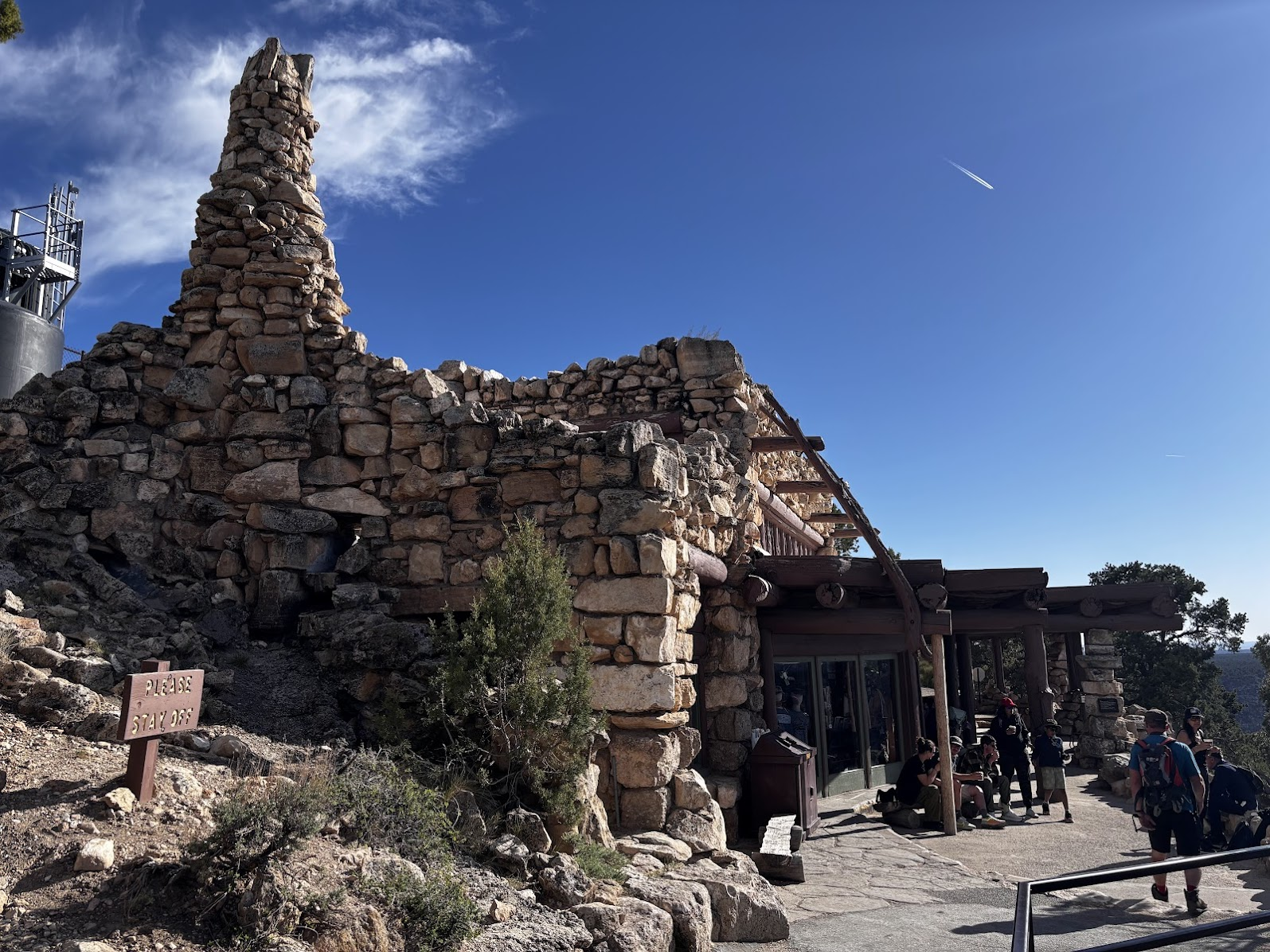
Każde zdjęcie kanionu jest inne, ale z drugiej strony, gdy przeglądam moją kolekcję trzy miesiące po podróży, zastanawiam się po co po raz kolejny uwieczniałem ten sam widok ;-). Poniżej kilka zdjęć z końcowej części szlaku. Na końcu Hermit's Rest - punkt gastronomiczny działający od 1914 roku. Tam kończymy szlak i autobusem wracamy na parking.
Each photo of the canyon is different, but browsing thru my collection three months after the trip, I am wondering why I took the same picture ;-). See below a few photos. The last one is Hermit's Rest - a refreshment point established in 1914. We ended the trail there and took the shuttle bus to return to the parking lot.
America the Beautiful Trip - Day 6
Grand Canyon South Rim Trail
| Data / Date | 23.04.2025 |
|---|---|
| Poprzedni dzień / Previous day | Antelope Canyon X |
| Trasa samochodem / Route by car | Valle <=> Grand Canyon Village (90km) |
| Szlak(i) pieszo / Trail(s) on foot | Grand Canyon South Rim Trail (21km, 540m total elevation gain; mostly paved) |
| Wstęp / Entry fee | America the Beautiful Annual Pass |
| Strona www Parku / Park website | https://www.nps.gov/grca/index.htm |
| Nocleg / Accommodation | Grand Canyon Inn & Motel - South Rim Entrance, AZ |
| Następny dzień / Next day | Inside the Grand Canyon |
| Plan podróży / Trip itinerary | 'America the Beautiful Trip' |
![Route 66 and Hoover Dam. Long Drive West. US Southwest trip Day 8 [POL / ENG]](https://img.truvvle.com/?src=aHR0cHM6Ly9pbWcudHJhdmVsZmVlZC5pby9zbnVma2luJTJGMjAyNS0wNy0yNy0xNy0wNy03MTYtaG9vdmVyZGFtLXBuZw&width=800)
![Short trips around Page, Arizona. Horseshoe Bend & Lake Powell. US Southwest trip Day 4. [POL / ENG]](https://img.truvvle.com/?src=aHR0cHM6Ly9pbWcudHJhdmVsZmVlZC5pby9zbnVma2luJTJGMjAyNS0wNi0xNC0xMi0wNi0wMjYtaG9yc2VzaG9lYmVuZC1wbmc&width=800)
![Breathtaking Antelope Canyon X. The most beautiful photos of my US Southwest trip - Day 5 [POL/ENG].](https://img.truvvle.com/?src=aHR0cHM6Ly9pbWcudHJhdmVsZmVlZC5pby9zbnVma2luJTJGMjAyNS0wNi0yMy0xOC0wNi01MzUtYW50ZWxvcGVjYW55b24tcG5n&width=800)
![Boynton Canyon Subway Cave and Horseshoe Bend - Unreal Arizona. US Road Trip 2026: Day 7 [POL/ENG].](https://img.truvvle.com/?src=aHR0cHM6Ly9pbWcudHJhdmVsZmVlZC5pby9zbnVma2luJTJGMjAyNi0wNy0yMC0xNy00Mi0zOS01Nzctc3Vid2F5Y2F2ZS1ub3Blb3BsZS1qcGc&width=800)