![Zion National Park, Utah. Angels Landing & Emerald Pools. US Southwest Trip - Day 1 [POL / ENG]](https://img.truvvle.com/?src=aHR0cHM6Ly9pbWcudHJhdmVsZmVlZC5pby9zbnVma2luJTJGMjAyNS0wNS0yMy0xNi0wNS05ODQtYW5nZWxzbGFuZGluZy1wbmc&width=2000)
"Zion National Park, Utah" post is written in Polish and English. English text is in italics, below each paragraph in Polish.
Pierwszy pełny dzień mojej podróży po południowo-zachodnich USA przeznaczamy na Park Narodowy Zion (Utah). Dzięki koleżance z pracy, udało nam się uzyskać pozwolenie na wejście na ikoniczną skałę Angels Landing. W drugiej połowie dnia dodaliśmy spacer do szmaragdowych jeziorek (Emerald Pools).
The first full day of my southwestern US trip was devoted to Zion National Park, Utah. Thanks to my workmate, we got a permit to scale the iconic Angels Landing rock. In the second half of the day, we hiked to Emerald Pools.
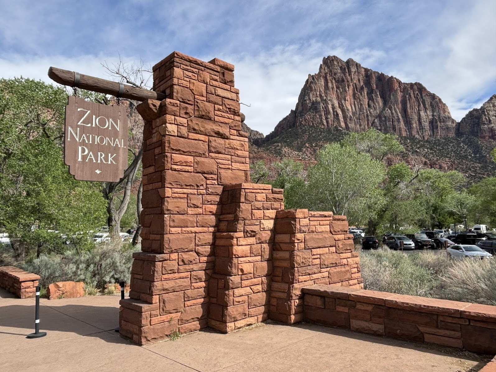
Zion National Park
Park Narodowy Zion leży na przecięciu trzech dramatycznie różnych regionów geograficznych - Płaskowyżu Kolorado, Pustyni Mojave i Wielkiej Kotliny. Takie położenie daje w efekcie unikalną topografię i różnorodne strefy biologiczne. Mieliśmy tylko jeden dzień i spędziliśmy go w najbardziej znanej części parku - kanionie Zion. Nazwa 'Zion' (Syjon) została nadana przez Kongres USA 1919 roku. Był to ukłon w stronę Mormonów, którzy licznie zasiedlali Utah. Wcześniej używano nazwy 'Mukuntuweap National Monument'.
Zion National Park is located at the junction of three geographic regions - Colorado Plateau, Mohave Desert and Great Basin. Such location results in variety of landscapes and several life zones. We had only a day, so we chose the most known part - the Zion Canyon. The name 'Zion' was established in 1919 by the US Congress and referred to Mormons. The previous name, 'Mukuntuweap National Monument' was deemed too difficult for tourists.
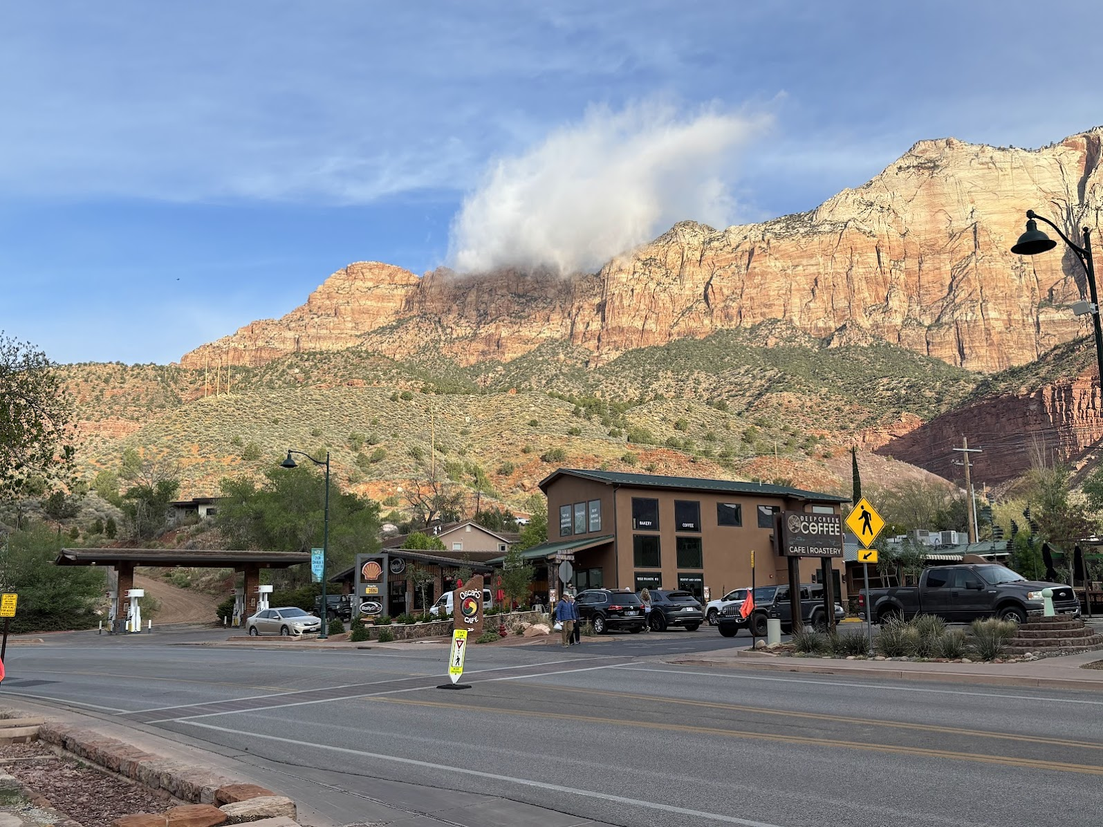
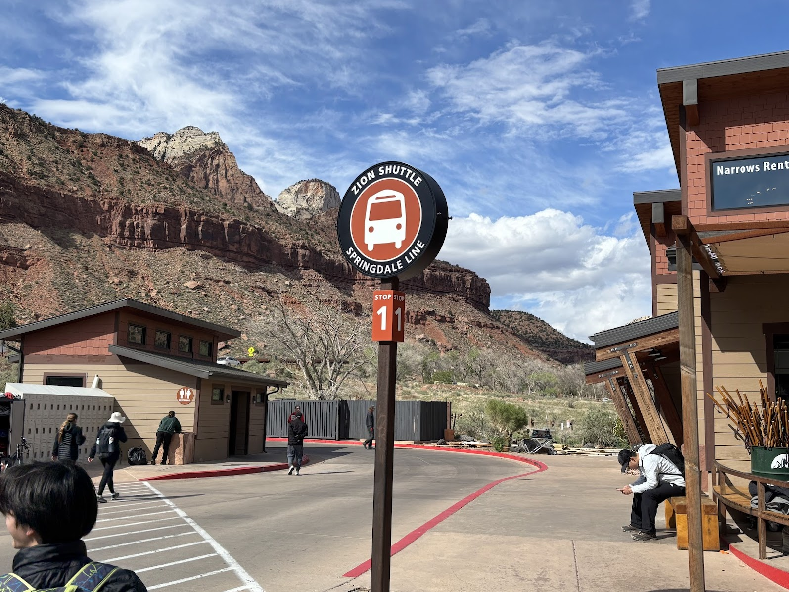
Najlepszą bazą do eksploracji parku Zion jest miasteczko Springdale (Utah). Nocleg mieliśmy u przyjaciela wspomnianej koleżanki z pracy. Dojazd do parku zapewnia darmowy autobus. W samym parku, wzdłuż doliny rzeki Virgin również kursuje darmowy autobus. Taki system działa w wielu parkach narodowych w USA i znacznie ułatwia planowanie wycieczek.
The best base for Zion Park exploration is Springdale, UT. From our accommodation at my workmate's friend's, we simply walked to the main street. From there, a free shuttle bus brought us to the park entrance. In the park itself, there's also a free shuttle bus service that runs along the river Virgin valley. It's a common system in US national parks and it makes hiking planning easy.
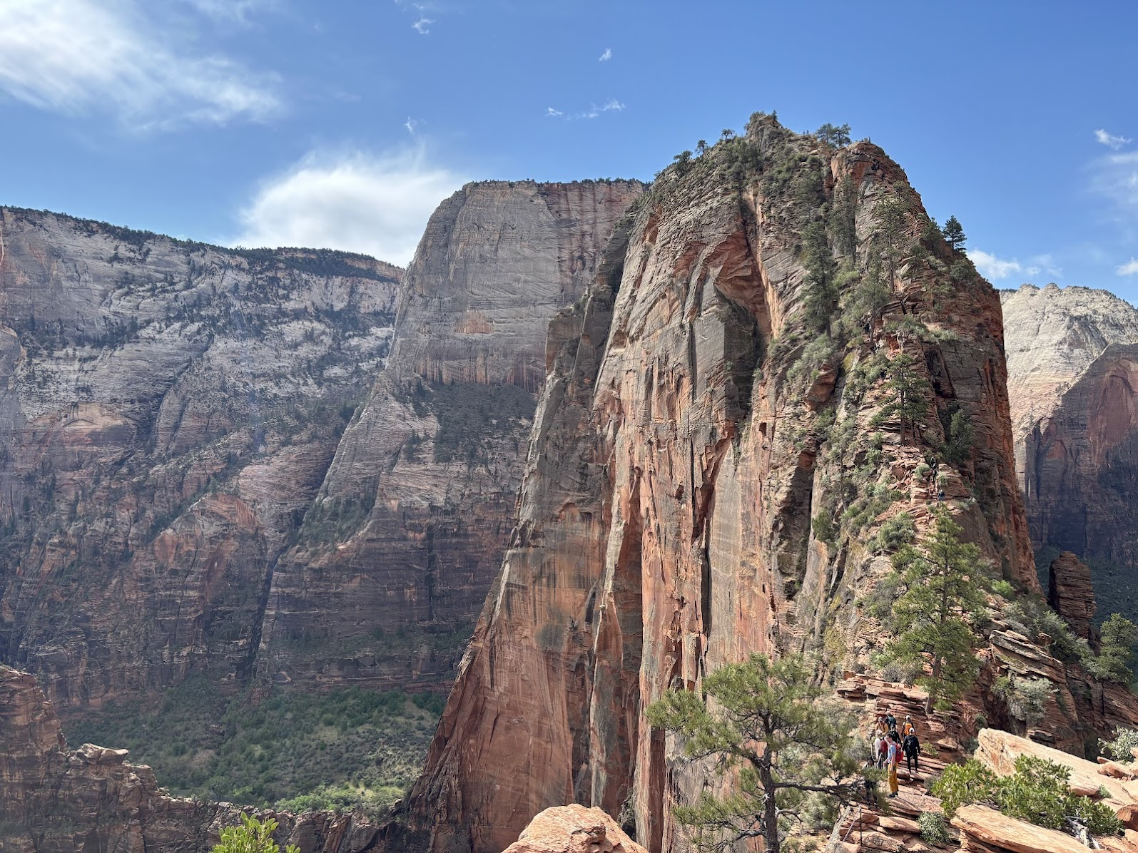
Korzystamy z parkowego autobusu i dojeżdżamy do przystanku 'Grotto'. Wystarczy przejść przez mostek i zaczynamy naszą przygodę - wejście na Angels Landing. Przed nami 3,5km i 450m podejść (powrót tą samą drogą). Nasz cel jest przed nami i wygląda solidnie i zastanawiamy się jak wejść na prawie pionową skałę.
We used the park shuttle and got off at the 'Grotto' stop. From there we crossed a bridge and started our trail to Angels Landing. It's a 3,5km trail, with 450m of elevation gain (return the same way). Our target loomed ahead of us. How on earth would we scale the almost horizontal wall?
Angels Landing
Easy Beginnings
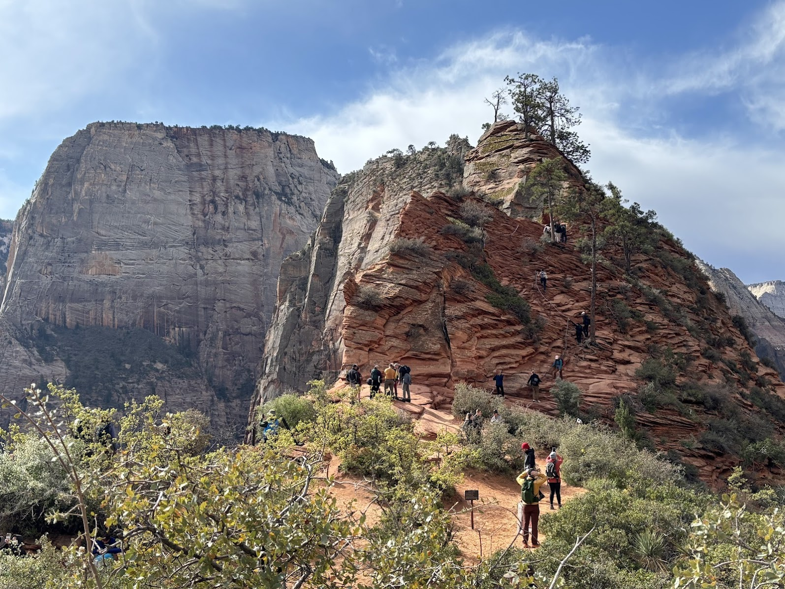
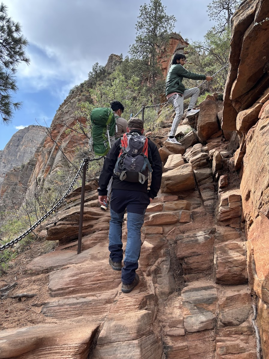
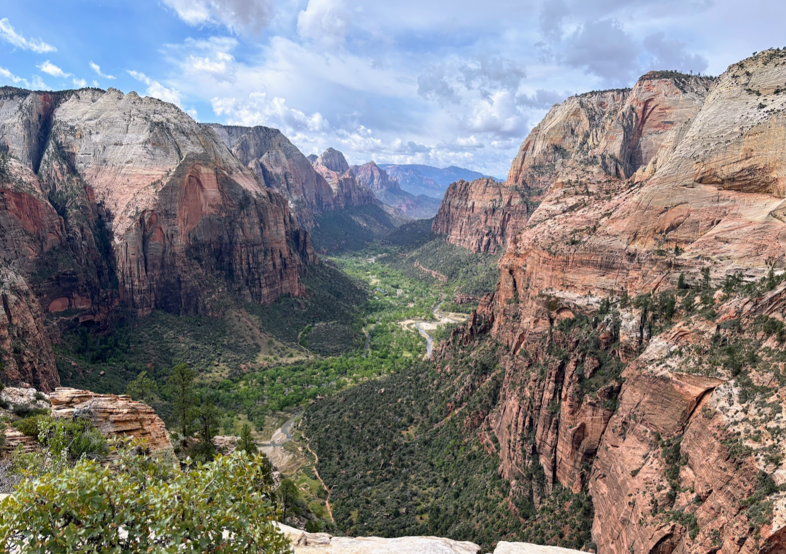
Angels Landing (1760m n.p.m.) to część góry Cathedral Mountain (2108m), wznosząca się 450-metrową ścianą ponad dolinę rzeki Virgin. Jest to ikoniczny punkt widokowy w parku Zion. Na ostatni fragment, który prowadzi wąską grzędą (od Scout Lookout na szczyt) wymagane jest pozwolenie, wydawane na jedno z trzech 3-godzinnych okienek w ciągu dnia. Celem systemu pozwoleń ('permit') jest ograniczenie liczby turystów wchodzących na szczyt - wejście i zejście prowadzi tym samym, wąskim szlakiem z łańcuchami zamocowanymi w piaskowcowej skale.
Angels Landing (1760m a.s.l) is a part of Cathedral Mountain (2108m) that protrudes over 450m above the bottom of the Virgin River valley. It is an iconic view point in Zion National Park. A permit is required to scale the summit (above Scout Lookout point). The rationale behind the permits system is to reduce the number of hikers on a steep and narrow path, where chains are bolted into the sandstone.
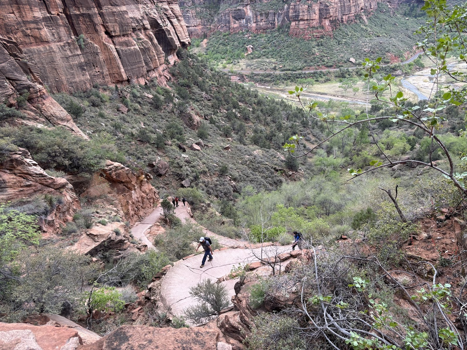
Szlak na Angels Landing zaczyna się łatwo. Szeroka ścieżka wznosi się łagodnie ponad dolinę. Gdy wreszcie trzeba podejść solidnie pod górę, ścieżka jest... betonowa i wspina się serią łagodnych zakosów, ułatwiających pokonywanie wysokości.
The beginning of the Angels Landing trail is easy. The path goes gently up the valley. When it needs to gain elevation, it does so by a series of switchbacks. The path is paved.
Walter's Wiggles
Następnie szlak pokonuje 21 bardzo ciasnych zakosów, gdzie gwałtownie nabiera wysokości. Ta część nazywana jest Zakrętami Waltera i została wykuta w 1926. Walter Ruesch był wtedy dyrektorem Parku Zion. Pomimo stromego podejścia, szlak jest relatywnie łatwy.
The next section is 21 tight switchbacks, called Walter's Wiggles. It was cut into the sandstone in 1926, while Walter Ruesch was the park's superintendent. Despite the sharp elevation gain, the switchbacks are relatively easy.
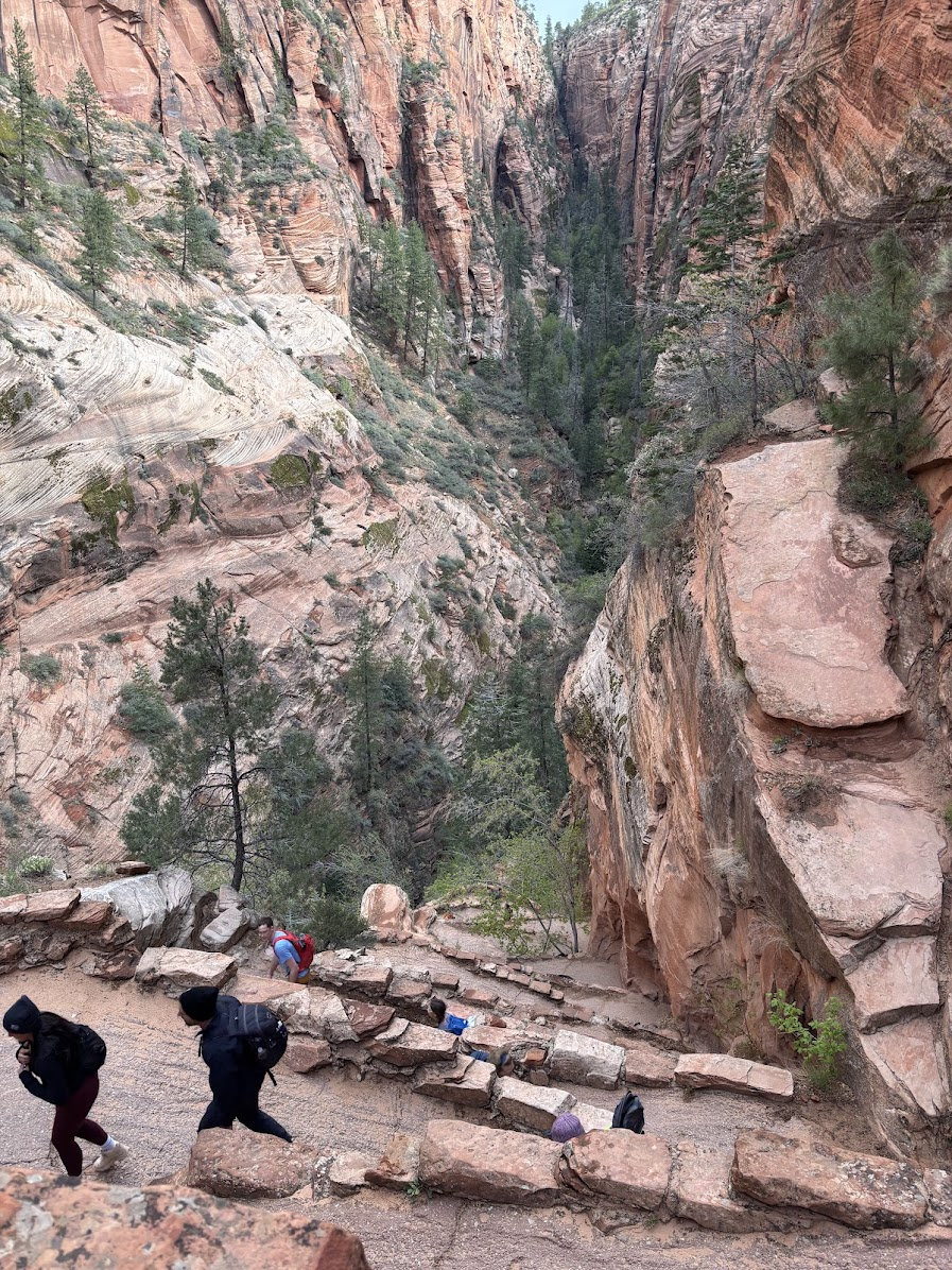
Zakosy kończą się w punkcie Scout Lookout. Jest to przełęcz oddzielająca Angels Landing od Cathedral Mountain. W tym miejscu pokazujemy strażnikom parkowym pozwolenie i ruszamy na szczyt. Łatwo już było, teraz przed nami strome i wąskie wejście, miejscami wyposażone w łańcuchy.
The switchbacks end at Scout Lookout. It's a pass that separates Angels Landing from Cathedral Mountain. A permit is required to hike further up. The easy part behind us, now we have to negotiate a steep and narrow crest. Chains are very helpful.
Summit
Skały z łańcuchami nie są moim środowiskiem naturalnym. Mam respekt do ekspozycji. Ale szlak na Angels Landing nie jest dla mnie przerażający. Zarówno wejście jak i zejście przebiegają - jak na mnie - całkiem sprawnie.
Rocks with chains are not my natural habitat. I do have a respect for expositions. This said, the Angels Landing Trail is not paralyzing for me. I negotiated the most steep parts quite smoothly, both up and down.
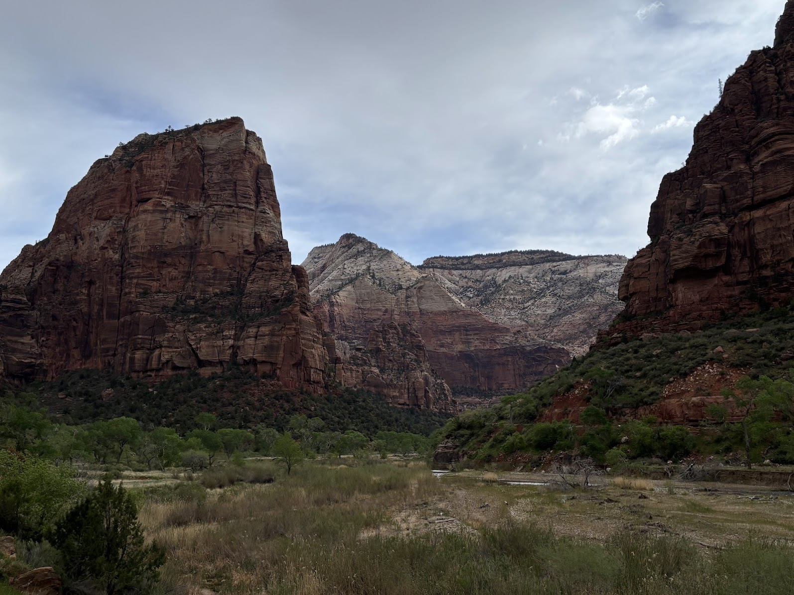
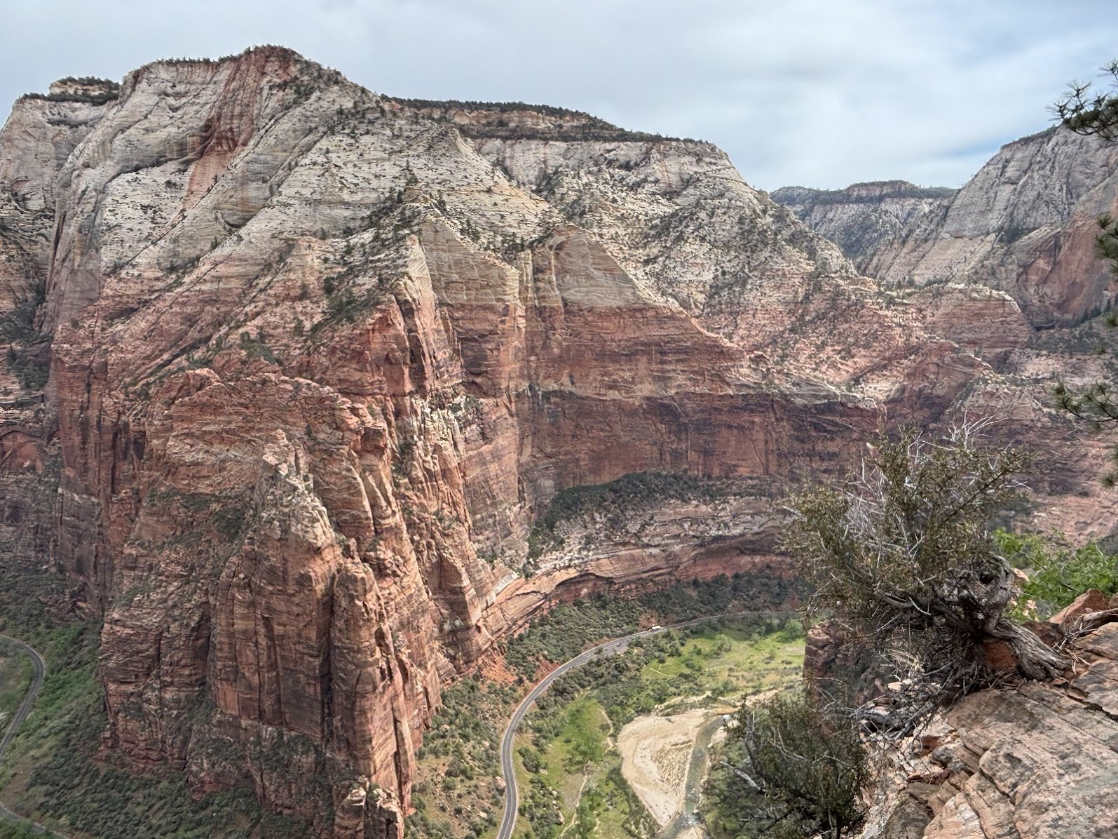
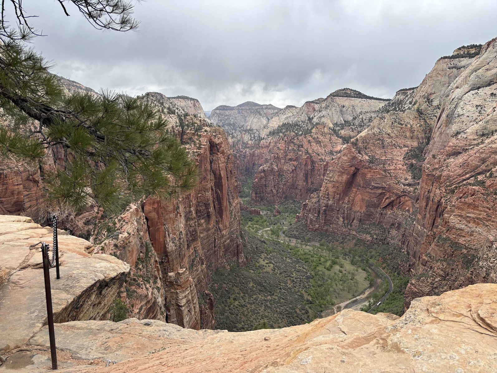
Warto wejść na szczyt. Pomimo, że nie jesteśmy w najwyższym punkcie parku, widoki robią duże wrażenie. Angels Landing mocno wcina się w dolinę rzeki Virgin, a od strony północnej jest prawie pionowa, 450-metrowa ściana.
It's worth the effort. Even though we are not at the highest point of the park, the view is dramatic. Angels Landing extends into the valley and its northern wall is a 450m sheer vertical drop into the valley.
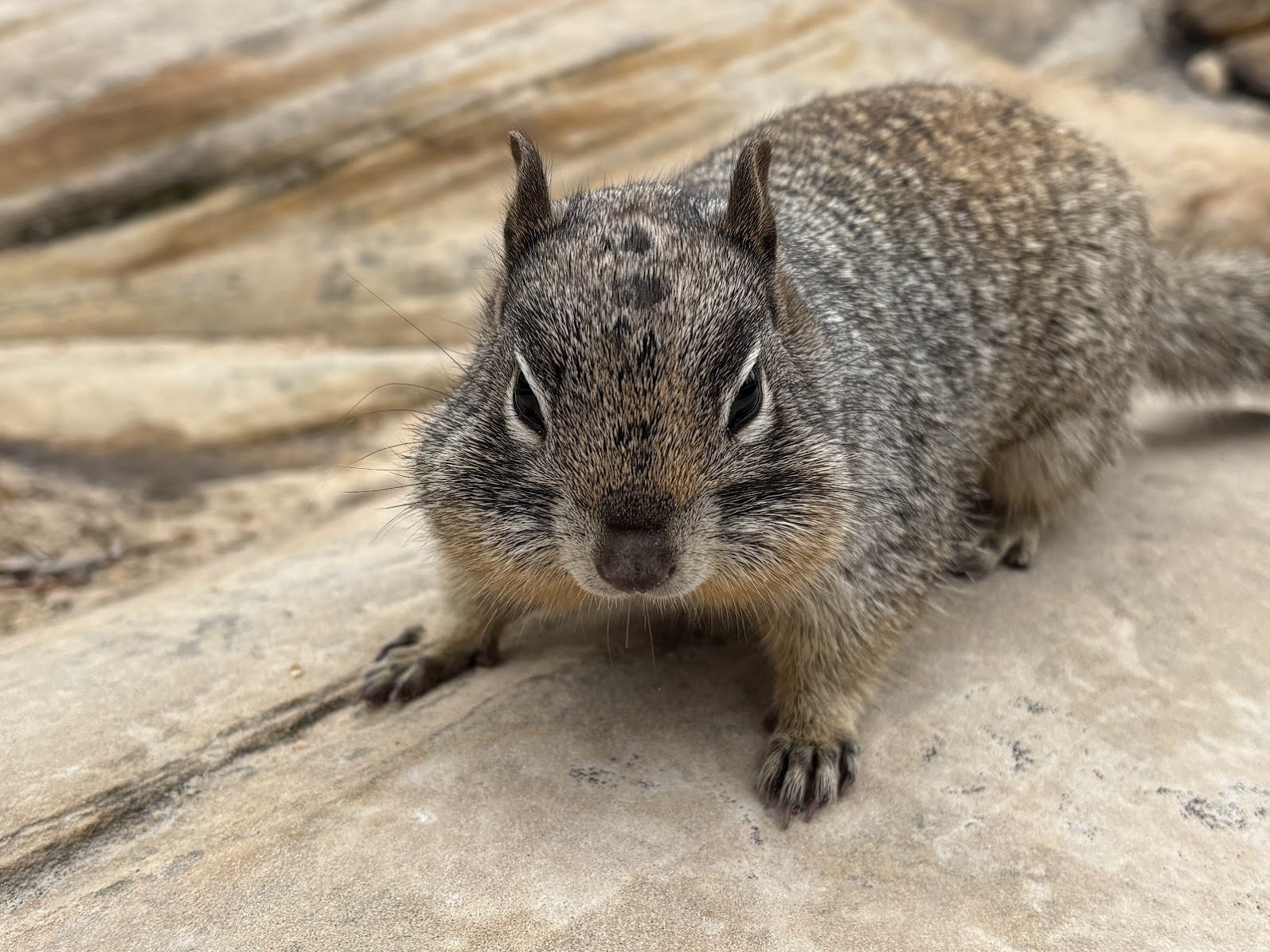
Na szczycie zamieszkują wiewiórki skalne. Są znacznie większe od europejskich wiewiórek drzewnych i ubarwione są na szaro. Przystosowały się do ludzi. Wystarczy postawić plecak na skale i od razu kilka wiewiórek podchodzi blisko, w nadziei, że z plecaka wypadną (przypadkiem, oczywiście!) orzeszki.
The peak is inhabited by ground squirrels and chipmunks. The former are much bigger than their tree cousins. They are accustomed to tourists and not only do not run away, but the moment we put our backpacks on the ground, they come very close. They hope that nuts may (accidentally, of course!) spill out of the backpack.
Emerald Pools
Wejście na Angels Landing i powrót do doliny to zaledwie 7km. Zaczęliśmy rano, mamy więc jeszcze czas na drugi szlak. Wybraliśmy 'Emerald Pools' (Szmaragdowe Jeziorka), zaczynający się również od przystanku 'Grotto'. W założeniu chcieliśmy wyjść na kolejny przystanek 'Zion Lodge', ale mostek w kluczowym miejscu było remontowany i wróciliśmy tą samą drogą.
The Angels Landing trail up and back is only 7km. We had started early and therefore had time for another hike. We chose Emerald Pools. The plan was to hike from 'Grotto' shuttle stop to 'Zion Lodge' stop. However, due to a bridge closed for renovation, we ended by returning the same way.
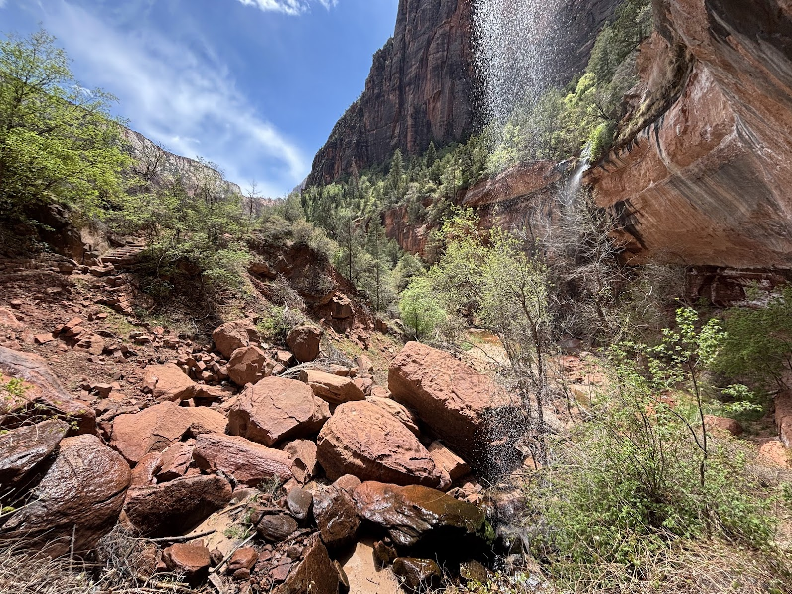
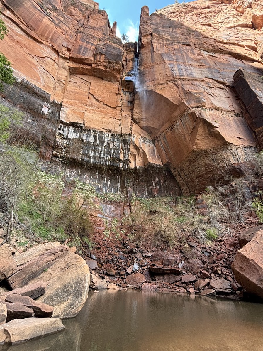
Nazwa 'szmaragdowe' jest trochę przesadzona. Jeziorka są brązowo-zielonkawe. Jeziorka są trzy - Lower, Middle i Upper. Tworzy je woda spadająca kilkoma kaskadami z szczytów Lady Mountain (2110m) and Castle Dome (2141m). Dwa pierwsze są stosunkowo łatwo dostępne - zaledwie ok. 70m powyżej dna doliny. Natomiast ostatnie, Upper Pool to już 250m podejścia.
The name 'emerald' pools is an overstatement. They appear more brownish than emerald. There are 3 pools - Lower, Middle and Upper. The first two are easily accessible (just 70m above the floor of the valley), while the the last requires 250m of elevation gain. All are created by water cascading from Lady Mountain (2110m) and Castle Dome (2141).
W Parku Narodowym Zion (Utah) widzieliśmy dwa popularne miejsca. Przepiękne miejsca, ale to niewielki ułamek tego, co oferuje to miejsce. Zdecydowanie chciałbym tam wrócić i poznać innego jego zakątki.
We have visited two popular places in Zion National Park, Utah. These were stunning places, but they are just a fraction of what the park has to offer. I would like to come back and explore it some more.
America the Beautiful Trip - Day 1
Zion National Park, Utah
| Data / Date | 18.04.2025 |
|---|---|
| Poprzedni dzień / Previous day | Valley of Fire State Park, Nevada |
| Trasa samochodem / Route by car | NA |
| Szlak(i) pieszo / Trail(s) on foot | Angels Landing (7km out and back) and Emerald Pools (4,3km out and back) |
| Wstęp / Entry fee | "America the Beautiful" annual pass |
| Strona www Parku / Park website | https://www.nps.gov/zion/ |
| Nocleg / Accommodation | Springdale, UT (friend's place) |
| Następny dzień / Next day | Bryce Canyon National Park |
| Plan podróży / Trip itinerary | 'America the Beautiful Trip' |
![Bryce Canyon National Park, Utah. 8-shaped Loop to the Bottom. US Southwest Trip - Day 2 [POL / ENG]](https://img.truvvle.com/?src=aHR0cHM6Ly9pbWcudHJhdmVsZmVlZC5pby9zbnVma2luJTJGMjAyNS0wNS0zMS0xOC0wNS04OTgtYnJ5Y2VjYW55b24tcG5n&width=800)
![Short trips around Page, Arizona. Horseshoe Bend & Lake Powell. US Southwest trip Day 4. [POL / ENG]](https://img.truvvle.com/?src=aHR0cHM6Ly9pbWcudHJhdmVsZmVlZC5pby9zbnVma2luJTJGMjAyNS0wNi0xNC0xMi0wNi0wMjYtaG9yc2VzaG9lYmVuZC1wbmc&width=800)
![Grand Canyon South Rim Trail / Szlak brzegiem Wielkiego Kanionu. US Southwest trip Day 6 [POL / ENG]](https://img.truvvle.com/?src=aHR0cHM6Ly9pbWcudHJhdmVsZmVlZC5pby9zbnVma2luJTJGMjAyNS0wNy0wMS0xOS0wNy04NTEtZ3JhbmRjYW55b24tcG5n&width=800)
![Grand Canyon National Park. South Kaibab Trail: Down & Back Up. US Road Trip 2026: Day 6. [POL/ENG].](https://img.truvvle.com/?src=aHR0cHM6Ly9pbWcudHJhdmVsZmVlZC5pby9zbnVma2luJTJGMjAyNi0wNy0wOS0xNy00Ny0xNi02NDAtZ3JhbmRjYW55b25fYmVzdC1qcGc&width=800)