![Bryce Canyon National Park, Utah. 8-shaped Loop to the Bottom. US Southwest Trip - Day 2 [POL / ENG]](https://img.truvvle.com/?src=aHR0cHM6Ly9pbWcudHJhdmVsZmVlZC5pby9zbnVma2luJTJGMjAyNS0wNS0zMS0xOC0wNS04NjAtYnJ5Y2VjYW55b24tcG5n&width=2000)
"Bryce Canyon National Park, Utah" post is written in Polish and English. English text is in italics, below each paragraph in Polish.
Park Narodowy Bryce Canyon (Utah) dodałem do planu podróży po płd-zach. USA w ostatniej chwili. Ale jest to miejsce, które z miejsca robi niesamowite wrażenie. Podziwiamy unikalne formacje skalne - hoodoos. Pogoda i erozja uformowały fantastyczne kształty w czerwonym i białym piaskowcu. Ten park zdecydowanie trzeba odwiedzić!
I added Bryce Canyon National Park, Utah as a last minute item to my southwest US trip. But this is 'out of this Earth' place. We admired there unique rock formations called hoodoos. The weather and erosion formed fantastic shapes in red and white sandstone. The park is a must see!
Bryce Canyon National Park, Utah
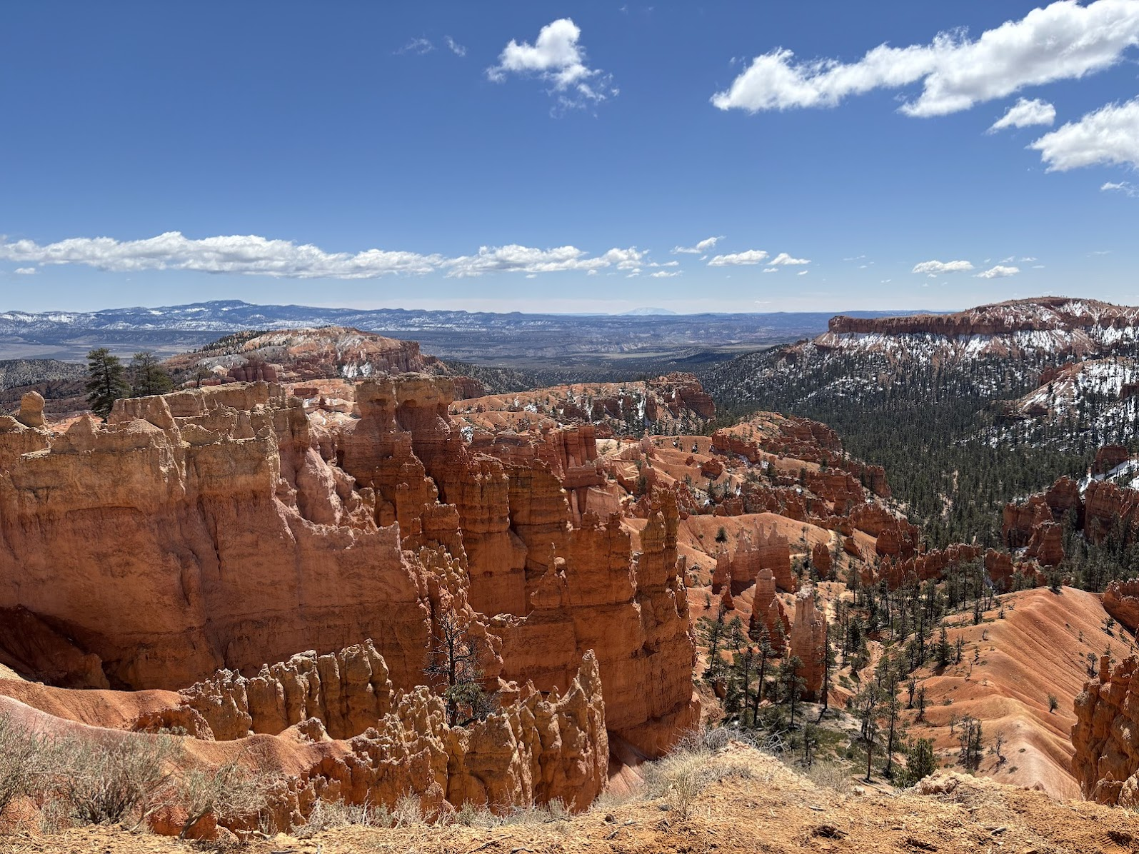
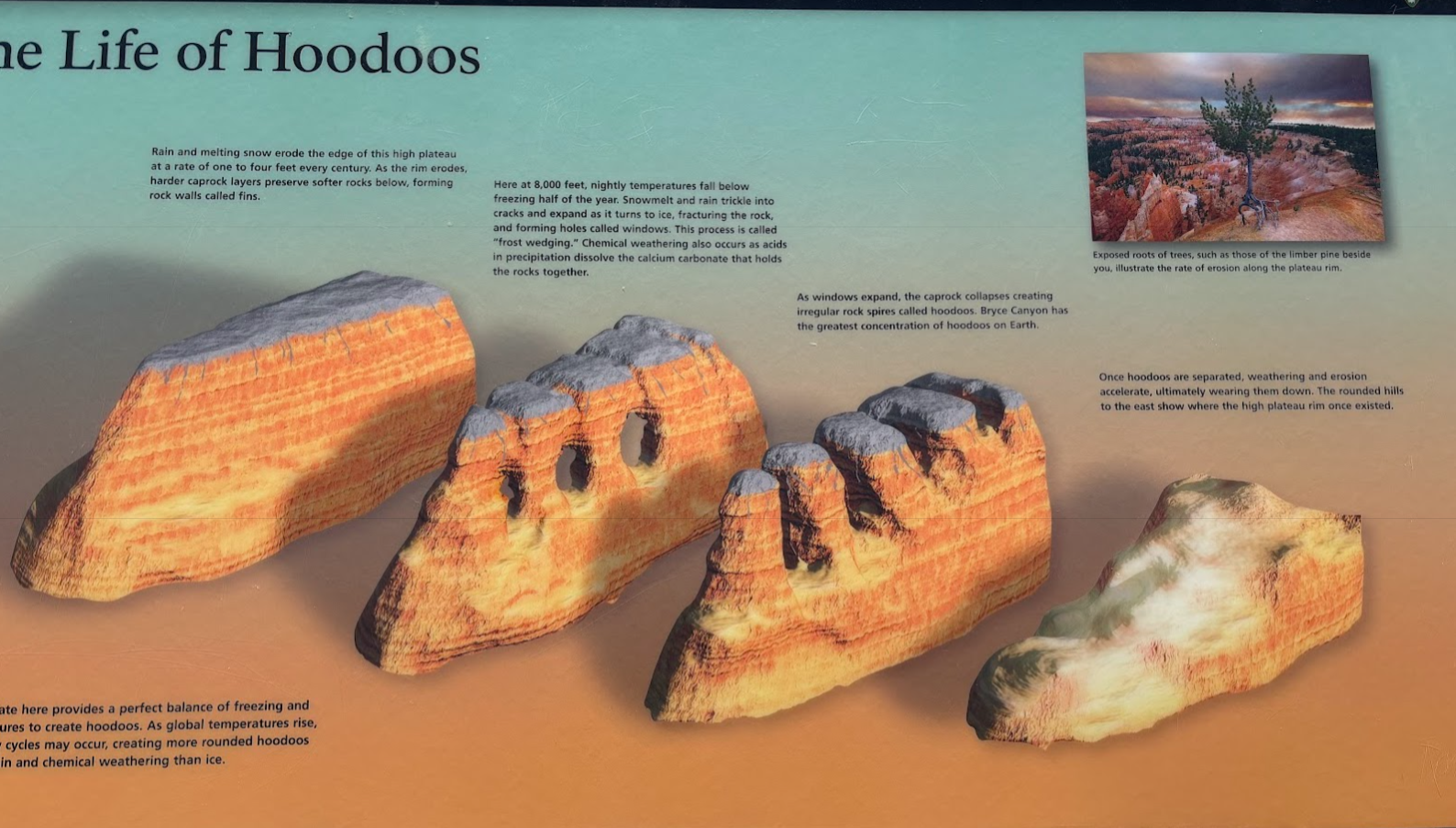
Bryce Canyon, wbrew nazwie, nie jest kanionem a grupą gigantycznych amfiteatrów uformowanych w piaskowcu. Brzeg kanionu jest na wysokości 2400-2700m n.p.m. (czyli Tatry Wysokie!) a dno to ok. 2000m (mniej więcej Tatry Zachodnie). Z dna kanionu wyrastają 'hoodoos', grupy lub pojedyncze kolumny piaskowcowe. Park został nazwany imieniem Ebenezera Bryce'a, mormońskiego pioniera z połowy lat XIX.
Bryce Canyon, contrary to its name, is not a canyon. It is a set of natural amphitheaters formed in sandstone. The canyon's rim is located at 2400-2700m a.s.l. and the bottom drops to 2000m. The main feature of the park are hoodoos - columns of sandstone. The park is named after Ebenezer Bryce, a mormon pioneer in the area in the mid 1800s.
Park można zwiedzać bez wysiłku. Zostawiamy samochód na parkingu przy Centrum Informacyjnym i poruszamy się bezpłatnym autobusem pomiędzy punktami widokowymi przy górnej krawędzi kanionu. Polecam zwłaszcza punkty Sunset Point, Sunrise Point i Bryce Point. Autobus i krótkie spacery to amerykański sposób na kontakt z zapierającą dech w piersiach naturą. My wybraliśmy inny, moim zdaniem lepszy sposób - o czym poniżej.
Bryce Canyon National Park offers an effortless contact with breath-taking nature. There is a free shuttle bus that runs along the rim. One can hop on an off and see the canyon from different angles along the rim. I recommend Sunset, Sunrise and Bryce points. The bus and short walks are an easy 'American-style' way of seeing the canyon. We, however, chose a different way of exploring the park. Read below what we did.
8-shaped Trail
Kanion Bryce pięknie wygląda z góry, ale najlepiej poznać go od wewnątrz. Połączyłem popularne szlaki - Queens Gardens Trail, Navajo Trail i Peekaboo Trail w jeden szlak o kształcie cyfry 8. Całość to niecałe 10km i 500m podejść.
Bryce Canyon looks amazing from the rim. I think, however, that it's best to see its insides. I have combined popular trails - Queens Gardens, Navajo and Peekaboo - into a single 8-shaped trail. It's just below 10km and 500m of total elevation gain.
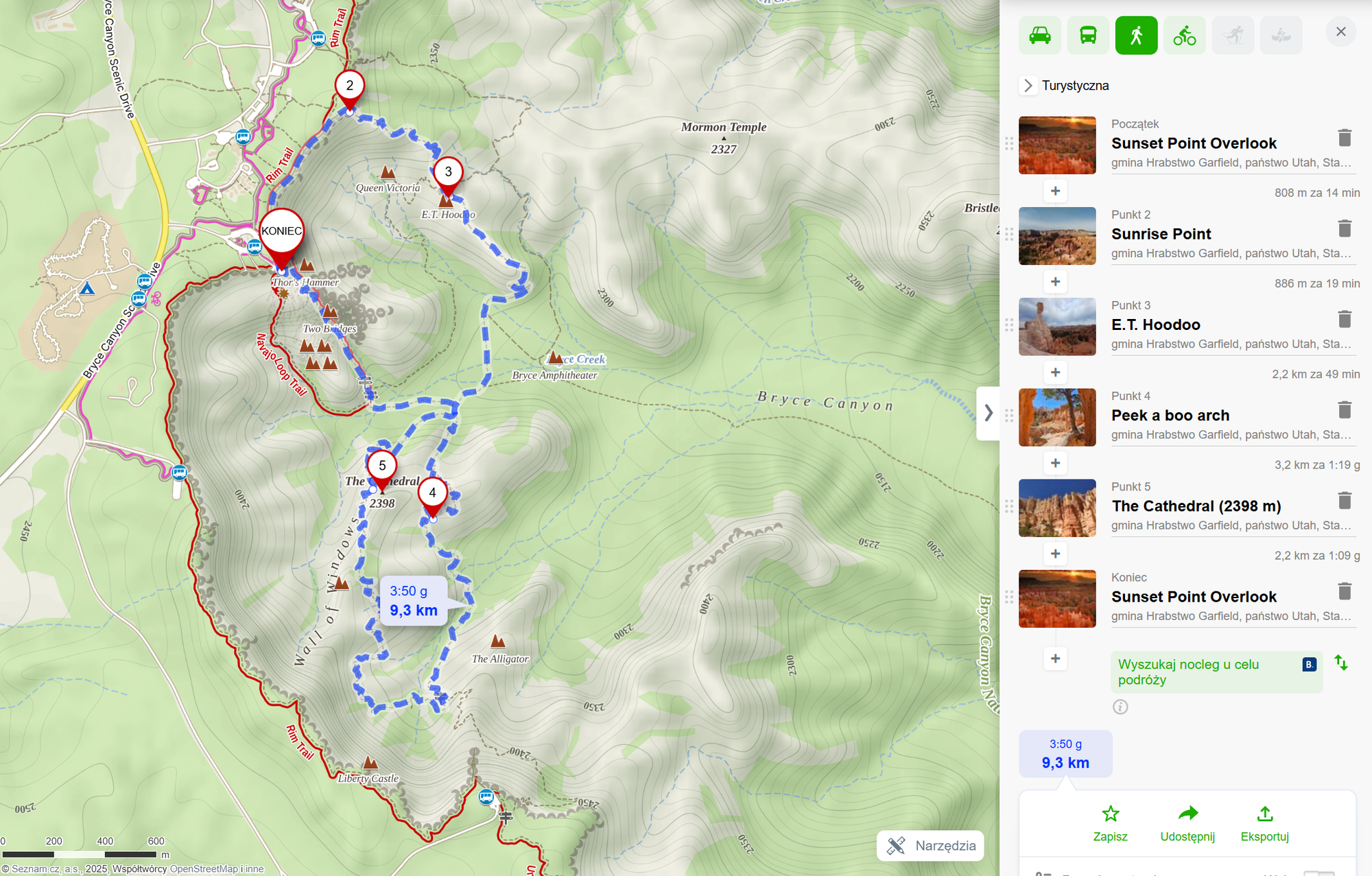
Darmowym autobusem dojechaliśmy do punktu Sunset Point. Stąd przeszliśmy krawędzią kanionu do Sunrise Point (patrz zdjęcia powyżej). Z każdym krokiem nabieraliśmy coraz większego apetytu na zejście w dół. Najpierw jednak musiałem zrozumieć co będę oglądać. Park oferuje wiele tablic informacyjnych i jedna z nich zaspokoiła moją ciekawość.
We took the shuttle to the Sunset Point. We then walked along the rim to Sunrise Point (see photos above). Each step sharpened our appetites for descending down into the canyon. But I had to understand what was going on. The Park shows many information boards and one of these solved the mystery of the hoodoos.
W dół kanionu / Getting Down
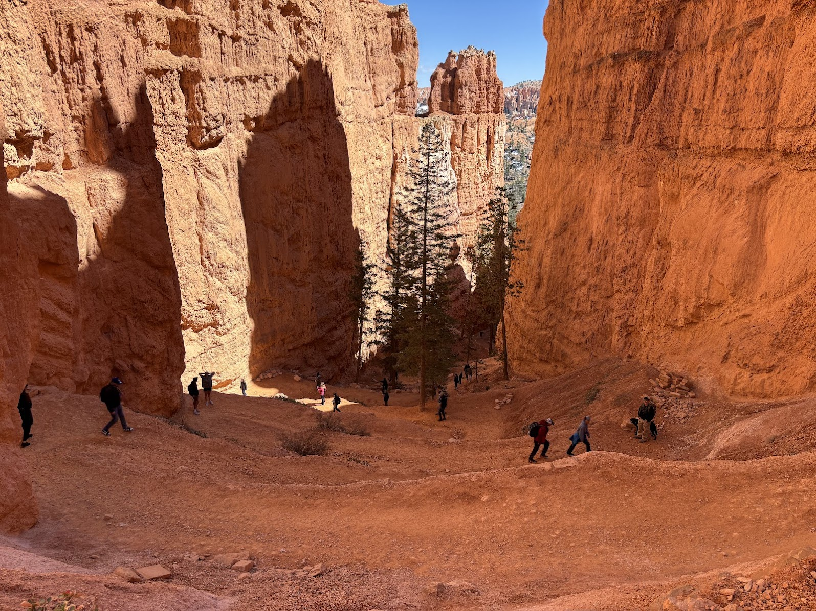
Schodzenie w dół zaczynamy w Sunrise Point, szlakiem Queen's Garden Trail. Obawiałem się zejścia 500m w dół, ale szlaki w USA są dużo łatwiejsze niż w mojej części świata. Schodzimy zakosami, drogą utwardzoną. Tam w zasadzie dałoby się zjechać wózkiem inwalidzkim czy dziecięcym.
We started the descend at the Sunrise Point, utilizing Queen's Garden Trail. I had had my qualms about getting 500m down a steep wall. Unnecessarily so - US trails are much easier than those in my part of the world. We descended using convenient, hardened switchbacks. I think I could get down with a wheelchair or a stroller.
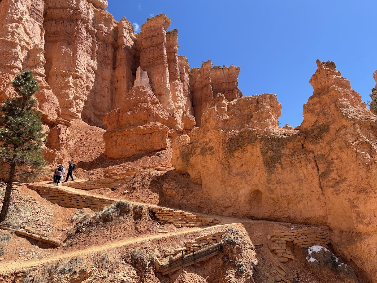
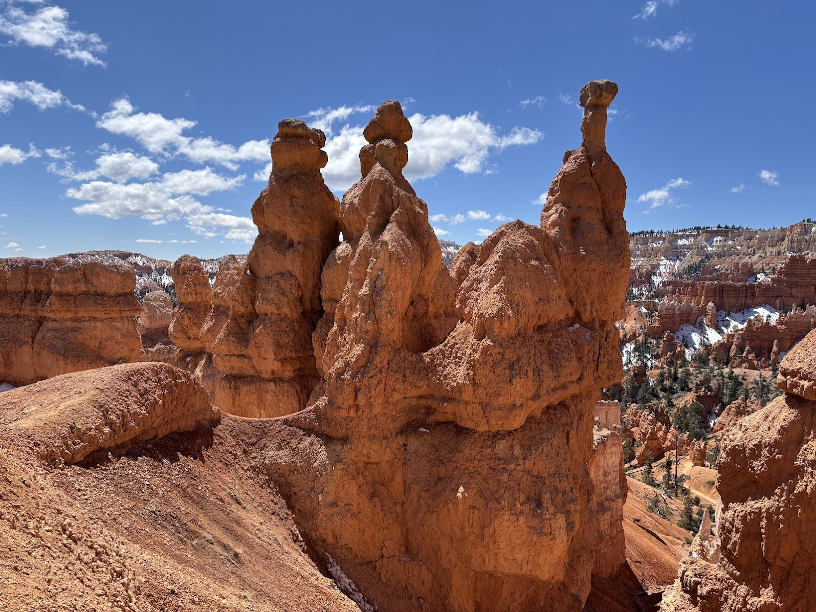
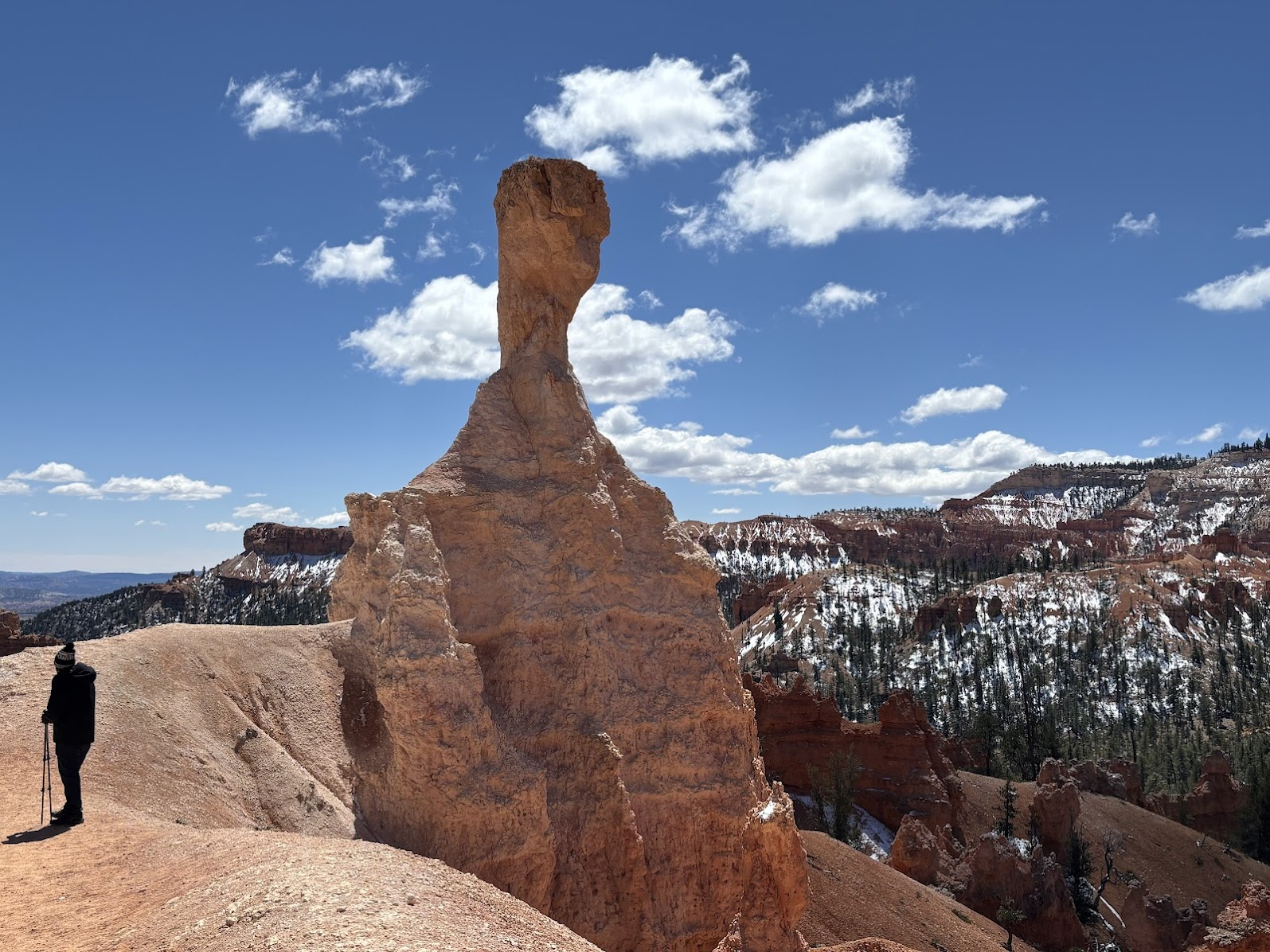
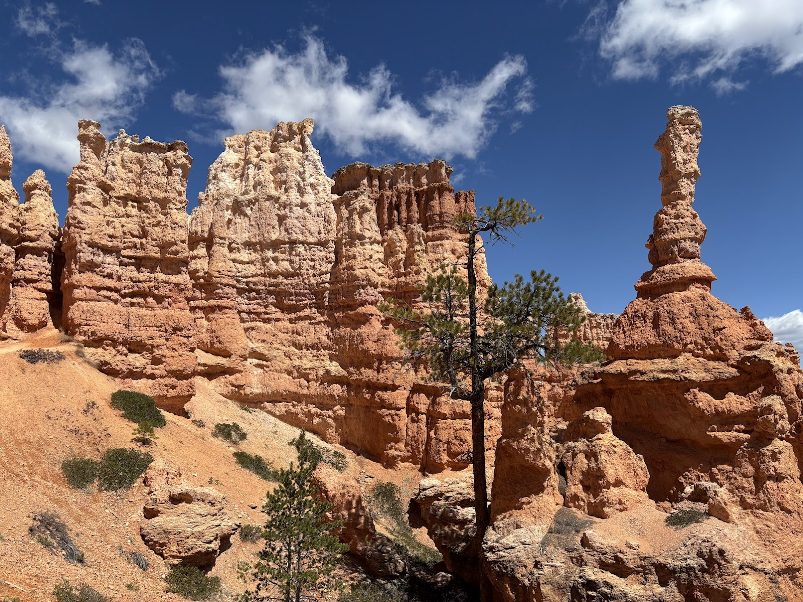
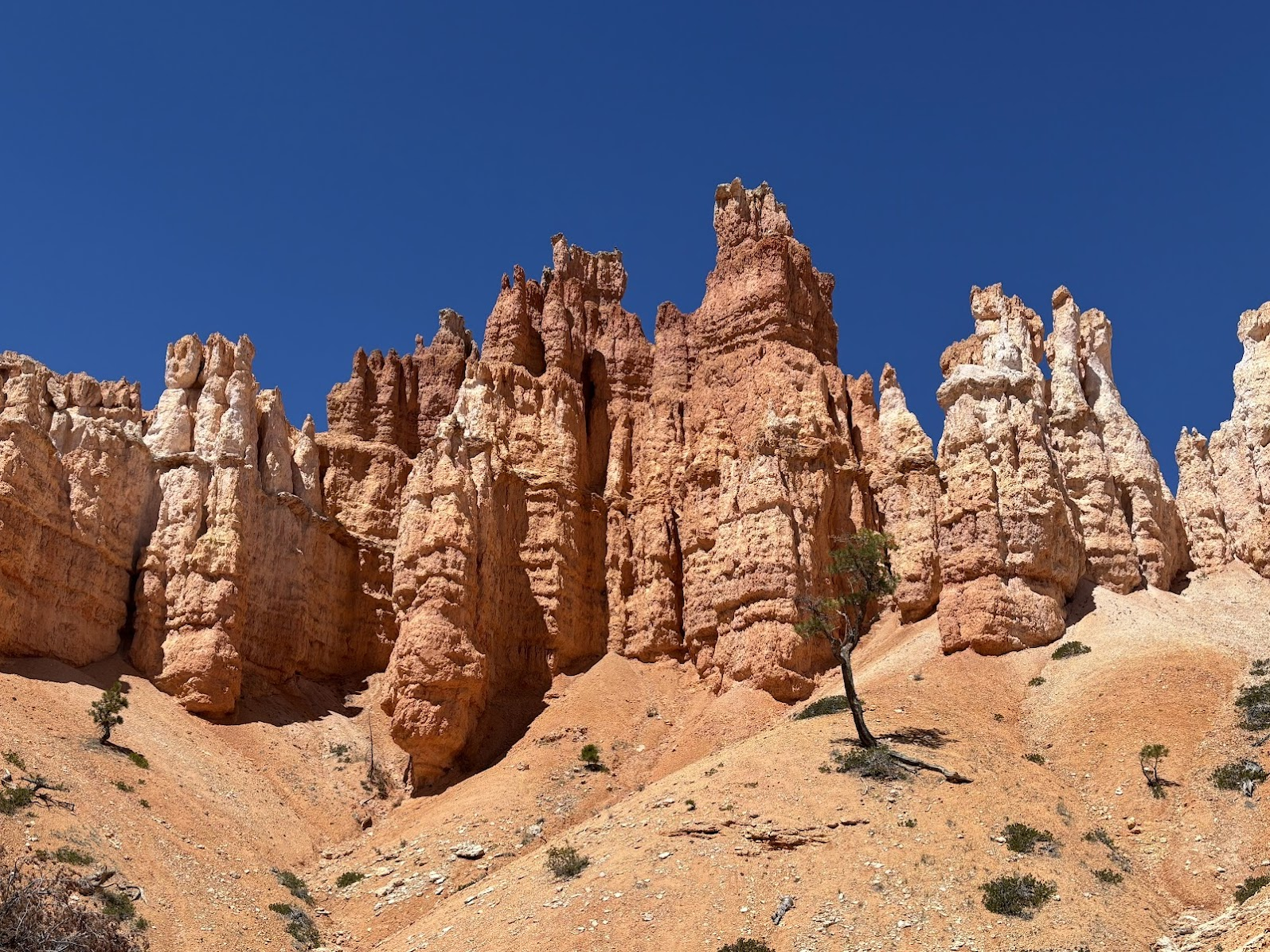
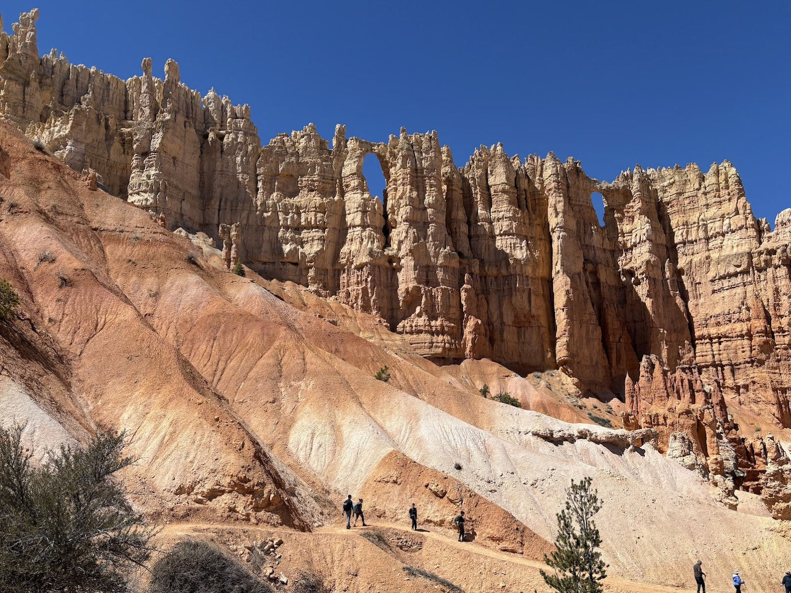
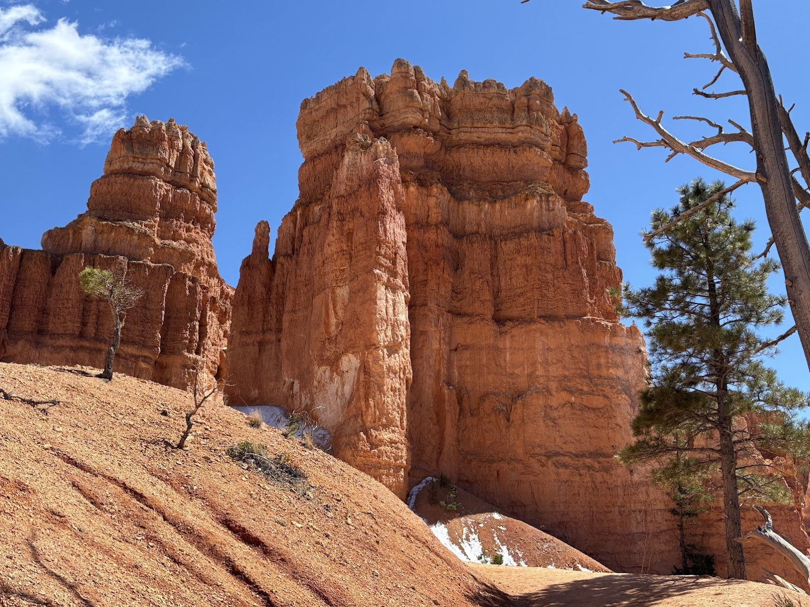
Patrząc z góry, widzimy układ skalnego amfiteatru. Dopiero jednak zejście w dół pozwala na przyjrzenie się pojedynczym hoodoos. Niby są podobne, ale każdy jest inny. Niektóre hoodoos są tak sugestywne, że mają swoje nazwy. Znajdziemy m.in. Królową Wiktorię, E.T. Młot Thora, Katedrę itp.
The rim view gives us a good understanding of the amphitheater. Only getting down, however, shows individual hoodoos in details. All may look similar, but each one is unique. Some shapes are so suggestive, that they got their own names. We will find, among others, Queen Victoria, E.T., Thor's Hammer, Cathedral etc.
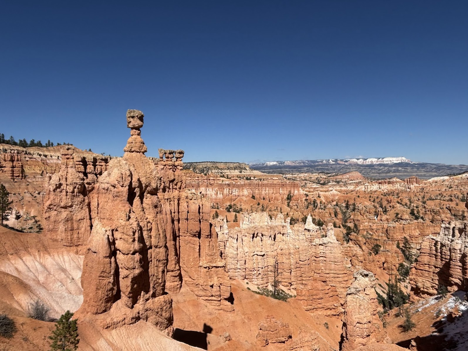
Bryce Amphitheater
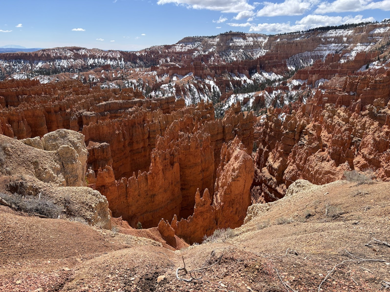
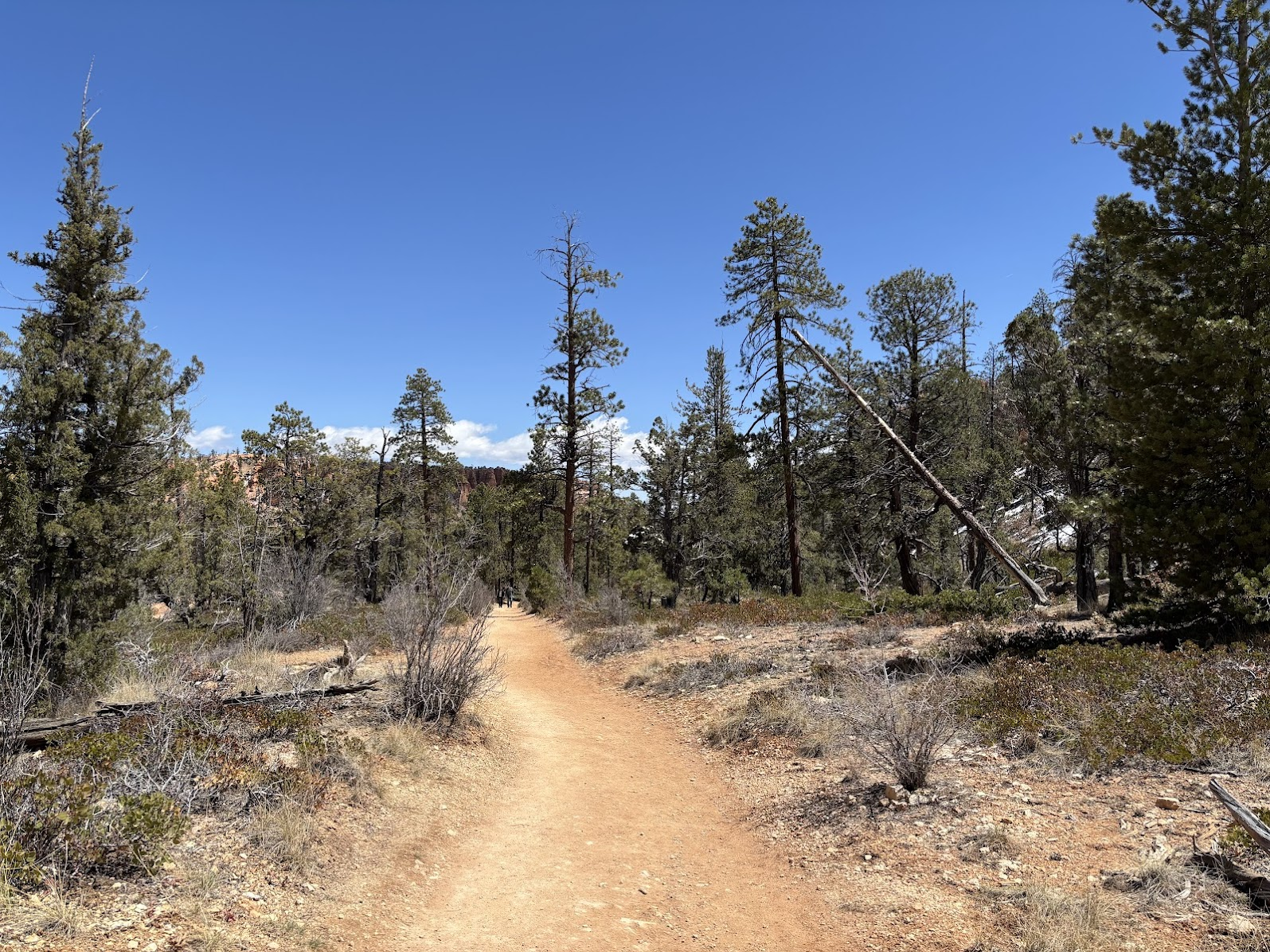
Kanion Bryce to rozległy amfiteatr, którego dno znajduje się ok. 400-600m poniżej górnego brzegu. Hoodoos wyrastają ponad nami, a my nagle znajdujemy się w rzadkim lesie iglastym.
The bottom of the canyon forms a large amphitheater. We are now some 400-600m below the rim. The hoodoos are above us and trail leads among coniferous trees.
Hoodoos widziane od dołu pokazują nam więcej szczegółów. Widzimy warstwy piaskowca w różnych kolorach (dominujący czerwony to efekt tlenku żelaza obecnego w skale). Dostrzegamy również pionowe szczeliny, wzdłuż których przebiega erozja. Możemy spróbować zgadnąć gdzie oderwie się następny blok skalny. Zobaczmy poniżej kilka zdjęć.
The hoodoos viewed from the bottom reveal more details. We can clearly see the different layers of sandstone. The vivid red hue comes from iron oxide. We can also spot the fault lines of erosion. One can try to guess which rock block would fall down next. Let's see a few photos below.
Powrót na górę / Getting Up
W głównym amfiteatrze jest szereg szlaków pieszych i konnych, które pozwalają na dogłębne poznanie kanionu. Pamiętajmy jednak, że powrót to wejście na górę. Trzeba odpowiednio rozplanować siły i wodę. W kwietniu pogodę mieliśmy idealną - na górze trochę powyżej. 0°, na dole przyjemne 10°. Latem temperatury przekraczają 30°
The main amphitheater is criss-crossed by multiple foot and horse trails. They allow thorough exploration of the canyon. We need to remember, however, that the way back to the parking is a climb up, so plan carefully. Our trip was in April, with a perfect weather. The temperature at the rim just above 0° , at the bottom it was a pleasant 10° (Celsius). In the summer the temperatures rise above 30°.
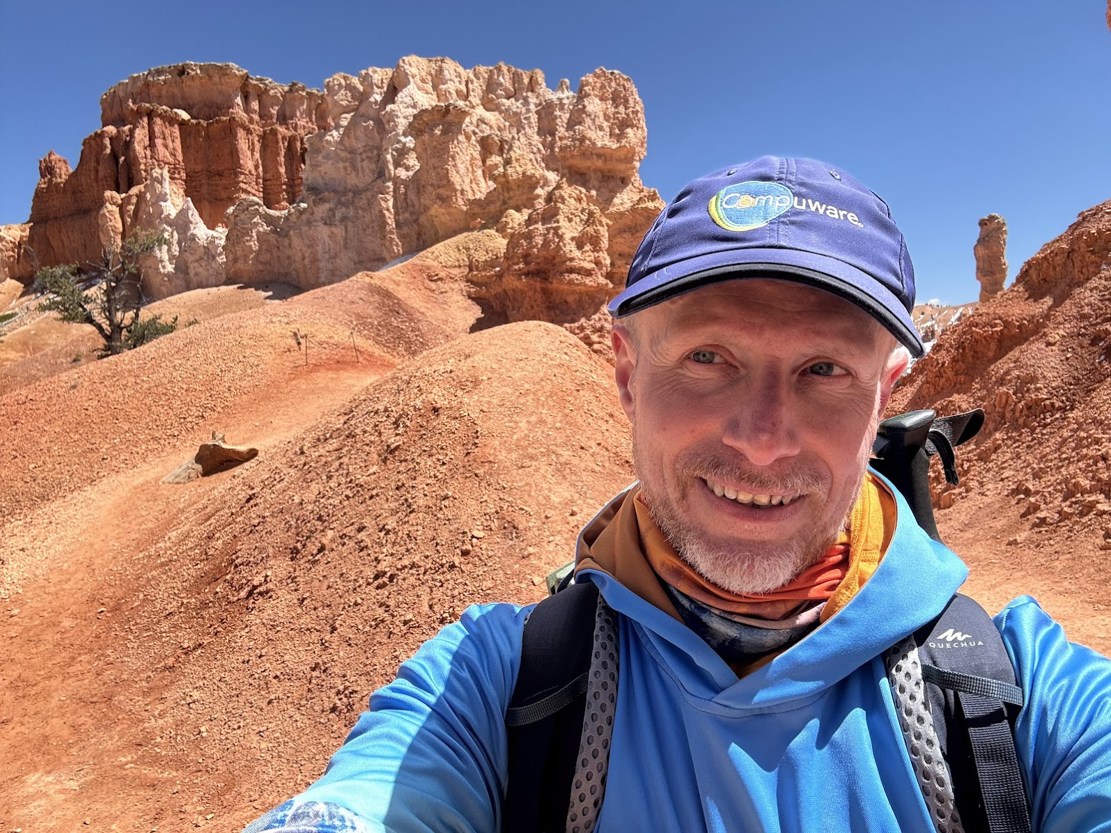
Powrót na górę ułatwiają ciasne zakosy. Wracamy szlakiem Navajo i wyjdziemy do punktu Sunset Point, skąd autobusem dojedziemy na parking przy Centrum Informacyjnym.
The ascend is not that difficult. The trail goes up in a series of switchbacks. We return via the Navajo Trail and reach the Sunset Point. From there, the free park shuttle takes us to the Visitor's Center.
Przed nami jeszcze dojazd na nocleg do Page i opuszczamy Bryce Canyon popołudniem. Moglibyśmy przejść więcej, oglądać więcej. Mamy jednak poczucie, że dużo zobaczyliśmy i dobrze poznaliśmy najważniejsze punkty parku. Nasza pętla to bardzo dobry pomysł na pół-dniową wycieczkę.
We leave the park mid-afternoon. We have to drive to Page for our next lodging. We could have spent more time in the canyon and could have seen more hoodoos. We are however satisfied. The combined 8-shaped trail gave us a very good look into Bryce Canyon National Park. It was a perfect trail for half a day trip.
America the Beautiful Trip - Day 2
Bryce Canyon National Park, Utah
| Data / Date | 19.04.2025 |
|---|---|
| Poprzedni dzień / Previous day | Zion National Park, Utah |
| Trasa samochodem / Route by car | Springdale, UT -> Bryce Canyon, UT -> Page, AZ (385km) |
| Szlak(i) pieszo / Trail(s) on foot | Several trails combined (9,3km 8-shaped loop) |
| Wstęp / Entry fee | "America the Beautiful" annual pass |
| Strona www Parku / Park website | https://www.nps.gov/brca/ |
| Nocleg / Accommodation | Travelodge Page, AZ |
| Następny dzień / Next day | Monument Valley, Forrest Gump Point & Valley of the gods |
| Plan podróży / Trip itinerary | 'America the Beautiful Trip' |
![Zion National Park, Utah. Angels Landing & Emerald Pools. US Southwest Trip - Day 1 [POL / ENG]](https://img.truvvle.com/?src=aHR0cHM6Ly9pbWcudHJhdmVsZmVlZC5pby9zbnVma2luJTJGMjAyNS0wNS0yMy0xNi0wNS0xNTMtYW5nZWxzbGFuZGluZy1wbmc&width=800)
![Short trips around Page, Arizona. Horseshoe Bend & Lake Powell. US Southwest trip Day 4. [POL / ENG]](https://img.truvvle.com/?src=aHR0cHM6Ly9pbWcudHJhdmVsZmVlZC5pby9zbnVma2luJTJGMjAyNS0wNi0xNC0xMi0wNi0wMjYtaG9yc2VzaG9lYmVuZC1wbmc&width=800)
![Breathtaking Antelope Canyon X. The most beautiful photos of my US Southwest trip - Day 5 [POL/ENG].](https://img.truvvle.com/?src=aHR0cHM6Ly9pbWcudHJhdmVsZmVlZC5pby9zbnVma2luJTJGMjAyNS0wNi0yMy0xOC0wNi01MzUtYW50ZWxvcGVjYW55b24tcG5n&width=800)
![Grand Canyon National Park. South Kaibab Trail: Down & Back Up. US Road Trip 2026: Day 6. [POL/ENG].](https://img.truvvle.com/?src=aHR0cHM6Ly9pbWcudHJhdmVsZmVlZC5pby9zbnVma2luJTJGMjAyNi0wNy0wOS0xNy00Ny0xNi02NDAtZ3JhbmRjYW55b25fYmVzdC1qcGc&width=800)