![Monument Valley, Forrest Gump Point & Valley of the gods. US Southwest trip Day 3. [POL / ENG]](https://img.truvvle.com/?src=aHR0cHM6Ly9pbWcudHJhdmVsZmVlZC5pby9zbnVma2luJTJGMjAyNS0wNi0wNi0xOC0wNi03ODQtbW9udW1lbnR2YWxsZXktcG5n&width=2000)
"Monument Valley, Forrest Gump Point (...)" post is written in Polish and English. English text is in italics, below each paragraph in Polish.
Spacer w Monument Valley, Forrest Gump Point, Mexican Hat i off-road w Valley of the gods to główne punkty długiego dnia na rozległych przestrzeniach krainy ludu Navajo (płn. Arizona / płd. Utah). Zapraszam na relację z trzeciego dnia wyprawy po płd-zach. USA. Przejechaliśmy setki kilometrów by zobaczyć niezwykłe formacje skalne i miejsca znane z filmów.
A hike in Monument Valley, Forrest Gump Point, Mexican Hat and off-road in Valley of the gods were the highlights of the third day of my trip across the US southwest. We drove hundreds of kilometers across northern Arizona and southern Utah to see fantastic rock formations and places known from Hollywood movies.
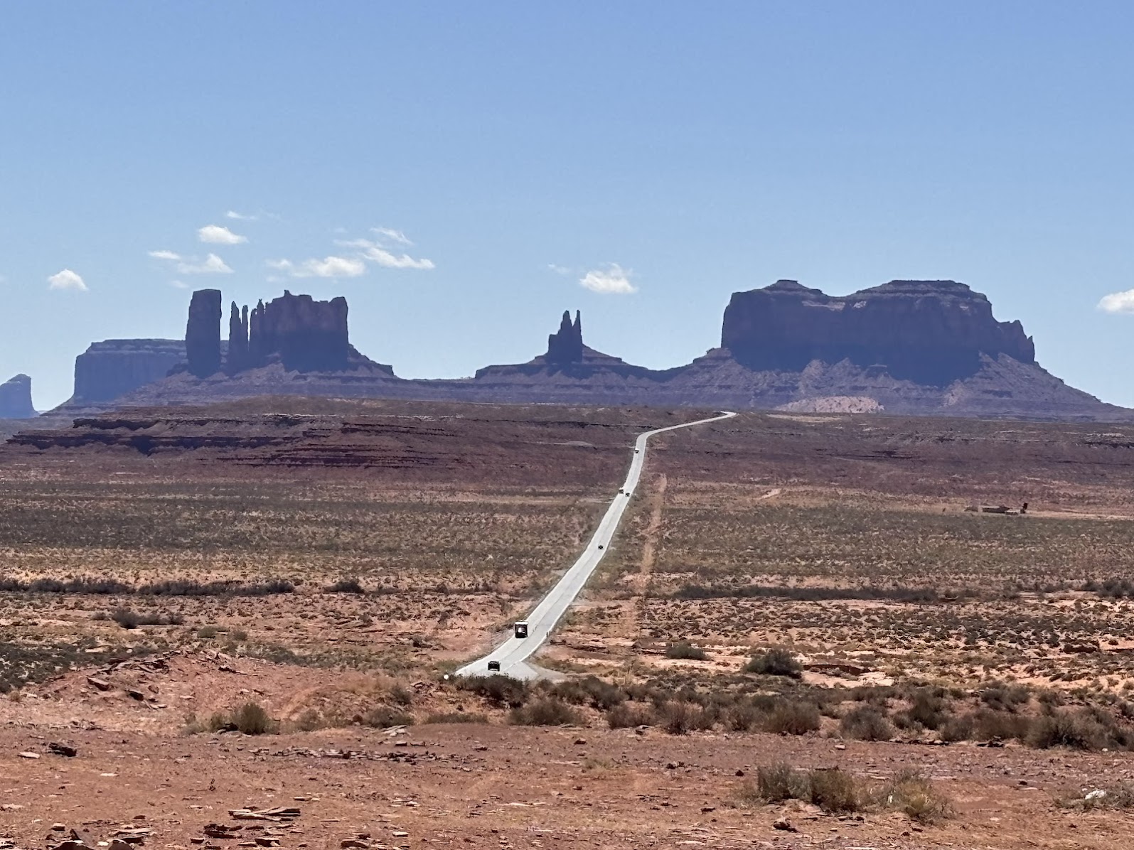
Monument Valley
Z bazy w Page (Arizona) pojechaliśmy na wschód do Monument Valley. To dwie godziny jazdy. Prosta droga po horyzont, przez 200km minęliśmy może ze trzy miasteczka. Dookoła skalista pustynia i wszechobecne ostańce z czerwonego piaskowca.
We drove east from our base in Page, AZ to Monument Valley. It's two hours drive across rocky desert adorned with sandstone buttes. The road seems to stretch to the horizon and driving 200km, we passed perhaps three towns.
Navajo Lands
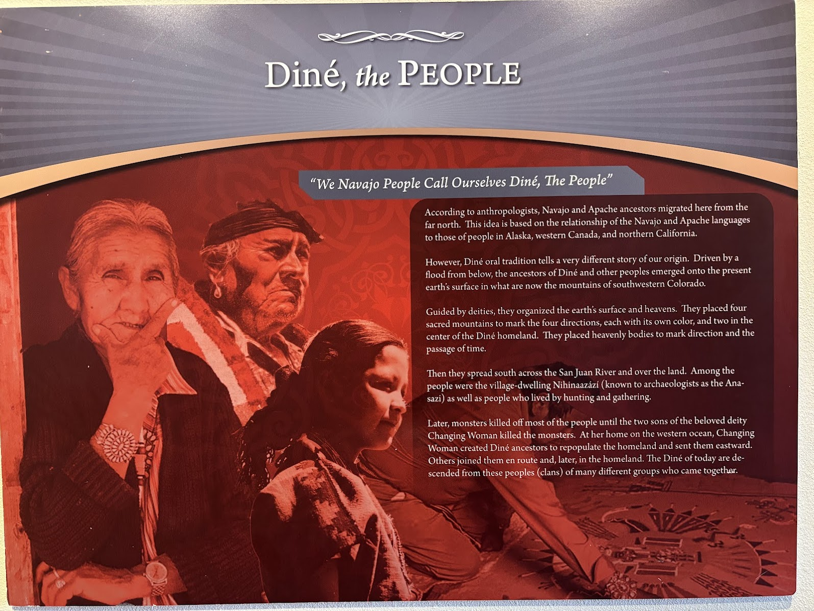
Park plemienny Monument Valley jest położony na ziemi narodu Navajo. Należałoby powiedzieć 'ludu Diné', gdyż tak określają sami siebie. Nazwa 'Navajo' została nadana przez hiszpańskich osadników w XVIIw ('la navaja' w j. hiszpańskim to 'ostrze noża, brzytwa', czyli popularny przedmiot handlu między osadnikami a rdzennymi mieszkańcami; inne możliwe pochodzenie nazwy to 'navahu', co w języku Tewe znaczy 'obszar rolny'). Diné to drugi największy naród rdzennych Amerykanów (po narodach Alaski), zamieszkujący największy terytorialnie rezerwat, znajdujący się na Płaskowyżu Kolorado na terenie 4 stanów - Arizona, Utah, Kolorado i Nowy Meksyk.
The Monument Valley Tribal Park is located on Navajo lands. I should say 'the Diné people', as this is how they call themselves. The term 'Navajo' was first used by Spanish settlers in 17th century. 'La navaja' means 'blade or razor' in Spanish and the name could refer to a popular trade item between the locals and settlers. The name could be also traced to 'navahu', which in the Tewu language denotes an area of cultivated land. Diné are the second largest nation of Native Americans (after the tribes of Alaska) and they mostly live in the largest reservation in the US, located on the Colorado Plateau and spanning 4 states - Arizona, Utah, Colorado and New Mexico.
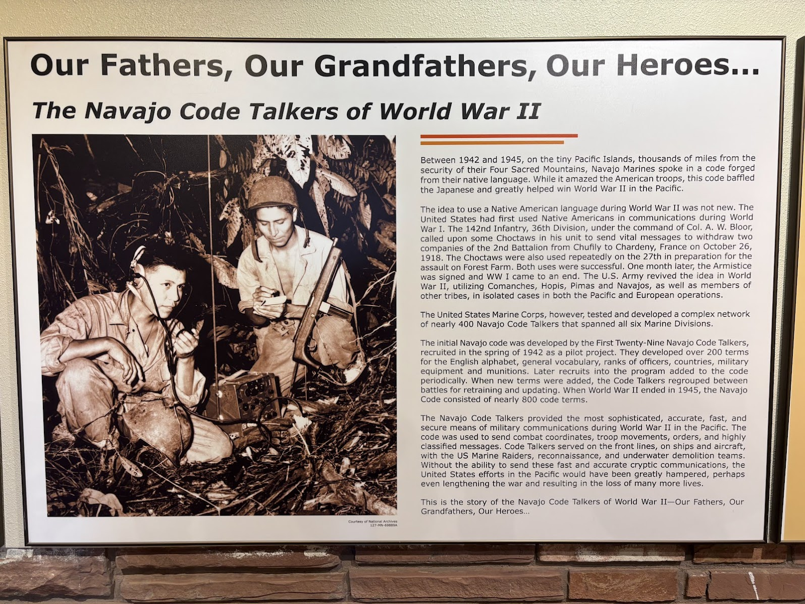
Lud Navajo zyskał sławę w czasie II Wojny Światowej. Żołnierze z tego plemienia służyli w wojsku amerykańskim jako szyfranci na froncie pacyficznym. Język Navajo służył do szyfrowania wiadomości, co znacznie pomogło w pokonaniu Japończyków.
The Navajo became famous during WWII. Code Talkers were essential on the Pacific front. Encrypted messaged were conveyed in the Navajo language, which contributed hugely to defeating Japan.
Monument Valley Tribal Park
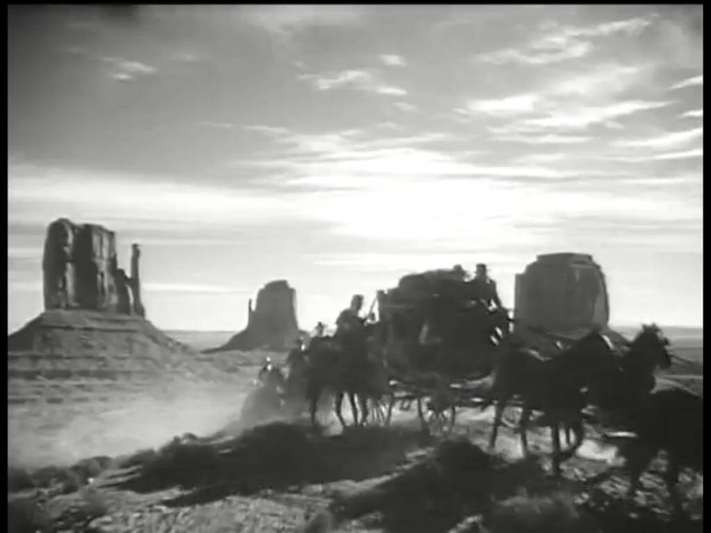
Monument Valley to miejsce ikoniczne. W klasycznych westernach Johna Forda z Johnem Wayne, dolina wielokrotnie służyła za scenografię. Ostańce z czerwonego piaskowca grały także w późniejszych produkcjach Hollywood, m.in. w "2001: A Space Odyssey", "Mission Impossible II" oraz "Forrest Gump" (o tym ostatnim czytaj dalej).
Monument Valley is an iconic place. It was the background in many classic Westerns by John Ford starring John Wayne. Red sandstone buttes could be also see in such Hollywood productions as "2001: A Space Odyssey", "Mission Impossible II" oraz "Forrest Gump" (read more on the latter further down).
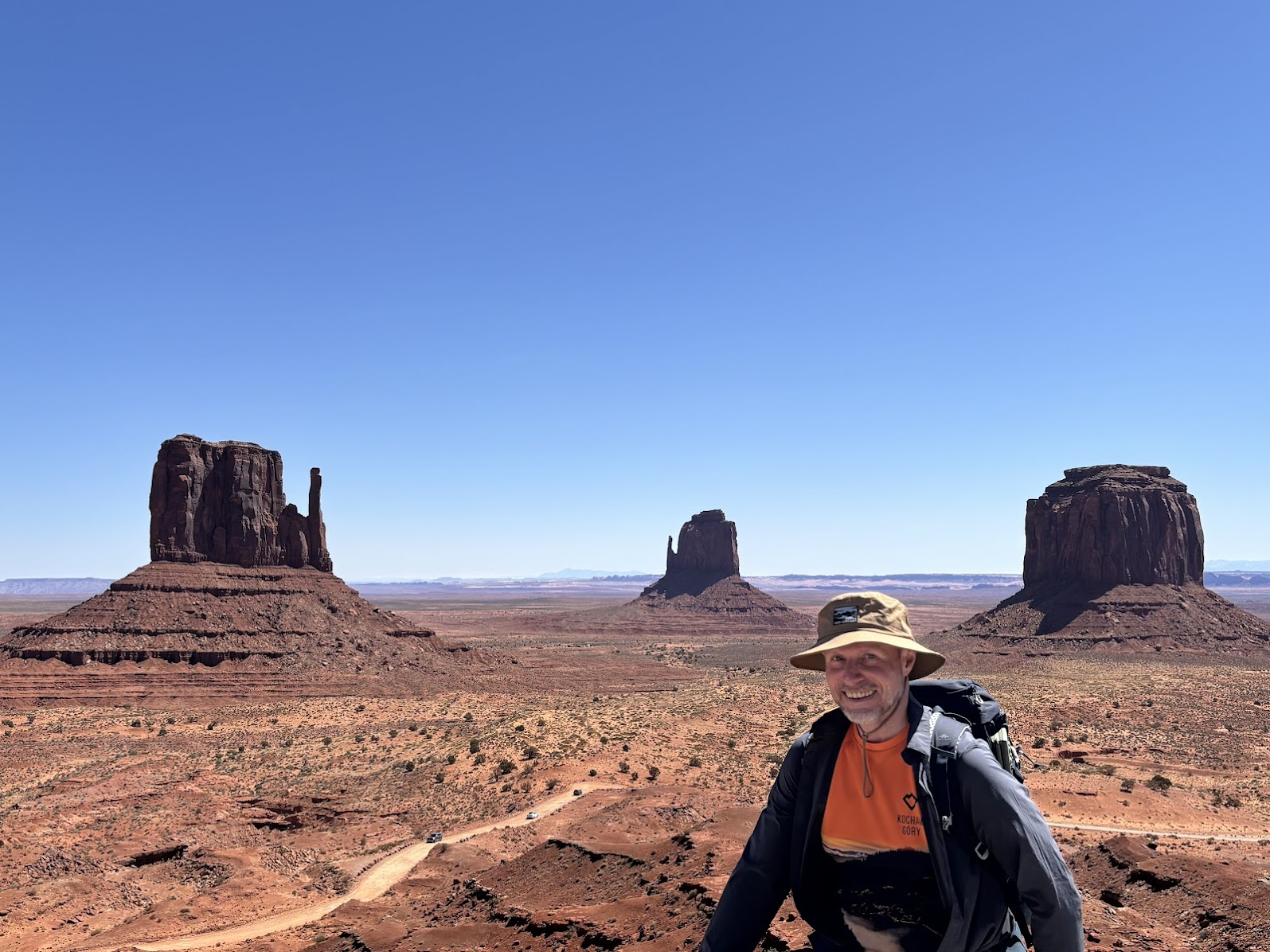
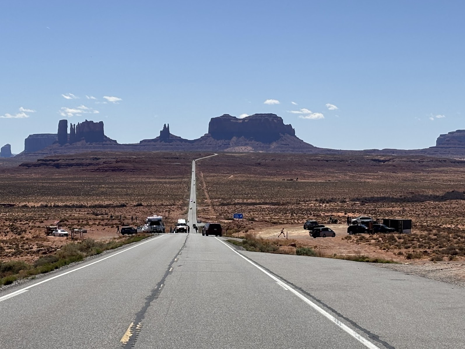
Amerykanie często zwiedzają parki narodowe samochodami. Monument Valley nie jest parkiem narodowym a plemiennym, ale sposób eksploracji jest taki sam. Wokół formacji skalnych prowadzi szutrowa droga. Niewiele osób decyduje się na pieszą wędrówkę. My parkujemy przy Centrum Informacyjnym, zapoznajemy się z historią rdzennych mieszkańców oraz geologią tej ziemi i będziemy zwiedzać park po polsku - czyli na piechotę. Jest kwiecień i pogoda jest doskonała - słonecznie, ale daleko jeszcze do letnich upałów.
Monument Valley is a tribal park, but the most common way of exploration is like in any national park - by car. There's a gravel road around the buttes. Only few people choose to have a walk. We parked at the Visitor's Center, where we learnt bits on Navajo history and local geology. We are going to see the park the Polish way - by taking a foot trail. Our visit is in April and the weather is excellent - sunny, but still far from summer heats.
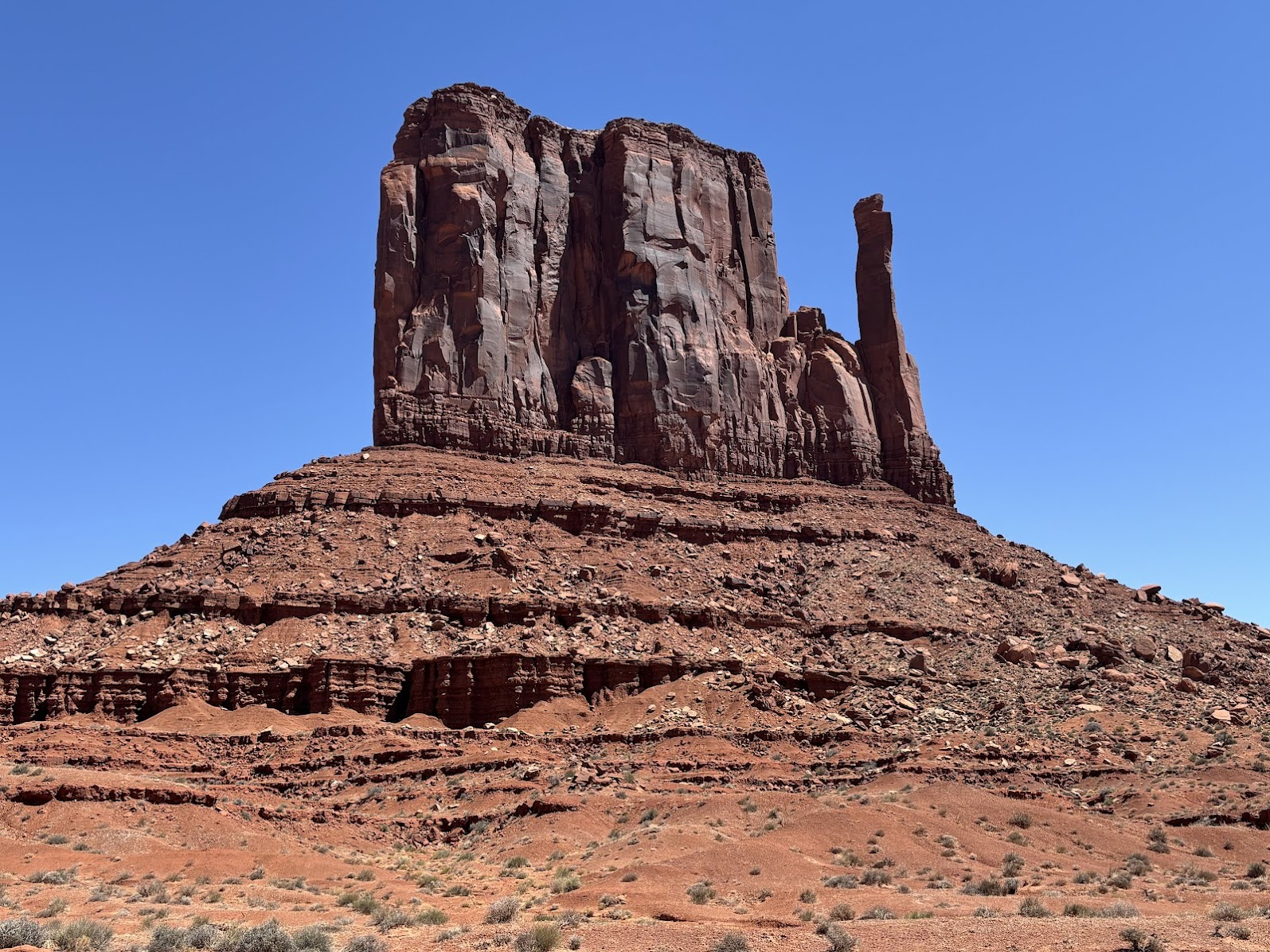
Buttes
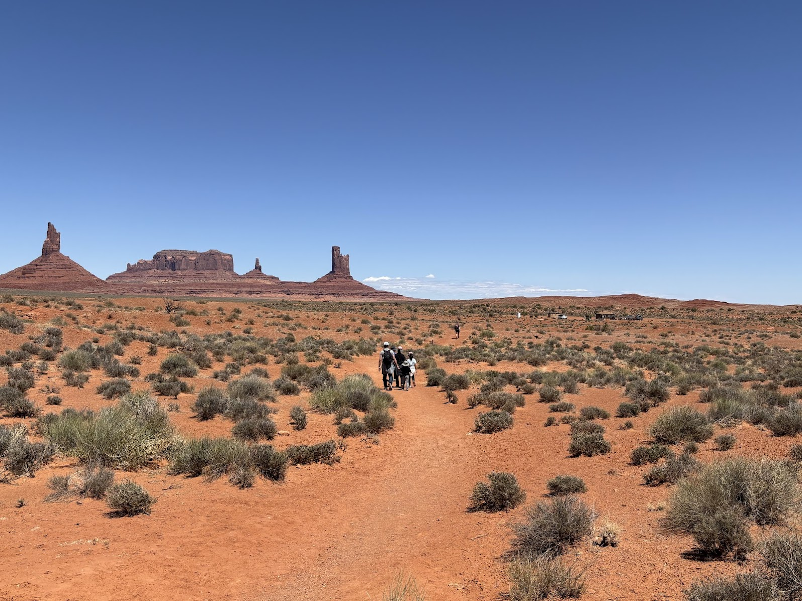
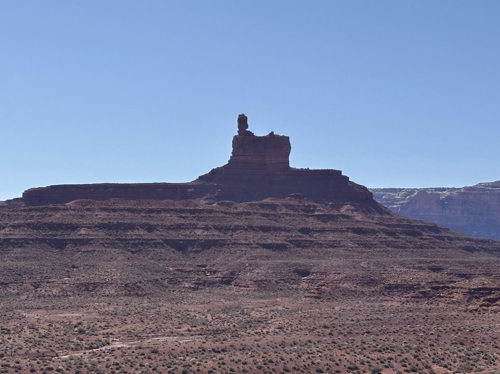
W poprzednim odcinku podróży po płd-zach. USA oglądaliśmy hoodoos w Bryce Canyon. Formacje skalne są tam ciasno rozmieszczone i tworzą grupy. W Monument Valley jest odwrotnie - większość materiału skalnego zerodowała, pozostawiając pojedyncze ostańce - 'buttes'. Wybraliśmy się na pieszą wędrówkę (7km, płasko) szlakiem 'Wildcat Trail' wokół jednego z nich - 'West Mitten' ('zachodnia rękawiczka jednopalcowa)'. Wspomnę, że w czasie 1,5h wędrówki spotkaliśmy 9 piechurów - w tym parę z Polski i rodzinę z Południowej Korei (świat jest mały - Koreańczyk wychował się w Polsce i mogliśmy porozmawiać w naszym ojczystym języku!).
In the previous post on my US southwest trip, we viewed hoodoos in Bryce Canyon. Rock formations there are grouped and are located in close proximity one to another. Monument Valley is the opposite. Here the erosion-left buttes are few and far in between. We chose to to hike (7km, flat) the Wildcat Trail around one of them, called the 'West Mitten'. Let me mention that during our 1.5h walk we met only 9 people, including a couple from Poland and a family from South Korea (the dad had been raised in Poland and we spoke with him in our native tongue - the world is a little village indeed!).
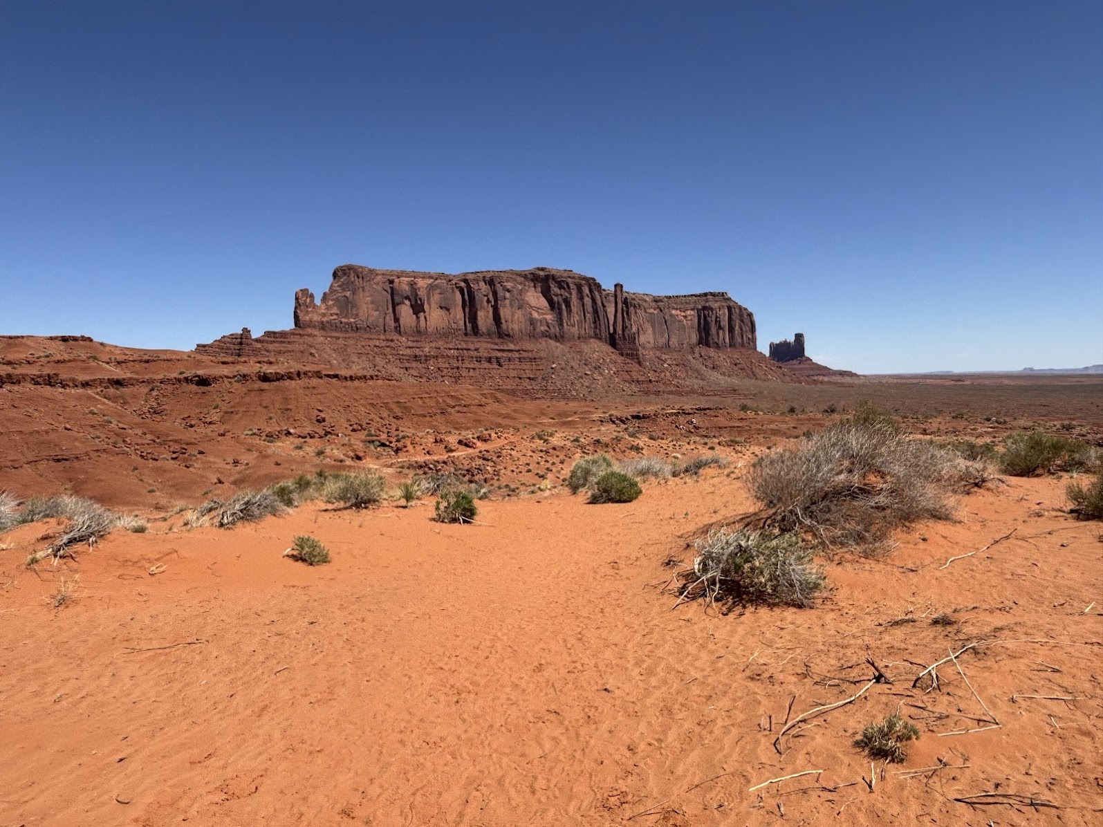
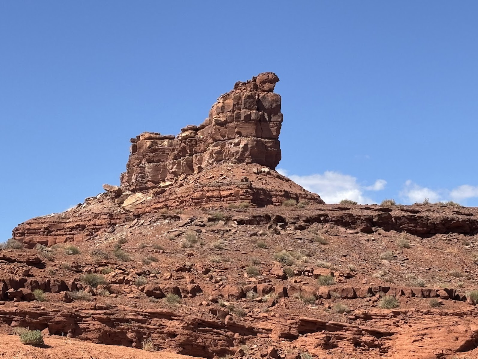
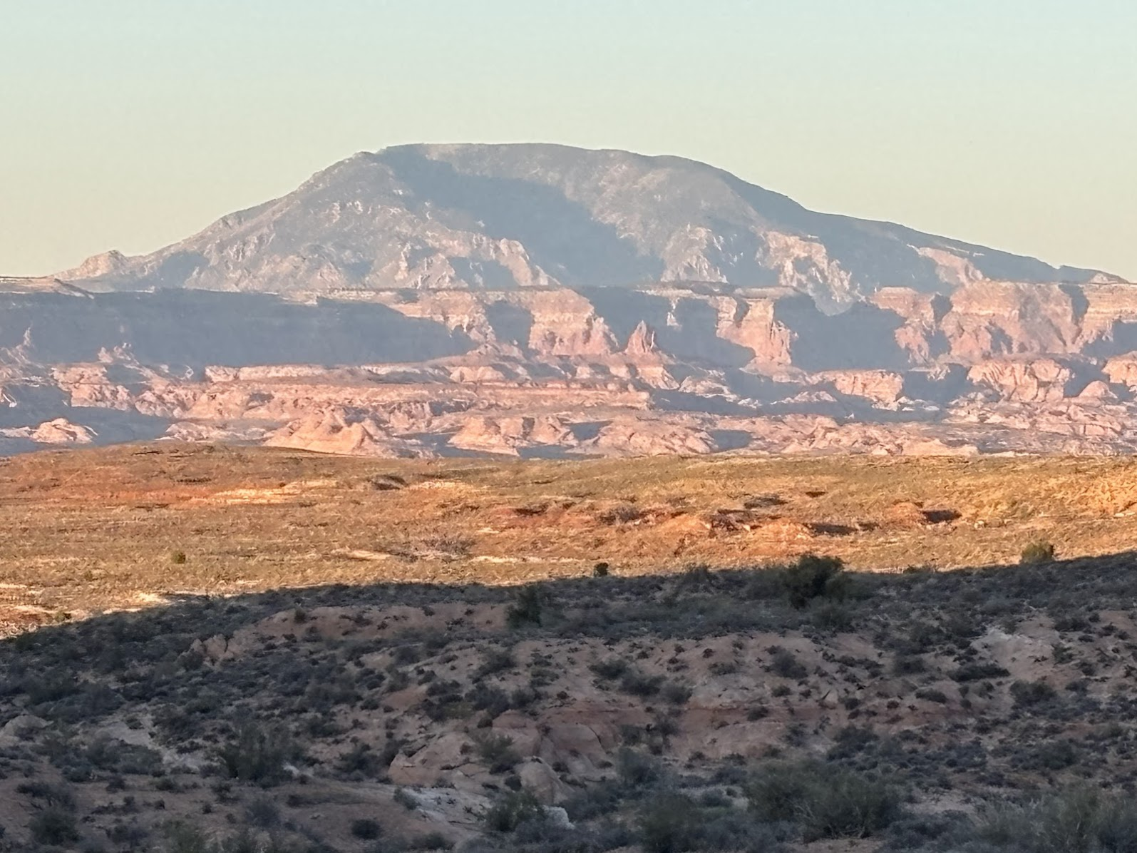
Monument Valley znajduje się w większości w Arizonie. Ale skała pokazana powyżej - 'Sentinel Mesa' jest w Utah. Granica pomiędzy tymi stanami jest prostą linią na mapie. Przy okazji, wiele ostańców na tym obszarze ma w nazwie słowo 'mesa'. To po hiszpańsku 'stół' - skały tak nazwane mają płaski, rozległy szczyt.
Monument Valley is mostly in Arizona. However, the rock shown above - 'Sentinel Mesa' - is in Utah. The state border is a straight line on the map. Note the name 'mesa' - it means 'a table' in Spanish and is common in this area. The buttes do indeed look like large tables with flat top.
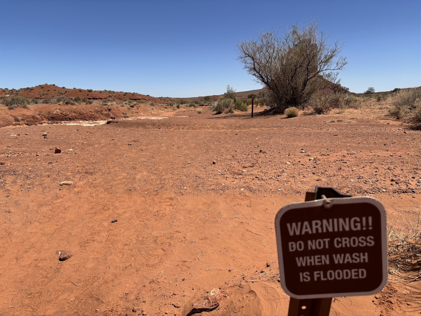
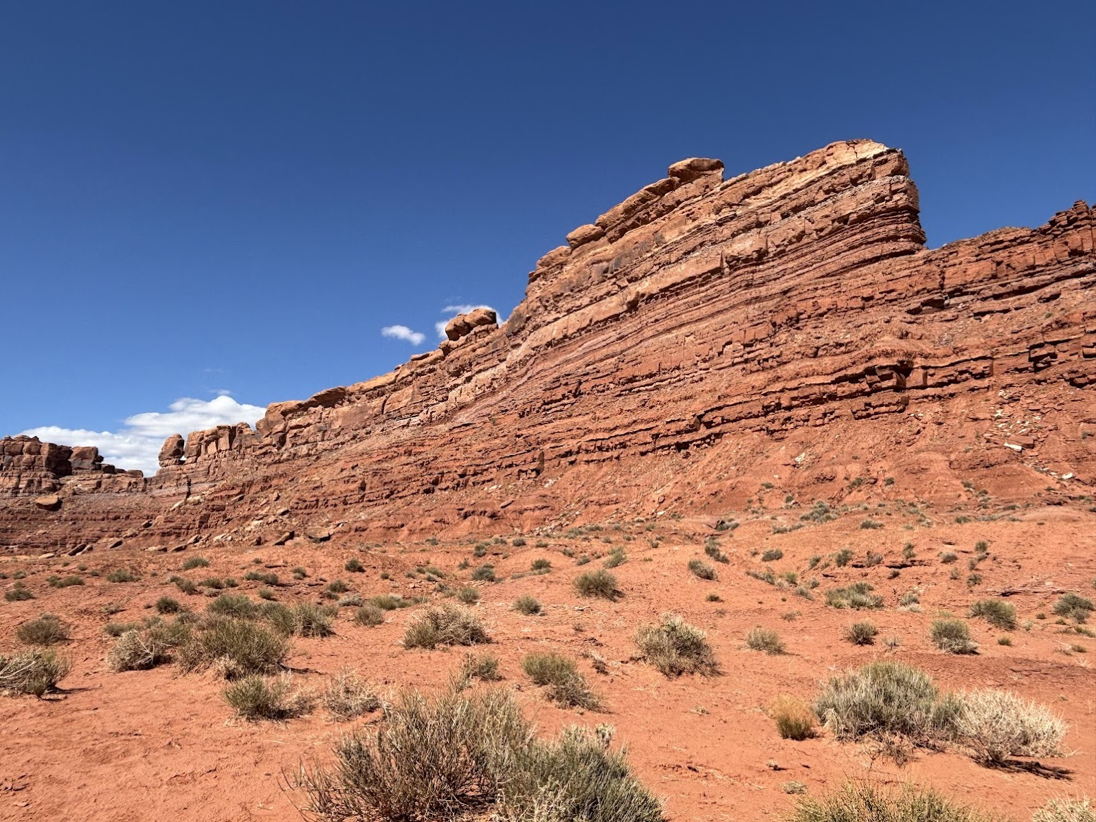
Krajobraz jest pustynny, wszędzie dookoła czerwonawy piasek. Niewiele roślin potrafi tu przeżyć. Powodem jest brak wody. Ale warto wiedzieć, że latem na Płaskowyżu Kolorado występują krótkie, ale intensywne deszcze. Such ziemia nie przyjmuje wody i formują się gwałtowne powodzie ('flash flood'). Jeśli jesteśmy w Arizonie w czasie deszczu, musimy jak najszybciej znaleźć wyżej położony grunt.
The landscape here is dry and barring. Plants have difficult times there due to lack of water. However, one needs to remember that in the summer short, violent rains are common here. The scorched earth doesn't soak water and flash floods form quickly. If we are in Arizona during rain, we need to find high ground immediately.
Forrest Gump Point
Po spacerze (7km) szlakiem Wildcat Trail, uzupełniamy wodę w Centrum Informacyjnym parku. W USA w zasadzie nie ma potrzeby kupowania wody butelkowej. W każdym odwiedzonym parku i na wielu przydrożnych parkingach są dostępne krany z wodą pitną. Uzupełnianie płynów jest kluczowe w gorącym, niegościnnym i suchym klimacie.
Having completing the 7km Wildcat Trail, we head to the Visitor's Center to refill our water bottles. Travelling in the USA, we don't need to buy water. Every park we visit and many road-side rest places offer free water fountains. Hydrating is key in the dry, hot and unforgiving climate.
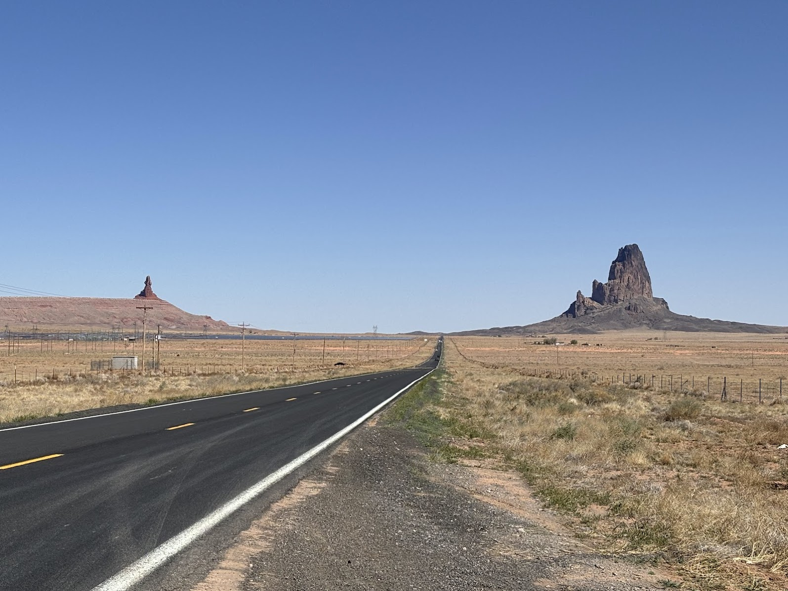
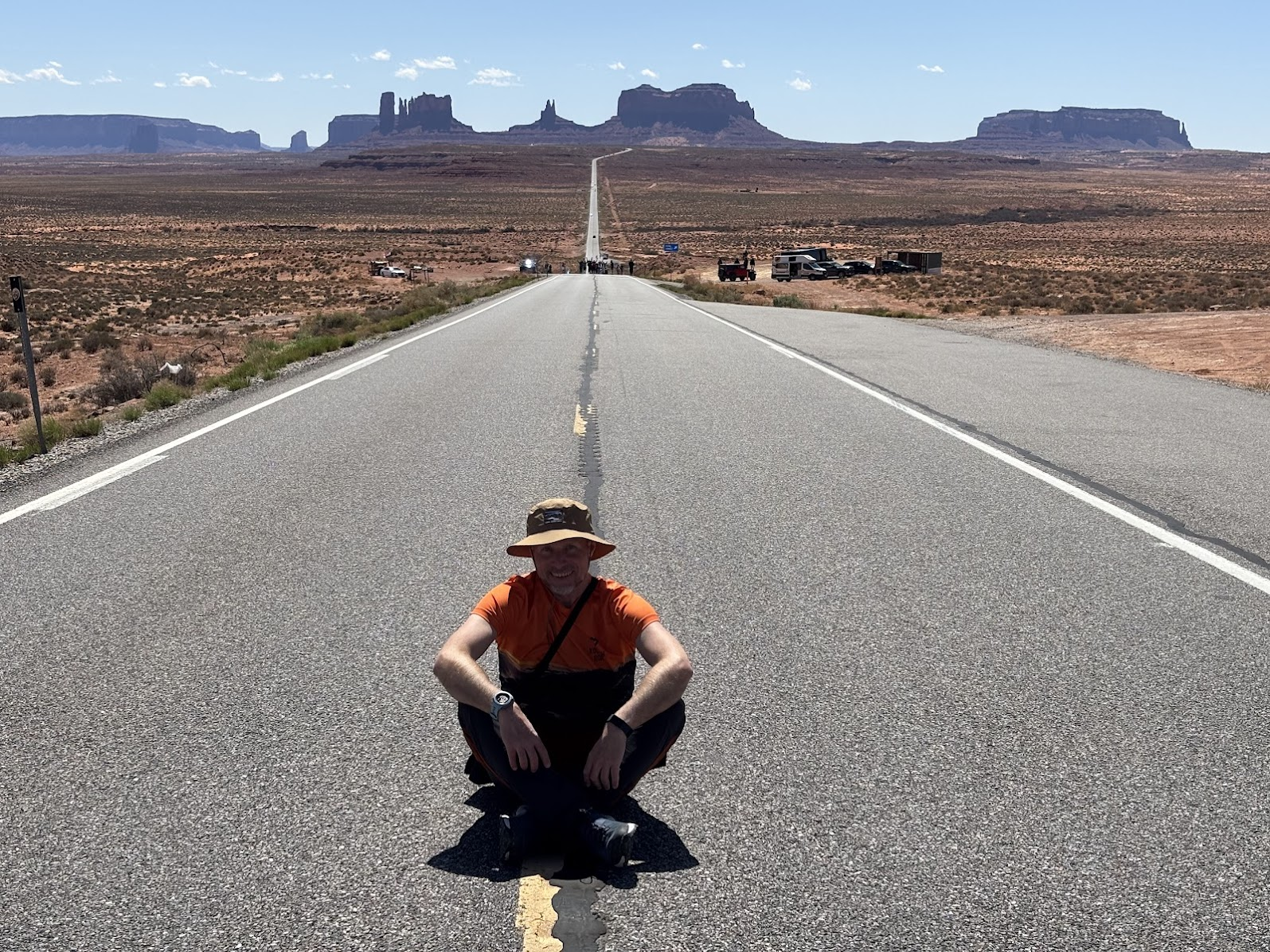
Nasz następny punkt znajduje się 20 minut jazdy od Monument Valley. Zmierzamy do Forrest Gump Point - miejsca, gdzie w kultowym filmie Forrest Gump (Tom Hanks) zakończył swój epicki bieg przez USA, co zajęło mu 3 lata, 2 miesiące, 14 dni i 16 godzin. Forrest przebiegł 15 248 mil.
Our next stop is just 20 minutes driving away. We are heading to Forrest Gump Point, the location when Forrest ( Tom Hanks) ended his epic run across USA. According to the movie, Forrest ran for 3 years, 2 months, 14 days, and 16 hours, and in that time he ran 15,248 miles.
Google Maps podaje precyzyjną lokalizację zakończenia biegu. Ale parking znajduje się 300m poniżej. Zauważyliśmy, że wszyscy turyści robili sobie zdjęcia przy parkingu. Tylko my podeszliśmy 300m w górę by mieć fotkę w prawdziwym Forrest Gump Point!
Google Maps gives the precise location where the run ended. However, a parking is located 300m below that point. We noticed that all tourists were posing for photos at the parking. We were the only to walk the short distance up and had photos in the exact Forrest Gump Point!
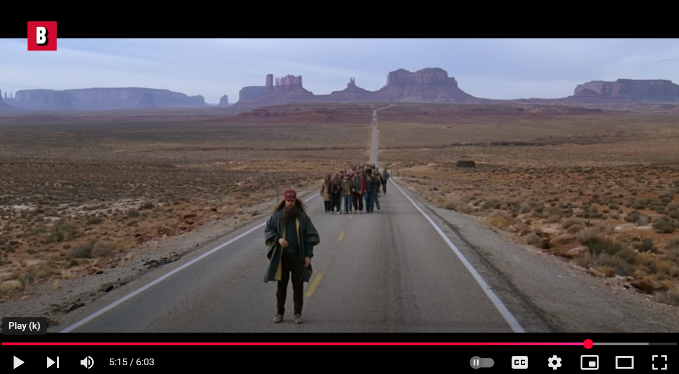
Kluczowa scena / the key scene "Forrest Gump", (YT link: Boxoffice Movie Scenes):
Off-road in Valley of the gods
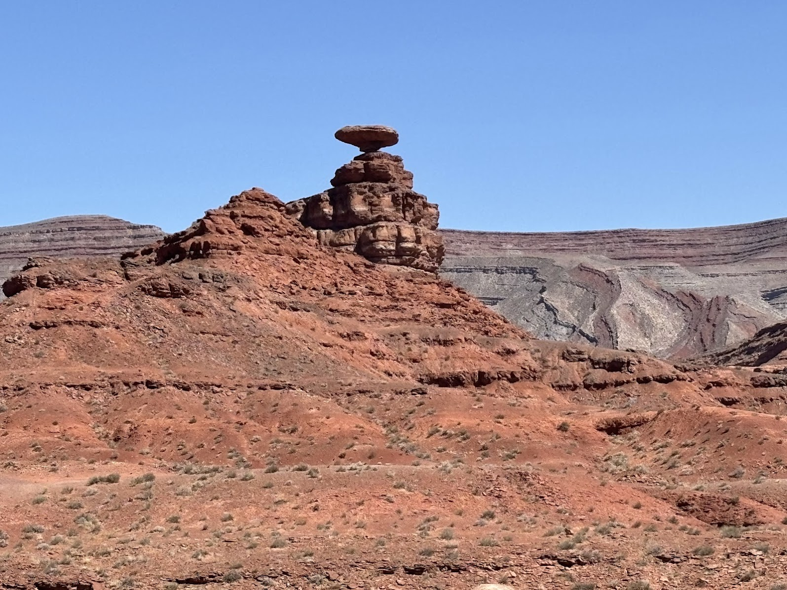
Mexican Hat
Monument Valley, Forrest Gump Point i pobliska skała Mexican Hat są położone niedaleko od siebie i warto je umieścić razem w programie wycieczki. Naszym kolejnym celem była 'Dolina bogów' ('Valley of the gods').
Monument Valley, Forrest Gump Point and nearby Mexican Hat rock are located close to each other and I recommend including them together in your trip itinerary. Our next destination was 'Valley of the gods'.
Dirt and Rock Drive
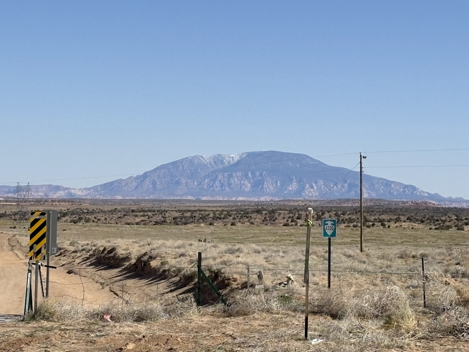
Valley of the gods (Utah) trudno zwiedzić w całości na piechotę. Szlak przez całą dolinę to 40km w jedną stronę, szutrową drogą w pełnym słońcu. Tym razem będziemy więc zwiedzać po amerykańsku - zafundowaliśmy sobie off-road. Nie ma biletów wstępu. Trzeba jednak mieć auto o podwyższonym prześwicie. Nasza wypożyczona Toyota RAV4 (i jej szczęśliwy kierowca!) wreszcie mogła pokazać co potrafi poza asfaltowymi drogami. Uwaga - w czasie deszczu sucha droga zamienia się w błotne strumienie i wtedy wjazd nie jest wskazany. Poniżej mapa i link do trasy przejazdu.
Valley of the gods, Utah is extremely pedestrian-unfriendly. The length of the main trail is 40km (25 miles), over a gravel road, under scorching sun. Therefore, we decided to visit the American way - an off-road drive. There are no entry fees. A car with high clearance is recommended. Our rental Toyota RAV4 (and its happy driver!) was in its element. Note - after rain the dry gravel turns into muddy streams and driving is not recommended. See below map with link to our route.
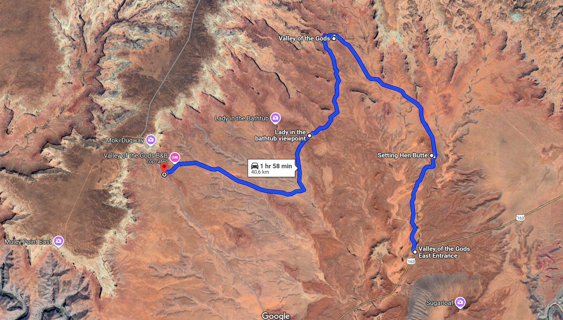
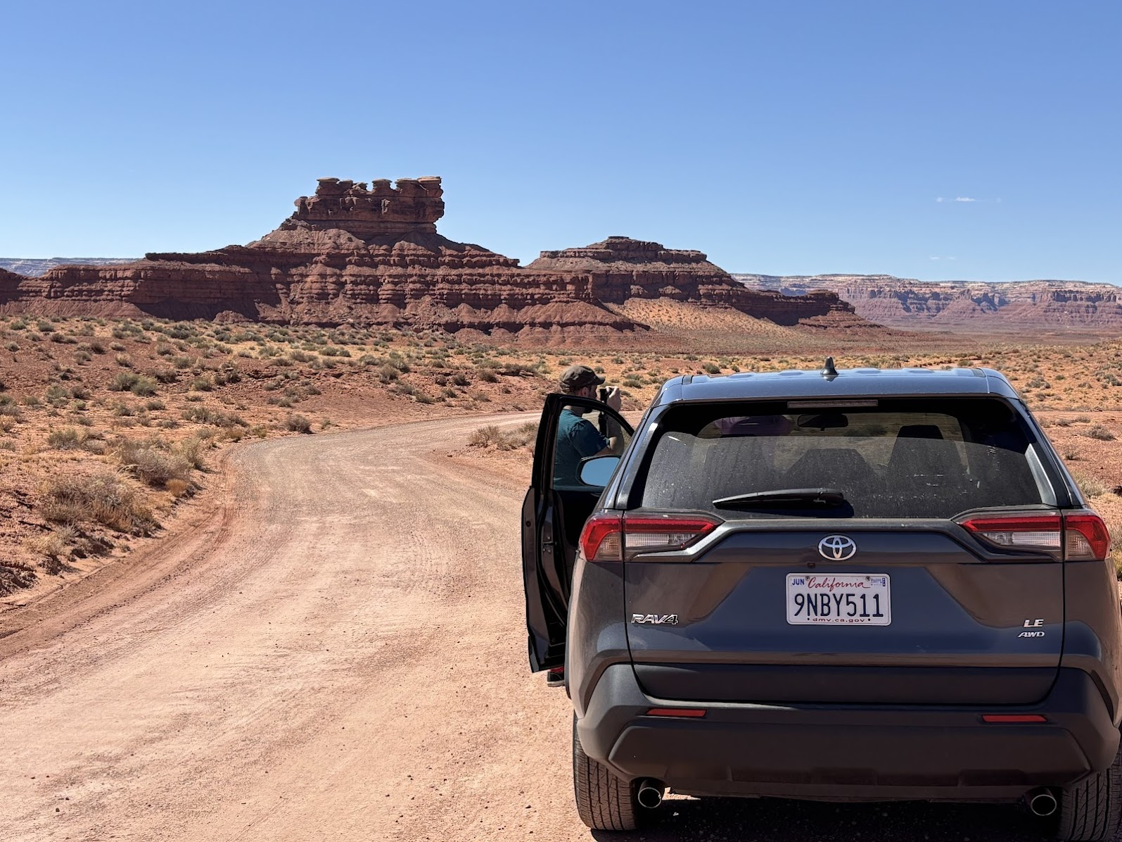
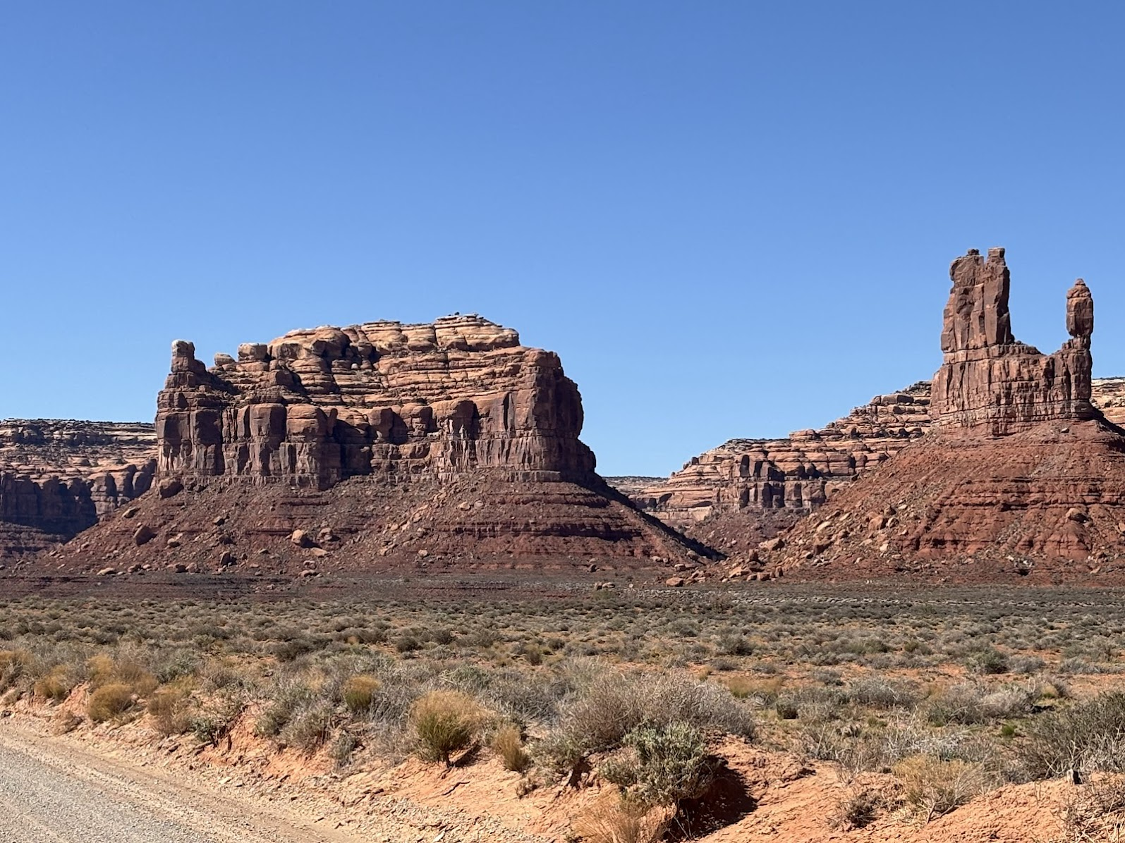
Wzdłuż trasy przejazdu znajdują się liczne ostańce, uformowane w czerwonym piaskowcu. Skały mają takie nazwy jak Siedząca Kura, Lokomotywa, Okręt Wojenny czy Kobieta w Wannie. A pewnie każdy będzie miał własne skojarzenia.
The route offers fantastic views of numerous red sandstone buttes. Just a few names - Sitting Hen, Locomotive, Battleship or Lady in the Bathtub - give an idea what to expect. I am sure that each visitor could find their own associations.
America the Beautiful Trip - Day 3
Monument Valley, Forrest Gump Point (Arizona / Utah)
To był długi, ale pełen widoków i wrażeń dzień. Przejechaliśmy wiele kilometrów po pustyniach Utah i Arizony. Następny dzień będzie stacjonarny - zobaczymy najbliższe okolice naszej tymczasowej bazy w Page (Arizona).
It was a long day, full of fantastic views. We drove many kilometers across Utah and Arizona. The next day would be more stationary, as we would see the vicinity of our temporary base in Page, Arizona.
Praktyczna uwaga: Utah i Arizona są w strefie czasowej Mountain Time Zone (MDT). Ale latem Arizona przechodzi na czas letni, a Utah nie. To powoduje godzinną różnicę czasu pomiędzy tymi stanami. W ciągu dnia wielokrotnie przekraczaliśmy granice tych stanów i podróżowaliśmy w czasie ;-)
Practical note: Utah and Arizona are in the same Mountain Time Zone (MDT). During spring, summer and early autumn, Utah doesn't go into Daylight Saving Time and Arizona does. This creates an hour time difference between the two states. During our trip we crossed the state border multiple times and traveled in time back and forth ;-)
| Data / Date | 20.04.2025 |
|---|---|
| Poprzedni dzień / Previous day | Bryce Canyon National Park, Utah |
| Trasa samochodem / Route by car | Page, AZ -> Monument Valley, AZ -> Forrest Gump Point, UT -> Valley of the gods, UT -> Page, AZ (525km) |
| Szlak(i) pieszo / Trail(s) on foot | Wildcat trail - Monument Valley (7,5km, mostly flat) |
| Wstęp / Entry fee | $8 per person - entry fee for Monument Valley Tribal Park |
| Strona www Parku / Park website | https://navajonationparks.org/navajo-tribal-parks/monument-valley/ |
| Nocleg / Accommodation | Travelodge Page, AZ |
| Następny dzień / Next day | Glen Canyon & Horseshoe Bend |
| Plan podróży / Trip itinerary | 'America the Beautiful Trip' |
![Breathtaking Antelope Canyon X. The most beautiful photos of my US Southwest trip - Day 5 [POL/ENG].](https://img.truvvle.com/?src=aHR0cHM6Ly9pbWcudHJhdmVsZmVlZC5pby9zbnVma2luJTJGMjAyNS0wNi0yMy0xOC0wNi01MzUtYW50ZWxvcGVjYW55b24tcG5n&width=800)
![Short trips around Page, Arizona. Horseshoe Bend & Lake Powell. US Southwest trip Day 4. [POL / ENG]](https://img.truvvle.com/?src=aHR0cHM6Ly9pbWcudHJhdmVsZmVlZC5pby9zbnVma2luJTJGMjAyNS0wNi0xNC0xMi0wNi0wMjYtaG9yc2VzaG9lYmVuZC1wbmc&width=800)
![Bryce Canyon National Park, Utah. 8-shaped Loop to the Bottom. US Southwest Trip - Day 2 [POL / ENG]](https://img.truvvle.com/?src=aHR0cHM6Ly9pbWcudHJhdmVsZmVlZC5pby9zbnVma2luJTJGMjAyNS0wNS0zMS0xOC0wNS04OTgtYnJ5Y2VjYW55b24tcG5n&width=800)
![Grand Canyon South Rim Trail / Szlak brzegiem Wielkiego Kanionu. US Southwest trip Day 6 [POL / ENG]](https://img.truvvle.com/?src=aHR0cHM6Ly9pbWcudHJhdmVsZmVlZC5pby9zbnVma2luJTJGMjAyNS0wNy0wMS0xOS0wNy04NTEtZ3JhbmRjYW55b24tcG5n&width=800)